
KARLICA
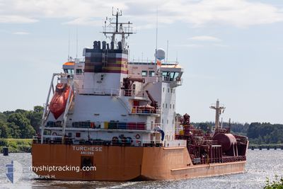
Oil/Chemical Tanker
Current Trip
| Time Travelled | 8 days |
|---|---|
| Remaining Time | --- |
| Distance Travelled | 2050.18 nm |
| Remaining Distance | --- |
| AVG Speed | 10.1 Knots |
| MAX Speed | 14.4 Knots |
| AVG Wind | 15.3 knots |
| MAX Wind | 29.2 knots |
| MIN Temp | 11.5°C / 52.7°F |
| MAX Temp | 20.6°C / 69.08°F |
| Draught | 8.5 m |
| Position Received | 1 m ago |
Current Position
| Longitude | 28.48749° |
|---|---|
| Latitude | 40.81633° |
| Status | Under way using engine |
| Speed | 12.3 Knots |
| Course | 82.1° |
| Area | Sea of Marmara |
| Station | T-AIS |
| Position Received | 1 m ago |
Info
Information
The current position of KARLICA is in Sea of Marmara with coordinates 40.81633° / 28.48749° as reported on 2024-05-07 02:36 by AIS to our vessel tracker app. The vessel's current speed is 12.3 Knots and is heading at the port of IZMIT. The estimated time of arrival as calculated by MyShipTracking vessel tracking app is 2024-05-07 09:00 LT
The vessel KARLICA (IMO: 9220354, MMSI: 271049308) is a Oil/Chemical Tanker that was built in 2000 ( 24 years old ). It's sailing under the flag of [TR] Turkey.
In this page you can find informations about the vessels current position, last detected port calls, and current voyage information. If the vessels is not in coverage by AIS you will find the latest position.
The current position of KARLICA is detected by our AIS receivers and we are not responsible for the reliability of the data. The last position was recorded while the vessel was in Coverage by the Ais receivers of our vessel tracking app.
The current draught of KARLICA as reported by AIS is 8.5 meters
Weather
| Temperature | 14.7°C / 58.46°F |
|---|---|
| Wind Speed | 7 knots |
| Direction | 176° S |
| Pressure | 1014.8 hPa |
| Humidity | 66.9 % |
| Cloud Coverage | --- |
Featured Company
Last Port Calls
| Port | Arrival | Departure | Time In Port |
|---|---|---|---|
| 2024-04-25 12:23 | 2024-04-28 20:25 | 3 d | |
| 2024-04-15 18:06 | 2024-04-18 03:58 | 2 d | |
| 2024-04-12 20:04 | 2024-04-13 21:49 | 1 d | |
| 2024-04-01 13:40 | 2024-04-02 17:32 | 1 d | |
| 2024-03-15 12:00 | 2024-03-18 19:16 | 3 d | |
| 2024-03-11 11:18 | 2024-03-11 15:21 | 4 h |
Last Trips
| Origin | Departure | Destination | Arrival | Distance | |
|---|---|---|---|---|---|
| 2024-04-18 05:58 | 2024-04-25 13:23 | 1473.72 nm | |||
| 2024-04-13 23:49 | 2024-04-15 20:06 | 444.24 nm | |||
| 2024-04-02 17:32 | 2024-04-12 22:04 | 1647.63 nm | |||
| 2024-03-18 20:16 | 2024-04-01 13:40 | 1131.07 nm | |||
| 2024-03-11 16:21 | 2024-03-15 13:00 | 917.88 nm | |||
| 2024-02-29 12:17 | 2024-03-11 12:18 | 2000.19 nm |
Events
| Time | Event | Details | Position / Dest | Info |
|---|---|---|---|---|
| 2024-05-06 20:56 | Status Changed | Under way using engine Default |
40.53161 / 27.04801
TRIZT
|
Speed: 12 kn Course: 65° |
| 2024-05-06 20:45 | IN Coverage |
40.53161 / 27.04801
Sea of Marmara
TRIZT
|
Speed: 12 kn Course: 63.8° |
|
| 2024-05-06 18:33 | Status Changed | Default Under way using engine |
40.27776 / 26.55757
TRIZT
|
Speed: 11.3 kn Course: 49.8° |
| 2024-05-06 18:24 | OUT of Coverage |
40.25794 / 26.52989
Sea of Marmara
TRIZT
|
Speed: 11.3 kn Course: 49.8° |
|
| 2024-05-06 16:20 | Change Sea Area | Turkish part of the Sea of Marmara Turkish part of the Aegean Sea |
40.02297 / 26.21127
Sea of Marmara
TRIZT
|
Speed: 10.2 kn Course: 78° |
| 2024-05-06 16:17 | Status Changed | Under way using engine Default |
40.02112 / 26.20371
TRIZT
|
Speed: 10.1 kn Course: 75° |
| 2024-05-06 16:16 | Status Changed | Default Under way using engine |
40.01971 / 26.19661
TRIZT
|
Speed: 9.7 kn Course: 75° |
| 2024-05-06 16:12 | Status Changed | Under way using engine Default |
40.01714 / 26.18327
TRIZT
|
Speed: 7.9 kn Course: 73° |
| 2024-05-06 16:03 | Status Changed | Default Under way using engine |
40.01160 / 26.15567
TRIZT
|
Speed: 8.1 kn Course: 74.9° |
| 2024-05-06 15:59 | Detected in Sea | Turkish part of the Aegean Sea |
40.00924 / 26.14491
Aegean Sea
TRIZT
|
Speed: 8.1 kn Course: 74.9° |