
KARLICA
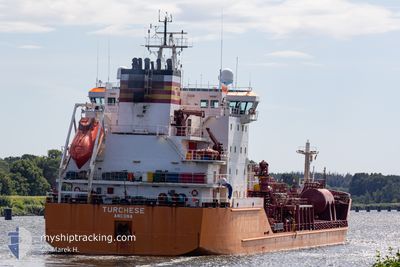
Oil/Chemical Tanker
Current Trip
| Time Travelled | 7 days |
|---|---|
| Remaining Time | --- |
| Distance Travelled | 1876.79 nm |
| Remaining Distance | --- |
| AVG Speed | 10 Knopen |
| MAX Speed | 14.4 Knopen |
| AVG Wind | 16.7 knots |
| MAX Wind | 29.2 knots |
| MIN Temp | 12.6°C / 54.68°F |
| MAX Temp | 20.6°C / 69.08°F |
| Diepgang | 8.5 M |
| Positie ontvangen | 1 m geleden |
Current Position
| Lengtegraad | 25.62401° |
|---|---|
| Breedtegraat | 39.36225° |
| Status | Under way using engine |
| Snelheid | 11.8 Knopen |
| Koers | 25.1° |
| Gebied | Aegean Sea |
| Station | T-AIS |
| Positie ontvangen | 1 m geleden |
Info
Information
The current position of KARLICA is in Aegean Sea with coordinates 39.36225° / 25.62401° as reported on 2024-05-06 10:50 by AIS to our vessel tracker app. The vessel's current speed is 11.8 Knopen and is heading at the port of IZMIT. The estimated time of arrival as calculated by MyShipTracking vessel tracking app is 2024-05-07 09:00 LT
The vessel KARLICA (IMO: 9220354, MMSI: 271049308) is a Oil/Chemical Tanker that was built in 2000 ( 24 Jaar oud ). It's sailing under the flag of [TR] Turkey.
In this page you can find informations about the vessels current position, last detected port calls, and current voyage information. If the vessels is not in coverage by AIS you will find the latest position.
The current position of KARLICA is detected by our AIS receivers and we are not responsible for the reliability of the data. The last position was recorded while the vessel was in Coverage by the Ais receivers of our vessel tracking app.
The current draught of KARLICA as reported by AIS is 8.5 meters
Weather
| Temperature | 16.4°C / 61.52°F |
|---|---|
| Wind Speed | 10 knots |
| Direction | 10° N |
| Pressure | 1016.6 hPa |
| Humidity | 58.2 % |
| Cloud Coverage | --- |
Featured Company
Last Port Calls
| Port | Arrival | Departure | Time In Port |
|---|---|---|---|
| 2024-04-25 12:23 | 2024-04-28 20:25 | 3 d | |
| 2024-04-15 18:06 | 2024-04-18 03:58 | 2 d | |
| 2024-04-12 20:04 | 2024-04-13 21:49 | 1 d | |
| 2024-04-01 13:40 | 2024-04-02 17:32 | 1 d | |
| 2024-03-15 12:00 | 2024-03-18 19:16 | 3 d | |
| 2024-03-11 11:18 | 2024-03-11 15:21 | 4 h |
Last Trips
| Origin | Departure | Destination | Arrival | Distance | |
|---|---|---|---|---|---|
| 2024-04-18 05:58 | 2024-04-25 13:23 | 1473.72 nm | |||
| 2024-04-13 23:49 | 2024-04-15 20:06 | 444.24 nm | |||
| 2024-04-02 17:32 | 2024-04-12 22:04 | 1647.63 nm | |||
| 2024-03-18 20:16 | 2024-04-01 13:40 | 1131.07 nm | |||
| 2024-03-11 16:21 | 2024-03-15 13:00 | 917.88 nm | |||
| 2024-02-29 12:17 | 2024-03-11 12:18 | 2000.19 nm |
Events
| Tijd | Evenement | Details | Positie / Bestemming | Info |
|---|---|---|---|---|
| 2024-05-06 09:11 | Status Changed | Under way using engine Default |
39.06555 / 25.44829
TRIZT
|
Snelheid: 11.8 kn Koers: 25° |
| 2024-05-06 08:53 | Status Changed | Default Under way using engine |
39.00932 / 25.41568
TRIZT
|
Snelheid: 11.8 kn Koers: 23.5° |
| 2024-05-06 08:51 | Status Changed | Under way using engine Default |
39.00331 / 25.41225
TRIZT
|
Snelheid: 12 kn Koers: 23° |
| 2024-05-06 08:41 | Status Changed | Default Under way using engine |
38.97502 / 25.39622
TRIZT
|
Snelheid: 11.8 kn Koers: 23.2° |
| 2024-05-05 16:32 | Status Changed | Under way using engine Default |
36.79231 / 23.54380
TRIZT
|
Snelheid: 9 kn Koers: 30° |
| 2024-05-05 16:26 | Status Changed | Default Under way using engine |
36.77833 / 23.53167
TRIZT
|
Snelheid: 9.3 kn Koers: 32.9° |
| 2024-05-05 16:22 | Wijzig zee gebeid | Greek part of the Aegean Sea Maltese part of the Mediterranean Sea - Eastern Basin |
36.77051 / 23.52682
Aegean Sea
TRIZT
|
Snelheid: 9.3 kn Koers: 31° |
| 2024-05-05 16:22 | Status Changed | Under way using engine Default |
36.77051 / 23.52682
TRIZT
|
Snelheid: 9 kn Koers: 32° |
| 2024-05-05 16:11 | Binnenbereik |
36.77051 / 23.52682
Aegean Sea
TRIZT
|
Snelheid: 9.3 kn Koers: 31° |
|
| 2024-05-03 18:54 | Buitenbereik |
36.26901 / 14.59573
Mediterranean Sea - Eastern Basin
TRIZT
|
Snelheid: 10.3 kn Koers: 103.2° |