
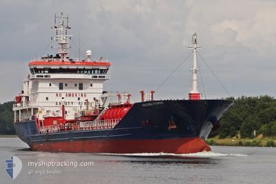
IPEK S
Oil/Chemical Tanker
Current Trip
| Time Travelled | 20 h, 7 mins |
|---|---|
| Remaining Time | 2 h, 6 mins |
| Distance Travelled | 97.12 nm |
| Remaining Distance | 79.97 nm |
| AVG Speed | 7.2 Knots |
| MAX Speed | 9.7 Knots |
| AVG Wind | 19.1 knots |
| MAX Wind | 22 knots |
| MIN Temp | 10.1°C / 50.18°F |
| MAX Temp | 11.2°C / 52.16°F |
| Draught | 5.5 m |
| Position Received | 8 h, 9 m ago |
Current Position
| Longitude | --- |
|---|---|
| Latitude | --- |
| Status | Under way using engine |
| Speed | 7.9 Knots |
| Course | 36.4° |
| Area | North Sea |
| Station | T-AIS |
| Position Received | 8 h, 9 m ago |
Info
Information
The current position of IPEK S is in North Sea with coordinates 52.85662° / 3.30026° as reported on 2025-12-11 03:40 by AIS to our vessel tracker app. The vessel's current speed is 7.9 Knots and is heading at the port of ROTTERDAM. The estimated time of arrival as calculated by MyShipTracking vessel tracking app is 2025-12-11 14:56 LT
The vessel IPEK S (IMO: 9499541, MMSI: 538090654) is a Oil/Chemical Tanker that was built in 2009 ( 16 years old ). It's sailing under the flag of [MH] Marshall Is.
In this page you can find informations about the vessels current position, last detected port calls, and current voyage information. If the vessels is not in coverage by AIS you will find the latest position.
The current position of IPEK S is detected by our AIS receivers and we are not responsible for the reliability of the data. The last position was recorded while the vessel was in Coverage by the Ais receivers of our vessel tracking app.
The current draught of IPEK S as reported by AIS is 5.5 meters
Weather
| Temperature | 10.1°C / 50.18°F |
|---|---|
| Wind Speed | 21 knots |
| Direction | 225° SW |
| Pressure | 1018.5 hPa |
| Humidity | 86.3 % |
| Cloud Coverage | 100 % |
Featured Company
Last Port Calls
| Port | Arrival | Departure | Time In Port |
|---|---|---|---|
| 2025-12-09 05:39 | 2025-12-10 16:43 | 1 d | |
| 2025-11-20 10:18 | 2025-11-21 15:28 | 1 d | |
| 2025-11-11 20:05 | 2025-11-13 00:21 | 1 d | |
| 2025-11-03 15:16 | 2025-11-06 00:08 | 2 d | |
| 2025-10-31 14:56 | 2025-11-02 08:10 | 1 d | |
| 2025-10-22 22:33 | 2025-10-24 15:25 | 1 d | |
| 2025-10-13 09:00 | 2025-10-14 16:49 | 1 d | |
| 2025-10-07 22:48 | 2025-10-08 02:37 | 3 h | |
| 2025-10-05 21:54 | 2025-10-06 22:46 | 1 d | |
| 2025-10-01 13:43 |
Last Trips
| Origin | Departure | Destination | Arrival | Distance | |
|---|---|---|---|---|---|
| 2025-11-21 15:28 | 2025-12-09 05:39 | 3483.70 nm | |||
| 2025-11-13 00:21 | 2025-11-20 10:18 | 1562.93 nm | |||
| 2025-11-06 00:08 | 2025-11-11 20:05 | 1165.35 nm | |||
| 2025-11-02 08:10 | 2025-11-03 15:16 | 228.90 nm | |||
| 2025-10-24 15:25 | 2025-10-31 14:56 | 1653.68 nm | |||
| 2025-10-14 16:49 | 2025-10-22 22:33 | 544.46 nm | |||
| 2025-10-08 02:37 | 2025-10-13 09:00 | 537.26 nm | |||
| 2025-10-06 22:46 | 2025-10-07 22:48 | 247.92 nm | |||
| 2025-10-01 13:43 | 2025-10-05 21:54 | 433.28 nm |
Events
| Time | Event | Details | Position / Dest | Info |
|---|---|---|---|---|
| 2025-12-11 03:41 | Status Changed | Default Under way using engine |
52.85811 / 3.30206
NLRTM
|
Speed: 7.9 kn Course: 36.4° |
| 2025-12-11 03:40 | Status Changed | Under way using engine Default |
52.85662 / 3.30026
NLRTM
|
Speed: 8 kn Course: 37° |
| 2025-12-11 03:40 | IN Coverage |
52.85662 / 3.30026
North Sea
NLRTM
|
Speed: 7.9 kn Course: 36.4° |
|
| 2025-12-11 03:40 | OUT of Coverage |
52.85662 / 3.30026
North Sea
NLRTM
|
Speed: 7.9 kn Course: 36.4° |
|
| 2025-12-10 19:13 | Status Changed | Default Under way using engine |
52.51859 / 4.20879
NLRTM
|
Speed: 9.2 kn Course: 282.7° |
| 2025-12-10 19:05 | OUT of Coverage |
52.51733 / 4.24108
North Sea
NLRTM
|
Speed: 9.2 kn Course: 282.7° |
|
| 2025-12-10 17:31 | START Moving | 0.34 nm, East of IJMUIDEN |
52.46585 / 4.59680
NLRTM
|
Speed: 4.6 kn Course: 271° |
| 2025-12-10 17:08 | STOP Moving | 0.45 nm, East of IJMUIDEN |
52.46587 / 4.59976
NLRTM
|
Speed: 0.3 kn Course: 270° |
| 2025-12-10 15:43 | PORT DEPARTURE |
|
52.43064 / 4.74597
NLRTM
|
Speed: 7.1 kn Course: 283° |
| 2025-12-10 15:29 | Status Changed | Under way using engine Moored |
52.41397 / 4.77496
[NL] AMSTERDAM
|
Speed: 7.1 kn Course: 341° |