
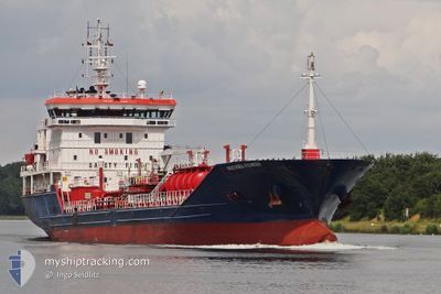
IPEK S
Oil/Chemical Tanker
Current Trip
| Time Travelled | 1 day |
|---|---|
| Remaining Time | 10 h, 29 mins |
| Distance Travelled | 77.34 nm |
| Remaining Distance | 175.18 nm |
| AVG Speed | 9.1 Knop |
| MAX Speed | 12 Knop |
| AVG Wind | 11.3 knots |
| MAX Wind | 22.7 knots |
| MIN Temp | 7°C / 44.6°F |
| MAX Temp | 13.9°C / 57.02°F |
| Djupgående | 5.2 m |
| Position mottagen | 13 h, 25 m sen |
Current Position
| Longitud | --- |
|---|---|
| Latitude | --- |
| Status | Under way using engine |
| Fart | 7.8 Knop |
| Kurs | 350° |
| Område | Black Sea |
| Station | T-AIS |
| Position mottagen | 13 h, 25 m sen |
Info
Information
The current position of IPEK S is in Black Sea with coordinates 41.45885° / 29.19720° as reported on 2024-12-22 02:53 by AIS to our vessel tracker app. The vessel's current speed is 7.8 Knop and is heading at the port of MIDIA. The estimated time of arrival as calculated by MyShipTracking vessel tracking app is 2024-12-23 02:47 LT
The vessel IPEK S (IMO: 9499541, MMSI: 538090654) is a Oil/Chemical Tanker that was built in 2009 ( 15 År gammal ). It's sailing under the flag of [MH] Marshall Is.
In this page you can find informations about the vessels current position, last detected port calls, and current voyage information. If the vessels is not in coverage by AIS you will find the latest position.
The current position of IPEK S is detected by our AIS receivers and we are not responsible for the reliability of the data. The last position was recorded while the vessel was in Coverage by the Ais receivers of our vessel tracking app.
The current draught of IPEK S as reported by AIS is 5.2 meters
Weather
| Temperature | 7.2°C / 44.96°F |
|---|---|
| Wind Speed | 23 knots |
| Direction | 322° NW |
| Pressure | 1013.3 hPa |
| Humidity | 87.8 % |
| Cloud Coverage | 100 % |
Featured Company
Last Port Calls
| Port | Arrival | Departure | Time In Port |
|---|---|---|---|
| 2024-12-15 10:47 | 2024-12-21 12:05 | 6 d | |
| 2024-12-13 05:29 | 2024-12-14 09:56 | 1 d | |
| 2024-11-28 09:24 | 2024-11-29 21:53 | 1 d | |
| 2024-11-17 05:25 | 2024-11-18 19:00 | 1 d | |
| 2024-11-04 17:04 | 2024-11-06 07:50 | 1 d | |
| 2024-10-11 14:47 | 2024-10-12 20:15 | 1 d | |
| 2024-10-09 16:13 | 2024-10-11 13:12 | 1 d | |
| 2024-10-05 02:01 | 2024-10-06 07:53 | 1 d |
Most Visited Ports (Last year)
| Port | Arrivals | |
|---|---|---|
| 2 | ||
| 2 | ||
| 2 | ||
| 2 | ||
| 1 | ||
| 1 |
Last Trips
| Origin | Departure | Destination | Arrival | Distance | |
|---|---|---|---|---|---|
| 2024-12-14 12:56 | 2024-12-15 13:47 | 30.87 nm | |||
| 2024-11-29 23:53 | 2024-12-13 08:29 | 1234.29 nm | |||
| 2024-11-18 21:00 | 2024-11-28 11:24 | 405.47 nm | |||
| 2024-11-06 09:50 | 2024-11-17 07:25 | 723.19 nm | |||
| 2024-10-12 22:15 | 2024-11-04 19:04 | 2960.62 nm | |||
| 2024-10-11 15:12 | 2024-10-11 16:47 | 14.20 nm | |||
| 2024-10-06 09:53 | 2024-10-09 18:13 | 579.13 nm | |||
| 2024-09-26 00:03 | 2024-10-05 04:01 | 647.89 nm |
Events
| Tid | Event | Detaljer | Position / Dest | Information |
|---|---|---|---|---|
| 2024-12-22 02:53 | UTANFÖR täckningsområde |
41.45885 / 29.19720
Black Sea
ROMID
|
Fart: 7.8 kn Kurs: 350° |
|
| 2024-12-22 00:55 | Byter havsområde | Turkish part of the Black Sea Turkish part of the Sea of Marmara |
41.23192 / 29.14045
Black Sea
ROMID
|
Fart: 7.6 kn Kurs: 37.5° |
| 2024-12-21 23:46 | ETA ändrat | 2024/12/23 04:00 2024/12/23 02:00 |
41.08322 / 29.05915
ROMID
|
Fart: 10.1 kn Kurs: 14.4° |
| 2024-12-21 22:51 | ETA ändrat | 2024/12/23 02:00 2024/12/23 20:00 |
40.95910 / 28.98361
ROMID
|
Fart: 9.5 kn Kurs: 20.6° |
| 2024-12-21 22:44 | ETA ändrat | 2024/12/23 20:00 2024/12/22 20:00 |
40.94311 / 28.97555
ROMID
|
Fart: 9.6 kn Kurs: 22.4° |
| 2024-12-21 21:58 | STARTAR förflyttning | 8.27 nm, South East of YESILKOY |
40.83902 / 28.92330
ROMID
|
Fart: 3.1 kn Kurs: 27° |
| 2024-12-21 18:28 | STOPPAR förflyttning | 8.71 nm, South of YESILKOY |
40.81903 / 28.89149
ROMID
|
Fart: 0.3 kn Kurs: 211° |
| 2024-12-21 17:57 | STARTAR förflyttning | 9.92 nm, South West of MALTEPE |
40.81023 / 28.95979
ROMID
|
Fart: 3.7 kn Kurs: 350° |
| 2024-12-21 16:48 | STOPPAR förflyttning | 10.18 nm, South West of MALTEPE |
40.81124 / 28.95154
ROMID
|
Fart: 0.3 kn Kurs: 121° |
| 2024-12-21 12:05 | AVGÅTT HAMN |
|
40.73001 / 29.48295
ROMID
|
Fart: 4.8 kn Kurs: 291° |