

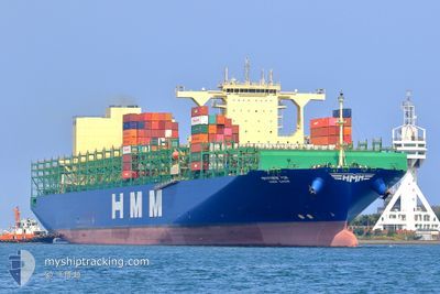
HMM GAON
Cargo

Current Trip
| Time Travelled | 5 days |
|---|---|
| Remaining Time | --- |
| Distance Travelled | 2238.86 nm |
| Remaining Distance | --- |
| AVG Speed | 15.7 Knots |
| MAX Speed | 19.6 Knots |
| AVG Wind | 8.8 knots |
| MAX Wind | 15 knots |
| MIN Temp | 23.5°C / 74.3°F |
| MAX Temp | 28.9°C / 84.02°F |
| Draught | 15.4 m |
| Position Received | 1 d ago |
Current Position
| Longitude | --- |
|---|---|
| Latitude | --- |
| Status | Under way using engine |
| Speed | 17.6 Knots |
| Course | 295.3° |
| Area | Laccadive Sea |
| Station | T-AIS |
| Position Received | 1 d ago |
Information
The current position of HMM GAON is in Laccadive Sea with coordinates 7.46791° / 75.94136° as reported on 2025-02-17 19:44 by AIS to our vessel tracker app. The vessel's current speed is 17.6 Knots and is heading at the port of DUBAI. The estimated time of arrival as calculated by MyShipTracking vessel tracking app is 2025-02-22 04:00 LT
The vessel HMM GAON (IMO: 9869174, MMSI: 636020383) is a Cargo It's sailing under the flag of [LR] Liberia.
In this page you can find informations about the vessels current position, last detected port calls, and current voyage information. If the vessels is not in coverage by AIS you will find the latest position.
The current position of HMM GAON is detected by our AIS receivers and we are not responsible for the reliability of the data. The last position was recorded while the vessel was in Coverage by the Ais receivers of our vessel tracking app.
The current draught of HMM GAON as reported by AIS is 15.4 meters
Weather
| Temperature | 26.9°C / 80.42°F |
|---|---|
| Wind Speed | 6 knots |
| Direction | 13° NNE |
| Pressure | 1011 hPa |
| Humidity | 76.2 % |
| Cloud Coverage | 5 % |


Featured Company
Last Port Calls
| Port | Arrival | Departure | Time In Port |
|---|---|---|---|
| 2025-02-11 18:47 | 2025-02-13 12:21 | 1 d | |
| 2025-02-05 17:53 | 2025-02-06 12:57 | 19 h | |
| 2025-02-01 17:08 | 2025-02-02 07:50 | 14 h | |
| 2025-01-25 14:01 | 2025-01-27 01:58 | 1 d | |
| 2025-01-21 17:13 | 2025-01-23 05:41 | 1 d | |
| 2025-01-14 02:22 | 2025-01-15 01:22 | 23 h | |
| 2025-01-04 13:41 | 2025-01-05 15:46 | 1 d | |
| 2025-01-01 20:48 | 2025-01-03 12:25 | 1 d | |
| 2024-12-31 15:55 | 2025-01-01 06:18 | 14 h | |
| 2024-12-28 14:46 | 2024-12-29 04:54 | 14 h |
Last Trips
| Origin | Departure | Destination | Arrival | Distance | |
|---|---|---|---|---|---|
| 2025-02-06 20:57 | 2025-02-12 02:47 | 1489.69 nm | |||
| 2025-02-02 15:50 | 2025-02-06 01:53 | 497.24 nm | |||
| 2025-01-27 10:58 | 2025-02-02 01:08 | 1199.35 nm | |||
| 2025-01-23 13:41 | 2025-01-25 23:01 | 517.51 nm | |||
| 2025-01-15 09:22 | 2025-01-22 01:13 | 2564.14 nm | |||
| 2025-01-05 19:46 | 2025-01-14 10:22 | 3341.14 nm | |||
| 2025-01-03 16:25 | 2025-01-04 17:41 | 263.64 nm | |||
| 2025-01-01 10:18 | 2025-01-02 00:48 | 63.21 nm | |||
| 2024-12-29 07:54 | 2024-12-31 19:55 | 447.29 nm | |||
| 2024-12-28 08:55 | 2024-12-28 17:46 | 121.05 nm |
Events
| Time | Event | Details | Position / Dest | Info |
|---|---|---|---|---|
| 2025-02-17 19:47 | Status Changed | Default Under way using engine |
7.47436 / 75.92738
SGSIN>AEDXB
|
Speed: 17.6 kn Course: 295.3° |
| 2025-02-17 19:44 | OUT of Coverage |
7.46791 / 75.94136
Laccadive Sea
SGSIN>AEDXB
|
Speed: 17.6 kn Course: 295.3° |
|
| 2025-02-17 19:42 | Status Changed | Under way using engine Default |
7.46353 / 75.95079
SGSIN>AEDXB
|
Speed: 17.8 kn Course: 293° |
| 2025-02-17 19:34 | Status Changed | Default Under way using engine |
7.44813 / 75.98584
SGSIN>AEDXB
|
Speed: 17.8 kn Course: 292.4° |
| 2025-02-17 13:35 | ETA Changed | 2025/02/22 04:00 2025/02/22 00:00 |
6.61122 / 77.55994
SGSIN>AEDXB
|
Speed: 17.5 kn Course: 297.9° |
| 2025-02-17 13:22 | Change Sea Area | Indian part of the Laccadive Sea Indonesian part of the Malacca Strait |
6.58019 / 77.61840
Laccadive Sea
SGSIN>AEDXB
|
Speed: 17.3 kn Course: 297.7° |
| 2025-02-17 13:20 | Status Changed | Under way using engine Default |
6.57613 / 77.62611
SGSIN>AEDXB
|
Speed: 17.4 kn Course: 298° |
| 2025-02-17 13:13 | IN Coverage |
6.58019 / 77.61840
Laccadive Sea
SGSIN>AEDXB
|
Speed: 17.3 kn Course: 297.7° |
|
| 2025-02-13 15:33 | Status Changed | Default Under way using engine |
1.26932 / 103.35772
SGSIN>AEDXB
|
Speed: 15.4 kn Course: 307.3° |
| 2025-02-13 15:26 | OUT of Coverage |
1.24779 / 103.38360
Malacca Strait
SGSIN>AEDXB
|
Speed: 15.4 kn Course: 307.3° |