

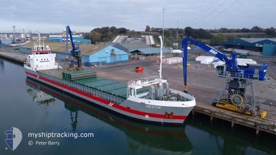
HESTIA
General Cargo

Current Trip
GBSEF
| Time Travelled | 4 days |
|---|---|
| Remaining Time | --- |
| Distance Travelled | 982.66 nm |
| Remaining Distance | --- |
| AVG Speed | 9.8 Knots |
| MAX Speed | 12.3 Knots |
| AVG Wind | 10.6 knots |
| MAX Wind | 38.7 knots |
| MIN Temp | 3.3°C / 37.94°F |
| MAX Temp | 8.3°C / 46.94°F |
| Draught | 5.5 m |
| Position Received | 15 h, 15 m ago |
Current Position
| Longitude | --- |
|---|---|
| Latitude | --- |
| Status | Under way using engine |
| Speed | 9.9 Knots |
| Course | 223.1° |
| Area | Inner Seas off the West Coast of Scotland |
| Station | T-AIS |
| Position Received | 15 h, 15 m ago |
Information
The current position of HESTIA is in Inner Seas off the West Coast of Scotland with coordinates 58.01823° / -6.18454° as reported on 2025-03-23 09:43 by AIS to our vessel tracker app. The vessel's current speed is 9.9 Knots
The vessel HESTIA (IMO: 9411783, MMSI: 246827000) is a General Cargo that was built in 2011 ( 14 years old ). It's sailing under the flag of [NL] Netherlands.
In this page you can find informations about the vessels current position, last detected port calls, and current voyage information. If the vessels is not in coverage by AIS you will find the latest position.
The current position of HESTIA is detected by our AIS receivers and we are not responsible for the reliability of the data. The last position was recorded while the vessel was in Coverage by the Ais receivers of our vessel tracking app.
The current draught of HESTIA as reported by AIS is 5.5 meters
Weather
| Temperature | 7.9°C / 46.22°F |
|---|---|
| Wind Speed | 10 knots |
| Direction | 333° NNW |
| Pressure | 1017.6 hPa |
| Humidity | 75.4 % |
| Cloud Coverage | 80 % |


Featured Company
Last Port Calls
| Port | Arrival | Departure | Time In Port |
|---|---|---|---|
| 2025-03-18 15:34 | 2025-03-19 17:59 | 1 d | |
| 2025-03-15 22:23 | 2025-03-15 23:04 | 40 m | |
| 2025-03-14 23:34 | 2025-03-15 10:08 | 10 h | |
| 2025-03-12 23:27 | 2025-03-13 14:00 | 14 h | |
| 2025-03-05 17:19 | 2025-03-07 15:01 | 1 d | |
| 2025-03-04 16:30 | 2025-03-05 15:16 | 22 h | |
| 2025-03-02 20:53 | 2025-03-03 10:58 | 14 h | |
| 2025-02-27 13:10 | 2025-02-28 18:46 | 1 d | |
| 2025-02-25 22:02 | 2025-02-26 18:05 | 20 h | |
| 2025-02-20 18:41 | 2025-02-21 20:15 | 1 d |
Last Trips
| Origin | Departure | Destination | Arrival | Distance | |
|---|---|---|---|---|---|
| 2025-03-15 23:04 | 2025-03-18 15:34 | 301.19 nm | |||
| 2025-03-15 10:08 | 2025-03-15 22:23 | 46.47 nm | |||
| 2025-03-13 14:00 | 2025-03-14 23:34 | 316.68 nm | |||
| 2025-03-07 15:01 | 2025-03-12 23:27 | 585.93 nm | |||
| 2025-03-05 15:16 | 2025-03-05 17:19 | 21.35 nm | |||
| 2025-03-03 10:58 | 2025-03-04 16:30 | 279.67 nm | |||
| 2025-02-28 18:46 | 2025-03-02 20:53 | 385.45 nm | |||
| 2025-02-26 18:05 | 2025-02-27 13:10 | 183.58 nm | |||
| 2025-02-21 20:15 | 2025-02-25 22:02 | 740.21 nm | |||
| 2025-02-18 23:47 | 2025-02-20 18:41 | 153.41 nm |
Events
| Time | Event | Details | Position / Dest | Info |
|---|---|---|---|---|
| 2025-03-23 09:44 | Status Changed | Default Under way using engine |
58.01758 / -6.18572
GBSEF
|
Speed: 9.9 kn Course: 223.1° |
| 2025-03-23 09:43 | OUT of Coverage |
58.01823 / -6.18454
Inner Seas off the West Coast of Scotland
GBSEF
|
Speed: 9.9 kn Course: 223.1° |
|
| 2025-03-23 09:36 | Status Changed | Under way using engine Default |
58.03214 / -6.15908
GBSEF
|
Speed: 9.8 kn Course: 225° |
| 2025-03-23 09:28 | Status Changed | Default Under way using engine |
58.04872 / -6.12839
GBSEF
|
Speed: 9.9 kn Course: 223.6° |
| 2025-03-23 08:39 | Change Sea Area | United Kingdom part of the Inner Seas off the West Coast of Scotland United Kingdom part of the North Atlantic Ocean |
58.14630 / -5.95514
Inner Seas off the West Coast of Scotland
GBSEF
|
Speed: 10.1 kn Course: 222.2° |
| 2025-03-23 08:39 | Status Changed | Under way using engine Default |
58.14630 / -5.95514
GBSEF
|
Speed: 10 kn Course: 222° |
| 2025-03-23 08:24 | IN Coverage |
58.14630 / -5.95514
Inner Seas off the West Coast of Scotland
GBSEF
|
Speed: 10.1 kn Course: 222.2° |
|
| 2025-03-23 02:32 | Status Changed | Default Under way using engine |
58.67646 / -4.53630
GBSEF
|
Speed: 7.9 kn Course: 268.4° |
| 2025-03-23 02:26 | OUT of Coverage |
58.67655 / -4.51396
North Atlantic Ocean
GBSEF
|
Speed: 7.9 kn Course: 268.4° |
|
| 2025-03-23 02:25 | Status Changed | Under way using engine Default |
58.67678 / -4.50773
GBSEF
|
Speed: 8.3 kn Course: 266° |