

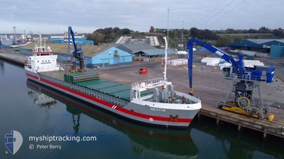
HESTIA
General Cargo

Current Trip
| Time Travelled | 8 h, 13 mins |
|---|---|
| Remaining Time | --- |
| Distance Travelled | 81.90 nm |
| Remaining Distance | --- |
| AVG Speed | 11.1 Noeuds |
| MAX Speed | 13.9 Noeuds |
| AVG Wind | 15.9 knots |
| MAX Wind | 24 knots |
| MIN Temp | 8.9°C / 48.02°F |
| MAX Temp | 10.1°C / 50.18°F |
| Tirant d eau | 5.1 m |
| Position reçue | 12 m depuis |
Current Position
| Longitude | --- |
|---|---|
| Latitude | --- |
| Etat | Under way using engine |
| Vitesse | 7 Noeuds |
| Parcours | 270.2° |
| Zone | Celtic Sea |
| Station | T-AIS |
| Position reçue | 12 m depuis |
Information
The current position of HESTIA is in Celtic Sea with coordinates 51.37121° / -5.00752° as reported on 2025-03-30 03:09 by AIS to our vessel tracker app. The vessel's current speed is 7 Noeuds and is heading at the port of LIMERICK. The estimated time of arrival as calculated by MyShipTracking vessel tracking app is 2025-03-31 17:00 LT
The vessel HESTIA (IMO: 9411783, MMSI: 246827000) is a General Cargo that was built in 2011 ( 14 Age ). It's sailing under the flag of [NL] Netherlands.
In this page you can find informations about the vessels current position, last detected port calls, and current voyage information. If the vessels is not in coverage by AIS you will find the latest position.
The current position of HESTIA is detected by our AIS receivers and we are not responsible for the reliability of the data. The last position was recorded while the vessel was in Coverage by the Ais receivers of our vessel tracking app.
The current draught of HESTIA as reported by AIS is 5.1 meters
Weather
| Temperature | 9.9°C / 49.82°F |
|---|---|
| Wind Speed | 14 knots |
| Direction | 293° WNW |
| Pressure | 1020.7 hPa |
| Humidity | 89.8 % |
| Cloud Coverage | 85 % |


Featured Company
Last Port Calls
| Port | Arrival | Departure | Time In Port |
|---|---|---|---|
| 2025-03-27 17:48 | 2025-03-29 19:08 | 2 d | |
| 2025-03-25 02:10 | 2025-03-26 13:32 | 1 d | |
| 2025-03-18 15:34 | 2025-03-19 17:59 | 1 d | |
| 2025-03-15 22:23 | 2025-03-15 23:04 | 40 m | |
| 2025-03-14 23:34 | 2025-03-15 10:08 | 10 h | |
| 2025-03-12 23:27 | 2025-03-13 14:00 | 14 h | |
| 2025-03-05 17:19 | 2025-03-07 15:01 | 1 d | |
| 2025-03-04 16:30 | 2025-03-05 15:16 | 22 h | |
| 2025-03-02 20:53 | 2025-03-03 10:58 | 14 h | |
| 2025-02-27 13:10 | 2025-02-28 18:46 | 1 d |
Last Trips
| Origin | Departure | Destination | Arrival | Distance | |
|---|---|---|---|---|---|
| 2025-03-26 13:32 | 2025-03-27 17:48 | 281.10 nm | |||
| 2025-03-19 17:59 | 2025-03-25 02:10 | 1189.61 nm | |||
| 2025-03-15 23:04 | 2025-03-18 15:34 | 301.19 nm | |||
| 2025-03-15 10:08 | 2025-03-15 22:23 | 46.47 nm | |||
| 2025-03-13 14:00 | 2025-03-14 23:34 | 316.68 nm | |||
| 2025-03-07 15:01 | 2025-03-12 23:27 | 585.93 nm | |||
| 2025-03-05 15:16 | 2025-03-05 17:19 | 21.35 nm | |||
| 2025-03-03 10:58 | 2025-03-04 16:30 | 279.67 nm | |||
| 2025-02-28 18:46 | 2025-03-02 20:53 | 385.45 nm | |||
| 2025-02-26 18:05 | 2025-02-27 13:10 | 183.58 nm |
Events
| Heure | Evenement | Détails | Position/ Destination | Info |
|---|---|---|---|---|
| 2025-03-30 03:20 | Etat Changé | Under way using engine Default |
51.37143 / -5.04338
IE LMK
|
Vitesse: 7.1 kn Parcours: 270° |
| 2025-03-30 03:16 | Etat Changé | Default Under way using engine |
51.37131 / -5.02864
IE LMK
|
Vitesse: 7 kn Parcours: 270.2° |
| 2025-03-30 02:36 | Etat Changé | Under way using engine Default |
51.37164 / -4.90514
IE LMK
|
Vitesse: 7.4 kn Parcours: 268° |
| 2025-03-30 02:32 | Etat Changé | Default Under way using engine |
51.37174 / -4.89107
IE LMK
|
Vitesse: 6.6 kn Parcours: 268.9° |
| 2025-03-30 01:58 | Changement de zone | United Kingdom part of the Celtic Sea United Kingdom part of the Bristol Channel |
51.37092 / -4.78523
Celtic Sea
IE LMK
|
Vitesse: 7.1 kn Parcours: 273.8° |
| 2025-03-30 01:53 | Etat Changé | Under way using engine Default |
51.37047 / -4.76892
IE LMK
|
Vitesse: 7.3 kn Parcours: 272° |
| 2025-03-30 01:16 | Etat Changé | Default Under way using engine |
51.37047 / -4.64265
IE LMK
|
Vitesse: 8 kn Parcours: 273.3° |
| 2025-03-30 01:09 | Etat Changé | Under way using engine Default |
51.36997 / -4.61880
IE LMK
|
Vitesse: 8.3 kn Parcours: 268° |
| 2025-03-30 00:52 | Etat Changé | Default Under way using engine |
51.37006 / -4.55599
IE LMK
|
Vitesse: 9 kn Parcours: 272.3° |
| 2025-03-30 00:37 | Etat Changé | Under way using engine Default |
51.36945 / -4.49984
IE LMK
|
Vitesse: 8.8 kn Parcours: 271° |