
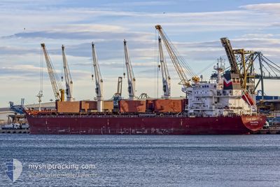
FOUR RIGOLETTO
Bulk Carrier
Current Trip
| Time Travelled | 3 days |
|---|---|
| Remaining Time | --- |
| Distance Travelled | 259.81 nm |
| Remaining Distance | --- |
| AVG Speed | 9.7 Knots |
| MAX Speed | 14.1 Knots |
| AVG Wind | 13 knots |
| MAX Wind | 32.3 knots |
| MIN Temp | 22.9°C / 73.22°F |
| MAX Temp | 31.7°C / 89.06°F |
| Draught | 7.6 m |
| Position Received | 17 h, 19 m ago |
Current Position
| Longitude | --- |
|---|---|
| Latitude | --- |
| Status | Under way using engine |
| Speed | 8.9 Knots |
| Course | 90.5° |
| Area | Caribbean Sea |
| Station | T-AIS |
| Position Received | 17 h, 19 m ago |
Info
Information
The current position of FOUR RIGOLETTO is in Caribbean Sea with coordinates 11.23939° / -74.62960° as reported on 2025-01-13 03:35 by AIS to our vessel tracker app. The vessel's current speed is 8.9 Knots
The vessel FOUR RIGOLETTO (IMO: 9450674, MMSI: 248489000) is a Bulk Carrier that was built in 2011 ( 14 years old ). It's sailing under the flag of [MT] Malta.
In this page you can find informations about the vessels current position, last detected port calls, and current voyage information. If the vessels is not in coverage by AIS you will find the latest position.
The current position of FOUR RIGOLETTO is detected by our AIS receivers and we are not responsible for the reliability of the data. The last position was recorded while the vessel was in Coverage by the Ais receivers of our vessel tracking app.
The current draught of FOUR RIGOLETTO as reported by AIS is 7.6 meters
Weather
| Temperature | 28.6°C / 83.48°F |
|---|---|
| Wind Speed | 19 knots |
| Direction | 43° NE |
| Pressure | 1009.4 hPa |
| Humidity | 70.5 % |
| Cloud Coverage | 81 % |
Featured Company
Last Port Calls
| Port | Arrival | Departure | Time In Port |
|---|---|---|---|
| 2025-01-06 15:00 | 2025-01-10 09:34 | 3 d | |
| 2024-12-15 05:46 | 2024-12-15 10:22 | 4 h | |
| 2024-12-08 21:29 | 2024-12-12 07:42 | 3 d | |
| 2024-12-03 09:38 | 2024-12-06 06:42 | 2 d | |
| 2024-11-24 10:49 | 2024-11-29 04:20 | 4 d | |
| 2024-11-16 11:52 | 2024-11-19 20:38 | 3 d | |
| 2024-11-07 01:25 | 2024-11-08 23:06 | 1 d | |
| 2024-11-03 17:59 | 2024-11-05 22:07 | 2 d |
Most Visited Ports (Last year)
| Port | Arrivals | |
|---|---|---|
| 4 | ||
| 3 | ||
| 2 | ||
| 1 | ||
| 1 | ||
| 1 |
Last Trips
| Origin | Departure | Destination | Arrival | Distance | |
|---|---|---|---|---|---|
| 2024-12-15 10:22 | 2025-01-06 15:00 | 1713.50 nm | |||
| 2024-12-12 07:42 | 2024-12-15 05:46 | 693.89 nm | |||
| 2024-12-06 06:42 | 2024-12-08 21:29 | 733.50 nm | |||
| 2024-11-29 04:20 | 2024-12-03 09:38 | 862.66 nm | |||
| 2024-11-19 20:38 | 2024-11-24 10:49 | 861.73 nm | |||
| 2024-11-08 23:06 | 2024-11-16 11:52 | 21.77 nm | |||
| 2024-11-05 22:07 | 2024-11-07 01:25 | 298.47 nm | |||
| 2024-10-08 02:37 | 2024-11-03 17:59 | 6736.94 nm |
Events
| Time | Event | Details | Position / Dest | Info |
|---|---|---|---|---|
| 2025-01-13 07:18 | STOP Moving | 0.65 nm, South West of SANTA MARTA |
11.23983 / -74.23006
SANTA MARTA
|
Speed: 0.1 kn Course: 64° |
| 2025-01-13 03:41 | Status Changed | Default Under way using engine |
11.23991 / -74.61449
SANTA MARTA
|
Speed: 8.9 kn Course: 90.5° |
| 2025-01-13 03:35 | OUT of Coverage |
11.23939 / -74.62960
Caribbean Sea
SANTA MARTA
|
Speed: 8.9 kn Course: 90.5° |
|
| 2025-01-13 03:24 | Status Changed | Under way using engine Default |
11.23912 / -74.65684
SANTA MARTA
|
Speed: 8.7 kn Course: 91° |
| 2025-01-13 03:15 | Status Changed | Default Under way using engine |
11.23889 / -74.67867
SANTA MARTA
|
Speed: 9 kn Course: 90.3° |
| 2025-01-13 02:56 | Status Changed | Under way using engine Default |
11.23772 / -74.72750
SANTA MARTA
|
Speed: 9.1 kn Course: 86° |
| 2025-01-13 02:54 | Status Changed | Default Under way using engine |
11.23751 / -74.73360
SANTA MARTA
|
Speed: 9.5 kn Course: 87° |
| 2025-01-12 23:32 | Status Changed | Under way using engine Default |
11.03807 / -75.23163
SANTA MARTA
|
Speed: 10.4 kn Course: 55° |
| 2025-01-12 23:31 | Status Changed | Default Under way using engine |
11.03695 / -75.23325
SANTA MARTA
|
Speed: 10.5 kn Course: 54.7° |
| 2025-01-12 23:08 | Status Changed | Under way using engine Default |
10.99867 / -75.28849
SANTA MARTA
|
Speed: 10.4 kn Course: 56° |