
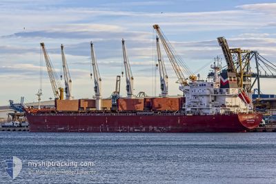
FOUR RIGOLETTO
Bulk Carrier
Current Trip
ACU
| Time Travelled | 7 days |
|---|---|
| Remaining Time | --- |
| Distance Travelled | 1777.49 nm |
| Remaining Distance | --- |
| AVG Speed | 11.6 Noeuds |
| MAX Speed | 13.3 Noeuds |
| AVG Wind | 8.7 knots |
| MAX Wind | 18.8 knots |
| MIN Temp | 22.8°C / 73.04°F |
| MAX Temp | 29.2°C / 84.56°F |
| Tirant d eau | 6.1 m |
| Position reçue | 4 d depuis |
Current Position
| Longitude | -38.63518° |
|---|---|
| Latitude | -13.04656° |
| Etat | At anchor |
| Vitesse | 0.4 Noeuds |
| Parcours | 161° |
| Zone | South Atlantic Ocean |
| Station | T-AIS |
| Position reçue | 4 d depuis |
Info
Information
The current position of FOUR RIGOLETTO is in South Atlantic Ocean with coordinates -13.04656° / -38.63518° as reported on 2024-04-26 19:32 by AIS to our vessel tracker app. The vessel's current speed is 0.4 Noeuds
The vessel FOUR RIGOLETTO (IMO: 9450674, MMSI: 248489000) is a Bulk Carrier that was built in 2011 ( 13 Age ). It's sailing under the flag of [MT] Malta.
In this page you can find informations about the vessels current position, last detected port calls, and current voyage information. If the vessels is not in coverage by AIS you will find the latest position.
The current position of FOUR RIGOLETTO is detected by our AIS receivers and we are not responsible for the reliability of the data. The last position was recorded while the vessel was in Coverage by the Ais receivers of our vessel tracking app.
The current draught of FOUR RIGOLETTO as reported by AIS is 6.1 meters
Weather
| Temperature | 27.6°C / 81.68°F |
|---|---|
| Wind Speed | 3 knots |
| Direction | 21° NNE |
| Pressure | 1009.8 hPa |
| Humidity | 74.9 % |
| Cloud Coverage | 65 % |
Featured Company
Last Port Calls
| Port | Arrival | Departure | Time In Port |
|---|---|---|---|
| 2024-04-21 19:30 | 2024-04-23 07:34 | 1 d | |
| 2024-04-14 10:06 | 2024-04-18 03:36 | 3 d | |
| 2024-03-28 06:41 | 2024-03-31 00:12 | 2 d | |
| 2024-03-22 17:14 | 2024-03-25 07:54 | 2 d | |
| 2024-03-09 02:19 | 2024-03-12 22:22 | 3 d |
Most Visited Ports (Last year)
| Port | Arrivals | |
|---|---|---|
| 1 | ||
| 1 | ||
| 1 | ||
| 1 | ||
| 1 | ||
| 1 |
Last Trips
| Origin | Departure | Destination | Arrival | Distance | |
|---|---|---|---|---|---|
| 2024-04-18 00:36 | 2024-04-21 16:30 | 117.13 nm | |||
| 2024-03-30 21:12 | 2024-04-14 07:06 | 2385.90 nm | |||
| 2024-03-25 04:54 | 2024-03-28 03:41 | 829.79 nm | |||
| 2024-03-12 19:22 | 2024-03-22 14:14 | 2381.62 nm | |||
| 2024-02-17 01:46 | 2024-03-08 23:19 | 5327.12 nm |
Events
| Heure | Evenement | Détails | Position/ Destination | Info |
|---|---|---|---|---|
| 2024-04-27 02:53 | Démarrage | 8.55 nm, South West of SALVADOR |
-13.05215 / -38.63201
ACU
|
Vitesse: 3.8 kn Parcours: 140° |
| 2024-04-26 19:36 | Etat Changé | Default At anchor |
-13.04500 / -38.63500
ACU
|
Vitesse: 0.4 kn Parcours: 161° |
| 2024-04-26 19:32 | Etat Changé | At anchor Default |
-13.04656 / -38.63518
ACU
|
Vitesse: 0.4 kn Parcours: 145° |
| 2024-04-26 19:32 | Hors de la zone couverte |
-13.04656 / -38.63518
South Atlantic Ocean
|
Vitesse: 0.4 kn Parcours: 35.4° |
|
| 2024-04-26 19:29 | Dans la zone couverte |
-13.04656 / -38.63518
South Atlantic Ocean
|
Vitesse: 0.4 kn Parcours: 35.4° |
|
| 2024-04-25 08:57 | Arret | 8.42 nm, South West of SALVADOR |
-13.04667 / -38.63334
ACU
|
Vitesse: Parcours: -1° |
| 2024-04-23 07:34 | PORT DE DEPART |
|
-21.84414 / -40.99514
ACU
|
Vitesse: 6.8 kn Parcours: 62° |
| 2024-04-23 07:28 | Démarrage |
-21.85194 / -41.01046
[BR] PORTO DO ACU
|
Vitesse: 6.8 kn Parcours: 62° |
|
| 2024-04-22 21:13 | Etat Changé | Default Moored |
-21.85320 / -41.02014
[BR] PORTO DO ACU
|
Vitesse: Parcours: 253° |
| 2024-04-22 21:01 | Hors de la zone couverte |
-21.85322 / -41.02015
South Atlantic Ocean
[BR] PORTO DO ACU
|
Vitesse: Parcours: 285.5° |