

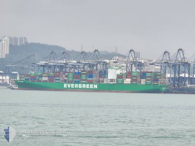
EVER LAMBENT
Container Ship

Current Trip
| Time Travelled | 21 days |
|---|---|
| Remaining Time | 3 days |
| Distance Travelled | 9108.93 nm |
| Remaining Distance | 1480.68 nm |
| AVG Speed | 17.8 Knots |
| MAX Speed | 20 Knots |
| AVG Wind | 11.3 knots |
| MAX Wind | 21.6 knots |
| MIN Temp | 16.2°C / 61.16°F |
| MAX Temp | 28.5°C / 83.3°F |
| Draught | 13.5 m |
| Position Received | 3 d ago |
Current Position
| Longitude | --- |
|---|---|
| Latitude | --- |
| Status | Under way using engine |
| Speed | 15.5 Knots |
| Course | 288.5° |
| Area | North Pacific Ocean |
| Station | T-AIS |
| Position Received | 3 d ago |
Information
The current position of EVER LAMBENT is in North Pacific Ocean with coordinates 7.54952° / 158.41220° as reported on 2025-02-16 05:38 by AIS to our vessel tracker app. The vessel's current speed is 15.5 Knots and is heading at the port of HONG KONG. The estimated time of arrival as calculated by MyShipTracking vessel tracking app is 2025-02-23 00:53 LT
The vessel EVER LAMBENT (IMO: 9595436, MMSI: 235093569) is a Container Ship that was built in 2012 ( 13 years old ). It's sailing under the flag of [GB] United Kingdom.
In this page you can find informations about the vessels current position, last detected port calls, and current voyage information. If the vessels is not in coverage by AIS you will find the latest position.
The current position of EVER LAMBENT is detected by our AIS receivers and we are not responsible for the reliability of the data. The last position was recorded while the vessel was in Coverage by the Ais receivers of our vessel tracking app.
The current draught of EVER LAMBENT as reported by AIS is 13.5 meters
Weather
| Temperature | 27°C / 80.6°F |
|---|---|
| Wind Speed | 22 knots |
| Direction | 47° NE |
| Pressure | 1014 hPa |
| Humidity | 75 % |
| Cloud Coverage | 16 % |


Featured Company
Last Port Calls
| Port | Arrival | Departure | Time In Port |
|---|---|---|---|
| 2025-01-27 17:13 | 2025-01-29 02:46 | 1 d | |
| 2025-01-22 19:34 | 2025-01-24 11:02 | 1 d | |
| 2025-01-18 13:11 | 2025-01-18 13:20 | 9 m | |
| 2025-01-16 13:21 | 2025-01-17 15:39 | 1 d | |
| 2025-01-08 20:33 | 2025-01-11 16:50 | 2 d | |
| 2024-12-20 01:49 | 2024-12-20 16:48 | 14 h | |
| 2024-12-14 11:41 | 2024-12-15 12:58 | 1 d | |
| 2024-12-12 07:08 | 2024-12-13 09:40 | 1 d | |
| 2024-12-10 01:33 | 2024-12-11 06:37 | 1 d |
Most Visited Ports (Last year)
| Port | Arrivals | |
|---|---|---|
| 6 | ||
| 5 | ||
| 5 | ||
| 4 | ||
| 4 | ||
| 4 |
Last Trips
| Origin | Departure | Destination | Arrival | Distance | |
|---|---|---|---|---|---|
| 2025-01-24 06:02 | 2025-01-27 14:13 | 1319.26 nm | |||
| 2025-01-18 08:20 | 2025-01-22 14:34 | 1165.22 nm | |||
| 2025-01-17 10:39 | 2025-01-18 08:11 | 363.49 nm | |||
| 2025-01-11 10:50 | 2025-01-16 08:21 | 1760.48 nm | |||
| 2024-12-21 00:48 | 2025-01-08 14:33 | 7304.41 nm | |||
| 2024-12-15 20:58 | 2024-12-20 09:49 | 603.95 nm | |||
| 2024-12-13 17:40 | 2024-12-14 19:41 | 353.66 nm | |||
| 2024-12-11 14:37 | 2024-12-12 15:08 | 68.86 nm | |||
| 2024-11-14 23:19 | 2024-12-10 09:33 | 10496.32 nm |
Events
| Time | Event | Details | Position / Dest | Info |
|---|---|---|---|---|
| 2025-02-16 05:44 | Status Changed | Default Under way using engine |
7.55685 / 158.39046
CL VAP>HK HKG
|
Speed: 15.5 kn Course: 288.5° |
| 2025-02-16 05:38 | Status Changed | Under way using engine Default |
7.54952 / 158.41220
CL VAP>HK HKG
|
Speed: 15.6 kn Course: 289° |
| 2025-02-16 05:38 | OUT of Coverage |
7.54952 / 158.41220
North Pacific Ocean
CL VAP>HK HKG
|
Speed: 15.5 kn Course: 288.5° |
|
| 2025-02-16 05:16 | Status Changed | Default Under way using engine |
7.51811 / 158.50427
CL VAP>HK HKG
|
Speed: 16 kn Course: 289.6° |
| 2025-02-16 04:50 | Change Sea Area | Micronesian part of the North Pacific Ocean Chilean (disputed - Chilean point of view) part of the South Pacific Ocean |
7.47980 / 158.61355
North Pacific Ocean
CL VAP>HK HKG
|
Speed: 16.1 kn Course: 289.1° |
| 2025-02-16 04:50 | Status Changed | Under way using engine Default |
7.47980 / 158.61355
CL VAP>HK HKG
|
Speed: 16.1 kn Course: 289° |
| 2025-02-16 04:41 | IN Coverage |
7.47980 / 158.61355
North Pacific Ocean
CL VAP>HK HKG
|
Speed: 16.1 kn Course: 289.1° |