
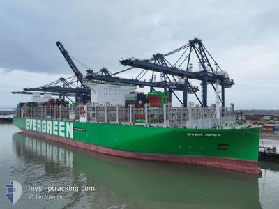
EVER APEX
Cargo D
Current Trip
| Time Travelled | 24 days |
|---|---|
| Remaining Time | --- |
| Distance Travelled | 11082.27 nm |
| Remaining Distance | --- |
| AVG Speed | 19 Knots |
| MAX Speed | 23.1 Knots |
| AVG Wind | 13.2 knots |
| MAX Wind | 27.9 knots |
| MIN Temp | 14.3°C / 57.74°F |
| MAX Temp | 29.6°C / 85.28°F |
| Draught | 16.6 m |
| Position Received | 2 h, 23 m ago |
Current Position
| Longitude | -8.65464° |
|---|---|
| Latitude | 44.75292° |
| Status | Under way using engine |
| Speed | 19.8 Knots |
| Course | 25.4° |
| Area | North Atlantic Ocean |
| Station | T-AIS |
| Position Received | 2 h, 23 m ago |
Info
Information
The current position of EVER APEX is in North Atlantic Ocean with coordinates 44.75292° / -8.65464° as reported on 2024-05-12 04:57 by AIS to our vessel tracker app. The vessel's current speed is 19.8 Knots
The vessel EVER APEX (IMO: 9893979, MMSI: 563155500) is a Cargo D It's sailing under the flag of [SG] Singapore.
In this page you can find informations about the vessels current position, last detected port calls, and current voyage information. If the vessels is not in coverage by AIS you will find the latest position.
The current position of EVER APEX is detected by our AIS receivers and we are not responsible for the reliability of the data. The last position was recorded while the vessel was in Coverage by the Ais receivers of our vessel tracking app.
The current draught of EVER APEX as reported by AIS is 16.6 meters
Weather
| Temperature | 14.2°C / 57.56°F |
|---|---|
| Wind Speed | 10 knots |
| Direction | 260° W |
| Pressure | 1017.1 hPa |
| Humidity | 97.3 % |
| Cloud Coverage | 100 % |
Featured Company
Last Port Calls
| Port | Arrival | Departure | Time In Port |
|---|---|---|---|
| 2024-04-16 23:40 | 2024-04-17 21:02 | 21 h | |
| 2024-04-10 02:17 | 2024-04-11 06:34 | 1 d | |
| 2024-04-07 22:42 | 2024-04-08 20:07 | 21 h | |
| 2024-04-04 09:24 | 2024-04-05 11:48 | 1 d | |
| 2024-04-01 12:25 | 2024-04-03 04:53 | 1 d | |
| 2024-03-28 18:32 | 2024-03-30 07:02 | 1 d | |
| 2024-03-23 23:42 | 2024-03-25 09:46 | 1 d |
Most Visited Ports (Last year)
| Port | Arrivals | |
|---|---|---|
| 6 | ||
| 5 | ||
| 4 | ||
| 4 | ||
| 4 | ||
| 4 |
Last Trips
| Origin | Departure | Destination | Arrival | Distance | |
|---|---|---|---|---|---|
| 2024-04-11 14:34 | 2024-04-17 07:40 | 1517.61 nm | |||
| 2024-04-09 04:07 | 2024-04-10 10:17 | 455.81 nm | |||
| 2024-04-05 19:48 | 2024-04-08 06:42 | 498.75 nm | |||
| 2024-04-03 12:53 | 2024-04-04 17:24 | 452.31 nm | |||
| 2024-03-30 15:02 | 2024-04-01 20:25 | 939.87 nm | |||
| 2024-03-25 17:46 | 2024-03-29 02:32 | 1646.50 nm | |||
| 2024-02-25 02:41 | 2024-03-24 07:42 | 11913.50 nm |
Events
| Time | Event | Details | Position / Dest | Info |
|---|---|---|---|---|
| 2024-05-12 05:06 | Status Changed | Default Under way using engine |
44.79613 / -8.62683
SG SIN>NL RTM
|
Speed: 19.8 kn Course: 25.4° |
| 2024-05-12 04:57 | OUT of Coverage |
44.75292 / -8.65464
North Atlantic Ocean
SG SIN>NL RTM
|
Speed: 19.8 kn Course: 25.4° |
|
| 2024-05-12 04:56 | Status Changed | Under way using engine Default |
44.74696 / -8.65884
SG SIN>NL RTM
|
Speed: 20.4 kn Course: 29° |
| 2024-05-12 04:43 | Status Changed | Default Under way using engine |
44.68357 / -8.70732
SG SIN>NL RTM
|
Speed: 20.5 kn Course: 28.3° |
| 2024-05-12 04:35 | Status Changed | Under way using engine Default |
44.64099 / -8.74010
SG SIN>NL RTM
|
Speed: 20.6 kn Course: 29° |
| 2024-05-12 04:26 | Status Changed | Default Under way using engine |
44.59724 / -8.77386
SG SIN>NL RTM
|
Speed: 20.4 kn Course: 29.3° |
| 2024-05-12 04:19 | Status Changed | Under way using engine Default |
44.56491 / -8.79910
SG SIN>NL RTM
|
Speed: 19.8 kn Course: 29° |
| 2024-05-12 04:19 | IN Coverage |
44.56491 / -8.79910
North Atlantic Ocean
SG SIN>NL RTM
|
Speed: 20.4 kn Course: 29.3° |
|
| 2024-05-12 02:23 | Status Changed | Default Under way using engine |
44.01348 / -9.21789
SG SIN>NL RTM
|
Speed: 19.3 kn Course: 29.1° |
| 2024-05-12 02:18 | OUT of Coverage |
43.99052 / -9.23564
North Atlantic Ocean
SG SIN>NL RTM
|
Speed: 19.3 kn Course: 29.1° |