
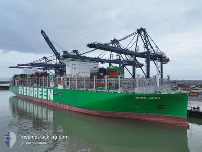
EVER APEX
Not available
Current Trip
SGSGP-NLRDM
| Time Travelled | 10 days |
|---|---|
| Remaining Time | --- |
| Distance Travelled | 4381.60 nm |
| Remaining Distance | --- |
| AVG Speed | 17.9 Knots |
| MAX Speed | 20.8 Knots |
| AVG Wind | 13.4 knots |
| MAX Wind | 24 knots |
| MIN Temp | 20°C / 68°F |
| MAX Temp | 29.6°C / 85.28°F |
| Dybgang | 16 m |
| Position Modtaget | 8 d siden |
Current Position
| Longitude | 94.91442° |
|---|---|
| Latitude | 5.81997° |
| Status | Under way using engine |
| Fart | 17.9 Knots |
| Kurs | 231° |
| Område | Bay of Bengal |
| Station | T-AIS |
| Position Modtaget | 8 d siden |
Info
Information
The current position of EVER APEX is in Bay of Bengal with coordinates 5.81997° / 94.91442° as reported on 2024-04-19 06:04 by AIS to our vessel tracker app. The vessel's current speed is 17.9 Knots
The vessel EVER APEX (MMSI: 563155500) is a Not available It's sailing under the flag of [SG] Singapore.
In this page you can find informations about the vessels current position, last detected port calls, and current voyage information. If the vessels is not in coverage by AIS you will find the latest position.
The current position of EVER APEX is detected by our AIS receivers and we are not responsible for the reliability of the data. The last position was recorded while the vessel was in Coverage by the Ais receivers of our vessel tracking app.
The current draught of EVER APEX as reported by AIS is 16 meters
Weather
| Temperature | 20.2°C / 68.36°F |
|---|---|
| Wind Speed | 18 knots |
| Direction | 153° SSE |
| Pressure | 1022.8 hPa |
| Humidity | 63.2 % |
| Cloud Coverage | 88 % |
Featured Company
Last Port Calls
| Port | Arrival | Departure | Time In Port |
|---|---|---|---|
| 2024-04-16 23:40 | 2024-04-17 21:02 | 21 h | |
| 2024-04-10 02:17 | 2024-04-11 06:34 | 1 d | |
| 2024-04-07 22:42 | 2024-04-08 20:07 | 21 h | |
| 2024-04-04 09:24 | 2024-04-05 11:48 | 1 d | |
| 2024-04-01 12:25 | 2024-04-03 04:53 | 1 d | |
| 2024-03-28 18:32 | 2024-03-30 07:02 | 1 d | |
| 2024-03-23 23:42 | 2024-03-25 09:46 | 1 d | |
| 2024-02-22 02:19 | 2024-02-25 01:41 | 2 d | |
| 2024-02-17 08:05 | 2024-02-20 06:25 | 2 d | |
| 2024-02-04 06:23 | 2024-02-07 00:30 | 2 d |
Most Visited Ports (Last year)
| Port | Arrivals | |
|---|---|---|
| 7 | ||
| 5 | ||
| 4 | ||
| 4 | ||
| 4 | ||
| 4 |
Last Trips
| Origin | Departure | Destination | Arrival | Distance | |
|---|---|---|---|---|---|
| 2024-04-11 14:34 | 2024-04-17 07:40 | 1517.61 nm | |||
| 2024-04-09 04:07 | 2024-04-10 10:17 | 455.81 nm | |||
| 2024-04-05 19:48 | 2024-04-08 06:42 | 498.75 nm | |||
| 2024-04-03 12:53 | 2024-04-04 17:24 | 452.31 nm | |||
| 2024-03-30 15:02 | 2024-04-01 20:25 | 939.87 nm | |||
| 2024-03-25 17:46 | 2024-03-29 02:32 | 1646.50 nm | |||
| 2024-02-25 02:41 | 2024-03-24 07:42 | 11913.50 nm | |||
| 2024-02-20 07:25 | 2024-02-22 03:19 | 344.89 nm | |||
| 2024-02-07 01:30 | 2024-02-17 09:05 | 529.82 nm | |||
| 2024-01-09 10:06 | 2024-02-04 07:23 | 11991.57 nm |
Events
| Tid | Hændelsen | Detaljer | Position / Dest | Info |
|---|---|---|---|---|
| 2024-04-20 14:15 | START Sejllads |
.35579 / 88.00510
SGSGP-NLRDM
|
Fart: 3.1 kn Kurs: 233° |
|
| 2024-04-20 14:01 | STOP Sejllads |
.36027 / 88.00985
SGSGP-NLRDM
|
Fart: 0.3 kn Kurs: 215° |
|
| 2024-04-20 09:59 | START Sejllads |
.84070 / 88.60757
SGSGP-NLRDM
|
Fart: 5.6 kn Kurs: 228° |
|
| 2024-04-20 07:56 | STOP Sejllads |
.86013 / 88.62626
SGSGP-NLRDM
|
Fart: 0.1 kn Kurs: 311° |
|
| 2024-04-19 06:04 | Udenfor Dækning |
5.81997 / 94.91442
Bay of Bengal
|
Fart: 17.9 kn Kurs: 231° |
|
| 2024-04-19 06:04 | Ændre havområde | Indonesian part of the Bay of Bengal Indonesian part of the Andaman or Burma Sea |
5.81997 / 94.91442
Bay of Bengal
|
Fart: 17.9 kn Kurs: 231° |
| 2024-04-19 04:28 | Dybgangen er ændret | 16 16.6 |
5.99665 / 95.36333
SGSGP-NLRDM
|
Fart: 19.9 kn Kurs: 269° |
| 2024-04-19 03:53 | Fundet i havområde | Indonesian part of the Andaman or Burma Sea |
5.99750 / 95.56064
Andaman or Burma Sea
|
Fart: 20.2 kn Kurs: 270° |
| 2024-04-19 03:53 | Indenfor Dækning |
5.99750 / 95.56064
Andaman or Burma Sea
|
Fart: 20.2 kn Kurs: 270° |