

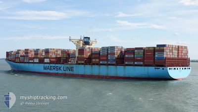
ELLY MAERSK
Container Ship

Current Trip
AEJAL-CNNPO
| Time Travelled | 21 h, 26 mins |
|---|---|
| Remaining Time | --- |
| Distance Travelled | 302.89 nm |
| Remaining Distance | --- |
| AVG Speed | 15.3 Knots |
| MAX Speed | 17.1 Knots |
| AVG Wind | 6.5 knots |
| MAX Wind | 11.3 knots |
| MIN Temp | 21.6°C / 70.88°F |
| MAX Temp | 25.2°C / 77.36°F |
| Draught | 11.1 m |
| Position Received | 6 h, 17 m ago |
Current Position
| Longitude | --- |
|---|---|
| Latitude | --- |
| Status | Under way using engine |
| Speed | 14.3 Knots |
| Course | 129.6° |
| Area | Gulf of Oman |
| Station | T-AIS |
| Position Received | 6 h, 17 m ago |
Information
The current position of ELLY MAERSK is in Gulf of Oman with coordinates 25.19049° / 57.36787° as reported on 2025-03-06 19:02 by AIS to our vessel tracker app. The vessel's current speed is 14.3 Knots
The vessel ELLY MAERSK (IMO: 9321536, MMSI: 220499000) is a Container Ship that was built in 2007 ( 18 years old ). It's sailing under the flag of [DK] Denmark.
In this page you can find informations about the vessels current position, last detected port calls, and current voyage information. If the vessels is not in coverage by AIS you will find the latest position.
The current position of ELLY MAERSK is detected by our AIS receivers and we are not responsible for the reliability of the data. The last position was recorded while the vessel was in Coverage by the Ais receivers of our vessel tracking app.
The current draught of ELLY MAERSK as reported by AIS is 11.1 meters
Weather
| Temperature | 23.7°C / 74.66°F |
|---|---|
| Wind Speed | 11 knots |
| Direction | 268° W |
| Pressure | 1014.9 hPa |
| Humidity | 66.7 % |
| Cloud Coverage | --- |


Featured Company
Last Port Calls
| Port | Arrival | Departure | Time In Port |
|---|---|---|---|
| 2025-03-03 07:38 | 2025-03-06 03:54 | 2 d | |
| 2025-02-28 05:52 | 2025-03-02 14:06 | 2 d | |
| 2025-02-05 01:19 | 2025-02-05 16:26 | 15 h | |
| 2025-01-31 00:15 | 2025-02-01 12:32 | 1 d | |
| 2025-01-25 14:37 | 2025-01-30 00:09 | 4 d | |
| 2025-01-20 06:36 | 2025-01-23 13:24 | 3 d | |
| 2025-01-17 05:02 | 2025-01-18 21:32 | 1 d |
Last Trips
| Origin | Departure | Destination | Arrival | Distance | |
|---|---|---|---|---|---|
| 2025-03-02 18:06 | 2025-03-03 11:38 | 57.88 nm | |||
| 2025-02-05 17:26 | 2025-02-28 09:52 | 10103.18 nm | |||
| 2025-02-01 12:32 | 2025-02-05 02:19 | 1405.75 nm | |||
| 2025-01-30 01:09 | 2025-01-31 00:15 | 189.19 nm | |||
| 2025-01-23 14:24 | 2025-01-25 15:37 | 451.14 nm | |||
| 2025-01-18 21:32 | 2025-01-20 07:36 | 403.20 nm | |||
| 2024-12-23 00:55 | 2025-01-17 05:02 | 10843.08 nm |
Events
| Time | Event | Details | Position / Dest | Info |
|---|---|---|---|---|
| 2025-03-06 19:10 | Status Changed | Default Under way using engine |
25.17110 / 57.39393
AEJAL-CNNPO
|
Speed: 14.3 kn Course: 129.6° |
| 2025-03-06 19:02 | OUT of Coverage |
25.19049 / 57.36787
Gulf of Oman
AEJAL-CNNPO
|
Speed: 14.3 kn Course: 129.6° |
|
| 2025-03-06 16:14 | Change Sea Area | Iranian part of the Gulf of Oman Omani part of the Gulf of Oman |
25.67030 / 56.84947
Gulf of Oman
AEJAL-CNNPO
|
Speed: 16.7 kn Course: 148.5° |
| 2025-03-06 15:17 | Change Sea Area | Omani part of the Gulf of Oman Omani part of the Persian Gulf |
25.91498 / 56.74123
Gulf of Oman
AEJAL-CNNPO
|
Speed: 16.8 kn Course: 165.5° |
| 2025-03-06 15:17 | Status Changed | Under way using engine Default |
25.91634 / 56.74085
AEJAL-CNNPO
|
Speed: 16.7 kn Course: 166° |
| 2025-03-06 14:57 | IN Coverage |
25.91498 / 56.74123
Gulf of Oman
AEJAL-CNNPO
|
Speed: 16.8 kn Course: 165.5° |
|
| 2025-03-06 10:26 | Status Changed | Default Under way using engine |
26.22004 / 55.97535
AEJAL-CNNPO
|
Speed: 16.1 kn Course: 46.8° |
| 2025-03-06 10:19 | OUT of Coverage |
26.19987 / 55.95174
Persian Gulf
AEJAL-CNNPO
|
Speed: 16.1 kn Course: 46.8° |
|
| 2025-03-06 10:10 | Change Sea Area | Omani part of the Persian Gulf United Arab Emirates part of the Persian Gulf |
26.17382 / 55.92095
Persian Gulf
AEJAL-CNNPO
|
Speed: 15.6 kn Course: 47.1° |
| 2025-03-06 04:01 | Draught Changed | 11.1 11.2 |
25.04734 / 55.01937
AEJAL-CNNPO
|
Speed: 13.4 kn Course: 313.3° |