
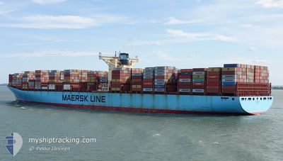
ELLY MAERSK
Container Ship
Current Trip
| Time Travelled | 8 days |
|---|---|
| Remaining Time | --- |
| Distance Travelled | 3953.11 nm |
| Remaining Distance | --- |
| AVG Speed | 19.7 Knop |
| MAX Speed | 23.2 Knop |
| AVG Wind | 16.6 knots |
| MAX Wind | 31 knots |
| MIN Temp | 20°C / 68°F |
| MAX Temp | 29.4°C / 84.92°F |
| Djupgående | 16.9 m |
| Position mottagen | 3 d sen |
Current Position
| Longitud | 54.66022° |
|---|---|
| Latitude | -20.61490° |
| Status | Under way using engine |
| Fart | 18.9 Knop |
| Kurs | 233.3° |
| Område | Indian Ocean |
| Station | T-AIS |
| Position mottagen | 3 d sen |
Info
Information
The current position of ELLY MAERSK is in Indian Ocean with coordinates -20.61490° / 54.66022° as reported on 2024-05-22 06:29 by AIS to our vessel tracker app. The vessel's current speed is 18.9 Knop and is heading at the port of TANGER MED. The estimated time of arrival as calculated by MyShipTracking vessel tracking app is 2024-06-06 09:30 LT
The vessel ELLY MAERSK (IMO: 9321536, MMSI: 220499000) is a Container Ship that was built in 2007 ( 17 År gammal ). It's sailing under the flag of [DK] Denmark.
In this page you can find informations about the vessels current position, last detected port calls, and current voyage information. If the vessels is not in coverage by AIS you will find the latest position.
The current position of ELLY MAERSK is detected by our AIS receivers and we are not responsible for the reliability of the data. The last position was recorded while the vessel was in Coverage by the Ais receivers of our vessel tracking app.
The current draught of ELLY MAERSK as reported by AIS is 16.9 meters
Weather
| Temperature | 21°C / 69.8°F |
|---|---|
| Wind Speed | 17 knots |
| Direction | 44° NE |
| Pressure | 1019.5 hPa |
| Humidity | 75 % |
| Cloud Coverage | 82 % |
Featured Company
Last Port Calls
| Port | Arrival | Departure | Time In Port |
|---|---|---|---|
| 2024-05-16 00:26 | 2024-05-17 13:10 | 1 d | |
| 2024-05-10 21:20 | 2024-05-12 03:30 | 1 d | |
| 2024-05-06 12:40 | 2024-05-07 12:46 | 1 d | |
| 2024-05-04 23:16 | 2024-05-06 00:56 | 1 d | |
| 2024-04-02 07:48 | 2024-04-06 18:19 | 4 d | |
| 2024-03-27 12:14 | 2024-03-29 10:36 | 1 d | |
| 2024-03-04 21:44 | 2024-03-05 22:24 | 1 d | |
| 2024-03-01 16:53 |
Most Visited Ports (Last year)
| Port | Arrivals | |
|---|---|---|
| 5 | ||
| 4 | ||
| 4 | ||
| 4 | ||
| 4 | ||
| 4 |
Last Trips
| Origin | Departure | Destination | Arrival | Distance | |
|---|---|---|---|---|---|
| 2024-05-12 03:30 | 2024-05-16 00:26 | 1604.71 nm | |||
| 2024-05-07 12:46 | 2024-05-10 21:20 | 1497.19 nm | |||
| 2024-05-06 00:56 | 2024-05-06 12:40 | 128.53 nm | |||
| 2024-04-06 18:19 | 2024-05-04 23:16 | 6740.40 nm | |||
| 2024-03-29 10:36 | 2024-04-02 07:48 | 53.21 nm | |||
| 2024-03-05 22:24 | 2024-03-27 12:14 | 10052.53 nm | |||
| 2024-03-01 16:53 | 2024-03-04 21:44 | 1238.74 nm |
Events
| Tid | Event | Detaljer | Position / Dest | Information |
|---|---|---|---|---|
| 2024-05-22 06:37 | Status ändrad | Default Under way using engine |
-20.63928 / 54.62655
LKCMB>MAPTM
|
Fart: 18.9 kn Kurs: 233.3° |
| 2024-05-22 06:29 | UTANFÖR täckningsområde |
-20.61490 / 54.66022
Indian Ocean
LKCMB>MAPTM
|
Fart: 18.9 kn Kurs: 233.3° |
|
| 2024-05-22 06:08 | Status ändrad | Under way using engine Default |
-20.54787 / 54.75169
LKCMB>MAPTM
|
Fart: 18.7 kn Kurs: 233° |
| 2024-05-22 06:06 | Status ändrad | Default Under way using engine |
-20.53920 / 54.76432
LKCMB>MAPTM
|
Fart: 18.5 kn Kurs: 230.6° |
| 2024-05-22 04:04 | Destination ändrad | LKCMB>MAPTM MYTPP>LKCMB |
-20.18289 / 55.32791
LKCMB>MAPTM
|
Fart: 18.8 kn Kurs: 236.9° |
| 2024-05-22 04:04 | ETA ändrat | 2024/06/06 08:30 2024/05/15 13:30 |
-20.18289 / 55.32791
LKCMB>MAPTM
|
Fart: 18.8 kn Kurs: 236.9° |
| 2024-05-22 03:32 | Status ändrad | Under way using engine Default |
-20.09183 / 55.47718
MYTPP>LKCMB
|
Fart: 18.5 kn Kurs: 237° |
| 2024-05-22 03:30 | Status ändrad | Default Under way using engine |
-20.08584 / 55.48692
MYTPP>LKCMB
|
Fart: 18.5 kn Kurs: 237.8° |
| 2024-05-22 03:17 | Upptäckt i hav | R�union part of the Indian Ocean |
-20.05108 / 55.54428
Indian Ocean
|
Fart: 18.4 kn Kurs: 239.1° |
| 2024-05-22 03:17 | Status ändrad | Under way using engine Default |
-20.05108 / 55.54428
MYTPP>LKCMB
|
Fart: 18.2 kn Kurs: 238° |