
ELLY MAERSK
Container Ship
Current Trip
| Trip Time | 24 days |
|---|---|
| Trip Distance | 10903.35 nm |
| AVG Speed | 18 Noeuds |
| MAX Speed | 23.7 Noeuds |
| Tirant d eau | 14.6 m |
| AVG Wind | 15.4 knots |
| MAX Wind | 31 knots |
| MIN Temp | 10.9°C / 51.62°F |
| MAX Temp | 29.4°C / 84.92°F |
| Position reçue | 1 m depuis |
Current Position
| Longitude | 1.29012° |
|---|---|
| Latitude | 51.96241° |
| Etat | Moored |
| Vitesse | |
| Parcours | 126° |
| Zone | North Sea |
| Station | T-AIS |
| Position reçue | 1 m depuis |
Info
Information
The current position of ELLY MAERSK is in North Sea with coordinates 51.96241° / 1.29012° as reported on 2024-06-12 06:30 by AIS to our vessel tracker app. The vessel's current speed is 0 Noeuds and is currently inside the port of FELIXSTOWE.
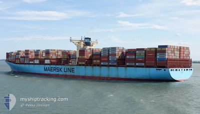
The vessel ELLY MAERSK (IMO: 9321536, MMSI: 220499000) is a Container Ship that was built in 2007 ( 17 Age ). It's sailing under the flag of [DK] Denmark.
In this page you can find informations about the vessels current position, last detected port calls, and current voyage information. If the vessels is not in coverage by AIS you will find the latest position.
The current position of ELLY MAERSK is detected by our AIS receivers and we are not responsible for the reliability of the data. The last position was recorded while the vessel was in Coverage by the Ais receivers of our vessel tracking app.
The current draught of ELLY MAERSK as reported by AIS is 12.8 meters
Weather
| Temperature | 8.8°C / 47.84°F |
|---|---|
| Wind Speed | 6 knots |
| Direction | 328° NNW |
| Pressure | 1021.7 hPa |
| Humidity | 87.4 % |
| Cloud Coverage | 57 % |
Featured Company
Last Port Calls
| Port | Arrival | Departure | Time In Port |
|---|---|---|---|
| 2024-06-10 18:32 | |||
| 2024-05-16 00:26 | 2024-05-17 13:10 | 1 d | |
| 2024-05-10 21:20 | 2024-05-12 03:30 | 1 d | |
| 2024-05-06 12:40 | 2024-05-07 12:46 | 1 d | |
| 2024-05-04 23:16 | 2024-05-06 00:56 | 1 d | |
| 2024-04-02 07:48 | 2024-04-06 18:19 | 4 d |
Most Visited Ports (Last year)
| Port | Arrivals | |
|---|---|---|
| 4 | ||
| 4 | ||
| 4 | ||
| 4 | ||
| 4 | ||
| 3 |
Last Trips
| Origin | Departure | Destination | Arrival | Distance | |
|---|---|---|---|---|---|
| 2024-05-17 13:10 | 2024-06-10 18:32 | 10903.35 nm | |||
| 2024-05-12 03:30 | 2024-05-16 00:26 | 1604.71 nm | |||
| 2024-05-07 12:46 | 2024-05-10 21:20 | 1497.19 nm | |||
| 2024-05-06 00:56 | 2024-05-06 12:40 | 128.53 nm | |||
| 2024-04-06 18:19 | 2024-05-04 23:16 | 6740.40 nm | |||
| 2024-03-29 10:36 | 2024-04-02 07:48 | 53.21 nm |
Events
| Heure | Evenement | Détails | Position/ Destination | Info |
|---|---|---|---|---|
| 2024-06-10 17:59 | Tirant d'eau modifié | 12.8 14.6 |
51.96247 / 1.28999
[GB] FELIXSTOWE
|
Vitesse: Parcours: 126° |
| 2024-06-10 17:59 | Changement de destination | GBFXS>DEHAM MAPTM>GBFXS |
51.96247 / 1.28999
[GB] FELIXSTOWE
|
Vitesse: Parcours: 126° |
| 2024-06-10 17:59 | Changement d'ETA | 2024/06/13 14:00 2024/06/10 15:00 |
51.96247 / 1.28999
[GB] FELIXSTOWE
|
Vitesse: Parcours: 126° |
| 2024-06-10 17:56 | Etat Changé | Moored Under way using engine |
51.96243 / 1.28999
[GB] FELIXSTOWE
|
Vitesse: Parcours: 125° |
| 2024-06-10 17:32 | Port d'arrivée |
|
51.95957 / 1.29360
[GB] FELIXSTOWE
|
Vitesse: 1.8 kn Parcours: 130° |
| 2024-06-10 17:05 | Arret | 0.22 nm, South of FELIXSTOWE |
51.95525 / 1.29983
MAPTM>GBFXS
|
Vitesse: 0.3 kn Parcours: 292° |
| 2024-06-10 11:08 | Changement de zone | United Kingdom part of the North Sea French part of the North Sea |
51.06630 / 1.61751
North Sea
MAPTM>GBFXS
|
Vitesse: 14.9 kn Parcours: 39.3° |
| 2024-06-10 10:56 | Changement de zone | French part of the North Sea French part of the English Channel |
51.02823 / 1.56969
North Sea
MAPTM>GBFXS
|
Vitesse: 15.2 kn Parcours: 40.9° |
| 2024-06-10 08:10 | Changement de zone | French part of the English Channel United Kingdom part of the English Channel |
50.47839 / .90521
English Channel
MAPTM>GBFXS
|
Vitesse: 17 kn Parcours: 69° |
| 2024-06-10 03:26 | Changement de zone | United Kingdom part of the English Channel French part of the English Channel |
50.17788 / -1.09006
English Channel
MAPTM>GBFXS
|
Vitesse: 15.9 kn Parcours: 75.2° |