
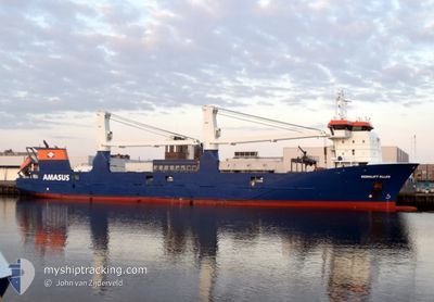
EEMSLIFT ELLEN
General Cargo
Current Trip
| Time Travelled | 3 days |
|---|---|
| Remaining Time | --- |
| Distance Travelled | 163.26 nm |
| Remaining Distance | --- |
| AVG Speed | 10.9 Knots |
| MAX Speed | 17.4 Knots |
| AVG Wind | 19.1 knots |
| MAX Wind | 29 knots |
| MIN Temp | --- |
| MAX Temp | 6.7°C / 44.06°F |
| Draught | 5.3 m |
| Position Received | 2 m ago |
Current Position
| Longitude | --- |
|---|---|
| Latitude | --- |
| Status | At anchor |
| Speed | |
| Course | 355° |
| Area | North Sea |
| Station | T-AIS |
| Position Received | 2 m ago |
Info
Information
The current position of EEMSLIFT ELLEN is in North Sea with coordinates 51.18815° / 1.43103° as reported on 2026-01-03 19:23 by AIS to our vessel tracker app. The vessel's current speed is 0 Knots
The vessel EEMSLIFT ELLEN (IMO: 9671474, MMSI: 244790608) is a General Cargo that was built in 2014 ( 12 years old ). It's sailing under the flag of [NL] Netherlands.
In this page you can find informations about the vessels current position, last detected port calls, and current voyage information. If the vessels is not in coverage by AIS you will find the latest position.
The current position of EEMSLIFT ELLEN is detected by our AIS receivers and we are not responsible for the reliability of the data. The last position was recorded while the vessel was in Coverage by the Ais receivers of our vessel tracking app.
The current draught of EEMSLIFT ELLEN as reported by AIS is 5.3 meters
Weather
| Temperature | 3°C / 37.4°F |
|---|---|
| Wind Speed | 19 knots |
| Direction | 314° NW |
| Pressure | 1011 hPa |
| Humidity | 71.4 % |
| Cloud Coverage | 7 % |
Featured Company
Last Port Calls
| Port | Arrival | Departure | Time In Port |
|---|---|---|---|
| 2025-12-30 22:29 | 2025-12-31 12:20 | 13 h | |
| 2025-12-22 23:59 | 2025-12-27 08:26 | 4 d | |
| 2025-12-20 07:57 | 2025-12-20 17:29 | 9 h | |
| 2025-12-19 06:52 | 2025-12-19 22:45 | 15 h | |
| 2025-12-16 06:50 | 2025-12-16 17:15 | 10 h | |
| 2025-12-15 03:02 | 2025-12-15 03:04 | 2 m | |
| 2025-12-13 13:48 | 2025-12-13 20:55 | 7 h | |
| 2025-12-03 11:46 | 2025-12-03 20:13 | 8 h | |
| 2025-11-23 19:14 | 2025-11-24 17:05 | 21 h | |
| 2025-11-12 18:27 | 2025-11-17 16:49 | 4 d |
Last Trips
| Origin | Departure | Destination | Arrival | Distance | |
|---|---|---|---|---|---|
| 2025-12-27 08:26 | 2025-12-30 22:29 | 314.85 nm | |||
| 2025-12-20 17:29 | 2025-12-22 23:59 | 424.61 nm | |||
| 2025-12-19 22:45 | 2025-12-20 07:57 | 130.41 nm | |||
| 2025-12-16 17:15 | 2025-12-19 06:52 | 849.87 nm | |||
| 2025-12-15 03:04 | 2025-12-16 06:50 | 356.40 nm | |||
| 2025-12-13 20:55 | 2025-12-15 03:02 | 330.50 nm | |||
| 2025-12-03 20:13 | 2025-12-13 13:48 | 3330.88 nm | |||
| 2025-11-24 17:05 | 2025-12-03 11:46 | 1450.76 nm | |||
| 2025-11-17 16:49 | 2025-11-23 19:14 | 2141.06 nm | |||
| 2025-11-10 13:12 | 2025-11-12 18:27 | 766.92 nm |
Events
| Time | Event | Details | Position / Dest | Info |
|---|---|---|---|---|
| 2026-01-03 17:42 | Status Changed | At anchor Default |
51.18822 / 1.43138
GBDVR
|
Speed: Course: 351° |
| 2026-01-03 17:39 | Status Changed | Default At anchor |
51.18820 / 1.43143
GBDVR
|
Speed: Course: 354° |
| 2026-01-03 12:41 | Status Changed | At anchor Default |
51.19085 / 1.42969
GBDVR
|
Speed: 0.1 kn Course: 226° |
| 2026-01-03 12:38 | Status Changed | Default At anchor |
51.19089 / 1.42976
GBDVR
|
Speed: 0.1 kn Course: 231° |
| 2026-01-03 09:29 | Status Changed | At anchor Default |
51.18936 / 1.43194
GBDVR
|
Speed: Course: 256° |
| 2026-01-03 09:26 | Status Changed | Default At anchor |
51.18923 / 1.43194
GBDVR
|
Speed: Course: 260° |
| 2026-01-03 01:41 | Status Changed | At anchor Default |
51.19075 / 1.43140
GBDVR
|
Speed: 0.1 kn Course: 221° |
| 2026-01-03 01:38 | Status Changed | Default At anchor |
51.19081 / 1.43126
GBDVR
|
Speed: 0.1 kn Course: 222° |
| 2026-01-02 20:23 | Status Changed | At anchor Default |
51.18896 / 1.43165
GBDVR
|
Speed: 0.1 kn Course: 342° |
| 2026-01-02 20:20 | Status Changed | Default At anchor |
51.18892 / 1.43162
GBDVR
|
Speed: 0.1 kn Course: 343° |