

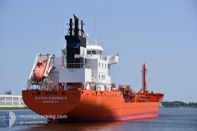
DUTCH EMERALD
Chemical Tanker

Current Trip
| Time Travelled | 11 h, 32 mins |
|---|---|
| Remaining Time | 16 h, 44 mins |
| Distance Travelled | 66.73 nm |
| Remaining Distance | 305.35 nm |
| AVG Speed | 7.4 Knots |
| MAX Speed | 18.7 Knots |
| AVG Wind | 5.5 knots |
| MAX Wind | 8.7 knots |
| MIN Temp | 4.5°C / 40.1°F |
| MAX Temp | 8.7°C / 47.66°F |
| Draught | 6.4 m |
| Position Received | 1 m ago |
Current Position
| Longitude | --- |
|---|---|
| Latitude | --- |
| Status | Under way using engine |
| Speed | 15.2 Knots |
| Course | 313.7° |
| Area | North Sea |
| Station | T-AIS |
| Position Received | 1 m ago |
Information
The current position of DUTCH EMERALD is in North Sea with coordinates 53.86039° / 8.74459° as reported on 2025-03-29 05:56 by AIS to our vessel tracker app. The vessel's current speed is 15.2 Knots and is heading at the port of TERNEUZEN. The estimated time of arrival as calculated by MyShipTracking vessel tracking app is 2025-03-29 23:42 LT
The vessel DUTCH EMERALD (IMO: 9191668, MMSI: 246436000) is a Chemical Tanker that was built in 2000 ( 25 years old ). It's sailing under the flag of [NL] Netherlands.
In this page you can find informations about the vessels current position, last detected port calls, and current voyage information. If the vessels is not in coverage by AIS you will find the latest position.
The current position of DUTCH EMERALD is detected by our AIS receivers and we are not responsible for the reliability of the data. The last position was recorded while the vessel was in Coverage by the Ais receivers of our vessel tracking app.
The current draught of DUTCH EMERALD as reported by AIS is 6.4 meters
Weather
| Temperature | 6.2°C / 43.16°F |
|---|---|
| Wind Speed | 9 knots |
| Direction | 333° NNW |
| Pressure | 1013.4 hPa |
| Humidity | 82 % |
| Cloud Coverage | 100 % |


Featured Company
Last Port Calls
| Port | Arrival | Departure | Time In Port |
|---|---|---|---|
| 2025-03-28 18:37 | 2025-03-28 19:26 | 48 m | |
| 2025-03-27 09:47 | 2025-03-28 05:18 | 19 h | |
| 2025-03-24 06:42 | 2025-03-24 15:10 | 8 h | |
| 2025-03-23 09:02 | 2025-03-23 16:46 | 7 h | |
| 2025-03-21 20:06 | 2025-03-22 10:26 | 14 h | |
| 2025-03-19 23:31 | 2025-03-20 18:22 | 18 h | |
| 2025-03-16 02:02 | 2025-03-16 02:07 | 4 m | |
| 2025-03-13 13:56 | 2025-03-14 20:16 | 1 d | |
| 2025-03-11 04:54 | 2025-03-12 02:44 | 21 h | |
| 2025-03-06 22:39 | 2025-03-08 08:04 | 1 d |
Last Trips
| Origin | Departure | Destination | Arrival | Distance | |
|---|---|---|---|---|---|
| 2025-03-28 05:18 | 2025-03-28 18:37 | 183.46 nm | |||
| 2025-03-24 15:10 | 2025-03-27 09:47 | 687.65 nm | |||
| 2025-03-23 16:46 | 2025-03-24 06:42 | 94.59 nm | |||
| 2025-03-22 10:26 | 2025-03-23 09:02 | 222.60 nm | |||
| 2025-03-20 18:22 | 2025-03-21 20:06 | 133.19 nm | |||
| 2025-03-16 02:07 | 2025-03-19 23:31 | 884.92 nm | |||
| 2025-03-14 20:16 | 2025-03-16 02:02 | 318.94 nm | |||
| 2025-03-12 02:44 | 2025-03-13 13:56 | 126.84 nm | |||
| 2025-03-08 08:04 | 2025-03-11 04:54 | 121.43 nm | |||
| 2025-03-05 10:40 | 2025-03-06 22:39 | 377.25 nm |
Events
| Time | Event | Details | Position / Dest | Info |
|---|---|---|---|---|
| 2025-03-29 05:04 | Change Sea Area | German part of the North Sea German part of the Baltic Sea |
53.89103 / 9.13926
North Sea
TERNEUZEN
|
Speed: 7.9 kn Course: 227.5° |
| 2025-03-29 05:03 | START Moving | 0.9 nm, South West of BRUNSBUETTEL |
53.89245 / 9.14183
TERNEUZEN
|
Speed: 4.5 kn Course: 225° |
| 2025-03-29 04:35 | STOP Moving | 0.79 nm, South West of BRUNSBUETTEL |
53.89368 / 9.14430
TERNEUZEN
|
Speed: Course: 227° |
| 2025-03-29 01:46 | START Moving | 0.81 nm, South West of FISCHERHUTTE |
54.14667 / 9.35405
TERNEUZEN
|
Speed: 7.3 kn Course: 234.3° |
| 2025-03-29 00:47 | STOP Moving | 0.59 nm, South West of FISCHERHUTTE |
54.14865 / 9.35918
TERNEUZEN
|
Speed: 0.1 kn Course: 242° |
| 2025-03-28 19:14 | START Moving | 3.95 nm, West of KIEL |
54.36004 / 10.05531
TERNEUZEN
|
Speed: 3.5 kn Course: 260° |
| 2025-03-28 19:01 | STOP Moving | 3.86 nm, West of KIEL |
54.36052 / 10.05844
TERNEUZEN
|
Speed: 0.3 kn Course: 253° |
| 2025-03-28 18:26 | PORT DEPARTURE |
|
54.36668 / 10.13480
TERNEUZEN
|
Speed: 6.3 kn Course: 288° |
| 2025-03-28 18:24 | START Moving |
54.36603 / 10.13830
[DE] KIEL
|
Speed: 4.8 kn Course: 286° |
|
| 2025-03-28 17:52 | STOP Moving |
54.36550 / 10.14134
[DE] KIEL
|
Speed: 0.2 kn Course: 283° |