
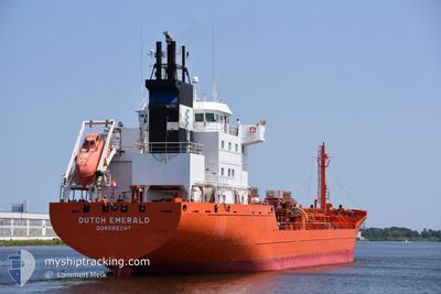
DUTCH EMERALD
Chemical Tanker
Current Trip
| Time Travelled | 19 h, 19 mins |
|---|---|
| Remaining Time | 14 h, 43 mins |
| Distance Travelled | 212.71 nm |
| Remaining Distance | 193.28 nm |
| AVG Speed | 12 Knop |
| MAX Speed | 15.4 Knop |
| AVG Wind | 11 knots |
| MAX Wind | 17 knots |
| MIN Temp | 11.8°C / 53.24°F |
| MAX Temp | 16.7°C / 62.06°F |
| Djupgående | 6.8 m |
| Position mottagen | 1 m sen |
Current Position
| Longitud | 0.24784° |
|---|---|
| Latitude | 54.08287° |
| Status | Under way using engine |
| Fart | 13.5 Knop |
| Kurs | 321.3° |
| Område | North Sea |
| Station | T-AIS |
| Position mottagen | 1 m sen |
Info
Information
The current position of DUTCH EMERALD is in North Sea with coordinates 54.08287° / 0.24784° as reported on 2024-09-25 14:31 by AIS to our vessel tracker app. The vessel's current speed is 13.5 Knop and is heading at the port of DUNDEE. The estimated time of arrival as calculated by MyShipTracking vessel tracking app is 2024-09-26 05:15 LT
The vessel DUTCH EMERALD (IMO: 9191668, MMSI: 246436000) is a Chemical Tanker that was built in 2000 ( 24 År gammal ). It's sailing under the flag of [NL] Netherlands.
In this page you can find informations about the vessels current position, last detected port calls, and current voyage information. If the vessels is not in coverage by AIS you will find the latest position.
The current position of DUTCH EMERALD is detected by our AIS receivers and we are not responsible for the reliability of the data. The last position was recorded while the vessel was in Coverage by the Ais receivers of our vessel tracking app.
The current draught of DUTCH EMERALD as reported by AIS is 6.8 meters
Weather
| Temperature | 12°C / 53.6°F |
|---|---|
| Wind Speed | 9 knots |
| Direction | 133° SE |
| Pressure | 998.5 hPa |
| Humidity | 80.6 % |
| Cloud Coverage | 100 % |
Featured Company
Last Port Calls
| Port | Arrival | Departure | Time In Port |
|---|---|---|---|
| 2024-09-22 11:33 | 2024-09-24 19:13 | 2 d | |
| 2024-09-16 22:10 | 2024-09-18 22:17 | 2 d | |
| 2024-09-16 15:08 | 2024-09-16 19:30 | 4 h | |
| 2024-09-12 17:40 | 2024-09-14 08:46 | 1 d | |
| 2024-09-09 14:07 | 2024-09-10 15:20 | 1 d | |
| 2024-09-08 02:34 | 2024-09-09 12:52 | 1 d | |
| 2024-09-04 11:37 | 2024-09-06 07:46 | 1 d | |
| 2024-08-28 18:37 | 2024-08-29 11:50 | 17 h | |
| 2024-08-26 11:00 | 2024-08-27 07:13 | 20 h | |
| 2024-08-23 04:09 | 2024-08-23 20:25 | 16 h |
Most Visited Ports (Last year)
| Port | Arrivals | |
|---|---|---|
| 9 | ||
| 7 | ||
| 7 | ||
| 6 | ||
| 6 | ||
| 6 |
Last Trips
| Origin | Departure | Destination | Arrival | Distance | |
|---|---|---|---|---|---|
| 2024-09-18 23:17 | 2024-09-22 13:33 | 715.82 nm | |||
| 2024-09-14 10:46 | 2024-09-16 23:10 | 720.93 nm | |||
| 2024-09-14 10:46 | 2024-09-16 16:08 | 694.32 nm | |||
| 2024-09-10 17:20 | 2024-09-12 19:40 | 271.61 nm | |||
| 2024-09-09 14:52 | 2024-09-09 16:07 | 8.11 nm | |||
| 2024-09-06 09:46 | 2024-09-08 04:34 | 558.80 nm | |||
| 2024-08-29 14:50 | 2024-09-04 13:37 | 1396.10 nm | |||
| 2024-08-27 09:13 | 2024-08-28 21:37 | 341.76 nm | |||
| 2024-08-23 22:25 | 2024-08-26 13:00 | 569.74 nm | |||
| 2024-08-21 10:38 | 2024-08-23 06:09 | 548.07 nm |
Events
| Tid | Event | Detaljer | Position / Dest | Information |
|---|---|---|---|---|
| 2024-09-25 13:26 | Status ändrad | Under way using engine Default |
53.89292 / .49185
DUNDEE
|
Fart: 13.3 kn Kurs: 322° |
| 2024-09-25 13:21 | Status ändrad | Default Under way using engine |
53.87906 / .51036
DUNDEE
|
Fart: 13.3 kn Kurs: 321.3° |
| 2024-09-25 13:21 | Status ändrad | Under way using engine Default |
53.87763 / .51229
DUNDEE
|
Fart: 12.9 kn Kurs: 321° |
| 2024-09-25 13:05 | I täckningsområde |
53.87763 / .51229
North Sea
DUNDEE
|
Fart: 13.3 kn Kurs: 321.3° |
|
| 2024-09-25 12:01 | Status ändrad | Default Under way using engine |
53.66407 / .81568
DUNDEE
|
Fart: 12.2 kn Kurs: 321.5° |
| 2024-09-25 11:57 | UTANFÖR täckningsområde |
53.65393 / .82933
North Sea
DUNDEE
|
Fart: 12.2 kn Kurs: 321.5° |
|
| 2024-09-25 11:32 | ETA ändrat | 2024/09/26 06:00 2024/09/16 13:00 |
53.58646 / .91860
DUNDEE
|
Fart: 11.8 kn Kurs: 322.1° |
| 2024-09-25 10:07 | Status ändrad | Under way using engine Default |
53.35482 / 1.16086
DUNDEE
|
Fart: 12.2 kn Kurs: 330° |
| 2024-09-25 10:05 | Status ändrad | Default Under way using engine |
53.34946 / 1.16600
DUNDEE
|
Fart: 12.2 kn Kurs: 327.1° |
| 2024-09-25 06:48 | Byter havsområde | United Kingdom part of the North Sea Dutch part of the North Sea |
52.80753 / 1.92236
North Sea
|
Fart: 13.8 kn Kurs: 305.5° |