
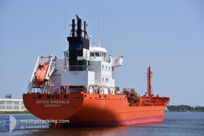
DUTCH EMERALD
Chemical Tanker
Current Trip
| Time Travelled | 2 days |
|---|---|
| Remaining Time | 1 day |
| Distance Travelled | 544.26 nm |
| Remaining Distance | 297.08 nm |
| AVG Speed | 10.5 Knopen |
| MAX Speed | 13.9 Knopen |
| AVG Wind | 16.3 knots |
| MAX Wind | 27.5 knots |
| MIN Temp | -1.1°C / 30.02°F |
| MAX Temp | 4.6°C / 40.28°F |
| Diepgang | 6.7 M |
| Positie ontvangen | Nu |
Current Position
| Lengtegraad | --- |
|---|---|
| Breedtegraat | --- |
| Status | Under way using engine |
| Snelheid | 10.4 Knopen |
| Koers | 319.3° |
| Gebied | Gulf of Bothnia |
| Station | T-AIS |
| Positie ontvangen | Nu |
Info
Information
The current position of DUTCH EMERALD is in Gulf of Bothnia with coordinates 60.01512° / 19.38677° as reported on 2025-03-18 04:47 by AIS to our vessel tracker app. The vessel's current speed is 10.4 Knopen and is heading at the port of KOKKOLA. The estimated time of arrival as calculated by MyShipTracking vessel tracking app is 2025-03-19 11:24 LT
The vessel DUTCH EMERALD (IMO: 9191668, MMSI: 246436000) is a Chemical Tanker that was built in 2000 ( 25 Jaar oud ). It's sailing under the flag of [NL] Netherlands.
In this page you can find informations about the vessels current position, last detected port calls, and current voyage information. If the vessels is not in coverage by AIS you will find the latest position.
The current position of DUTCH EMERALD is detected by our AIS receivers and we are not responsible for the reliability of the data. The last position was recorded while the vessel was in Coverage by the Ais receivers of our vessel tracking app.
The current draught of DUTCH EMERALD as reported by AIS is 6.7 meters
Weather
| Temperature | 3.4°C / 38.12°F |
|---|---|
| Wind Speed | 25 knots |
| Direction | 313° NW |
| Pressure | 1016 hPa |
| Humidity | 77.5 % |
| Cloud Coverage | 95 % |
Featured Company
Last Port Calls
| Port | Arrival | Departure | Time In Port |
|---|---|---|---|
| 2025-03-16 02:02 | 2025-03-16 02:07 | 4 m | |
| 2025-03-13 13:56 | 2025-03-14 20:16 | 1 d | |
| 2025-03-11 04:54 | 2025-03-12 02:44 | 21 h | |
| 2025-03-06 22:39 | 2025-03-08 08:04 | 1 d | |
| 2025-03-05 08:29 | 2025-03-05 10:40 | 2 h | |
| 2025-02-27 22:59 | 2025-03-01 11:38 | 1 d | |
| 2025-02-23 01:42 | 2025-02-24 09:36 | 1 d | |
| 2025-02-17 10:33 | 2025-02-21 11:41 | 4 d | |
| 2025-02-15 08:25 | 2025-02-15 15:33 | 7 h | |
| 2025-02-14 09:49 | 2025-02-14 18:37 | 8 h |
Last Trips
| Origin | Departure | Destination | Arrival | Distance | |
|---|---|---|---|---|---|
| 2025-03-14 20:16 | 2025-03-16 02:02 | 318.94 nm | |||
| 2025-03-12 02:44 | 2025-03-13 13:56 | 126.84 nm | |||
| 2025-03-08 08:04 | 2025-03-11 04:54 | 121.43 nm | |||
| 2025-03-05 10:40 | 2025-03-06 22:39 | 377.25 nm | |||
| 2025-03-01 11:38 | 2025-03-05 08:29 | 989.77 nm | |||
| 2025-02-24 09:36 | 2025-02-27 22:59 | 808.93 nm | |||
| 2025-02-21 11:41 | 2025-02-23 01:42 | 456.81 nm | |||
| 2025-02-15 15:33 | 2025-02-17 10:33 | 130.40 nm | |||
| 2025-02-14 18:37 | 2025-02-15 08:25 | 128.23 nm | |||
| 2025-02-13 08:13 | 2025-02-14 09:49 | 309.03 nm |
Events
| Tijd | Evenement | Details | Positie / Bestemming | Info |
|---|---|---|---|---|
| 2025-03-18 03:53 | Status Changed | Under way using engine Not under command |
59.89418 / 19.58152
KOKKOLA
|
Snelheid: 7.2 kn Koers: 20.8° |
| 2025-03-18 03:53 | Status Changed | Not under command Under way using engine |
59.89346 / 19.58252
KOKKOLA
|
Snelheid: 10.4 kn Koers: 327.9° |
| 2025-03-18 03:04 | Wijzig zee gebeid | Finnish part of the Gulf of Bothnia Finnish part of the Baltic Sea |
59.78775 / 19.76362
Gulf of Bothnia
KOKKOLA
|
Snelheid: 10.4 kn Koers: 316.6° |
| 2025-03-18 01:33 | Status Changed | Under way using engine Default |
59.59882 / 20.12203
KOKKOLA
|
Snelheid: 10.3 kn Koers: 317° |
| 2025-03-18 01:30 | Status Changed | Default Under way using engine |
59.59204 / 20.13514
KOKKOLA
|
Snelheid: 10.1 kn Koers: 329.8° |
| 2025-03-18 00:40 | Gevonden in zee | Finnish part of the Baltic Sea |
59.45496 / 20.15252
Baltic Sea
KOKKOLA
|
Snelheid: 11.2 kn Koers: 35° |
| 2025-03-18 00:05 | Status Changed | Under way using engine Default |
59.36807 / 20.03221
KOKKOLA
|
Snelheid: 11 kn Koers: 35° |
| 2025-03-18 00:02 | Status Changed | Default Under way using engine |
59.35984 / 20.02065
KOKKOLA
|
Snelheid: 11 kn Koers: 35.5° |
| 2025-03-17 23:55 | Status Changed | Under way using engine Default |
59.34249 / 19.99611
KOKKOLA
|
Snelheid: 11 kn Koers: 36° |
| 2025-03-17 23:50 | Status Changed | Default Under way using engine |
59.33073 / 19.97920
KOKKOLA
|
Snelheid: 11 kn Koers: 36.9° |