
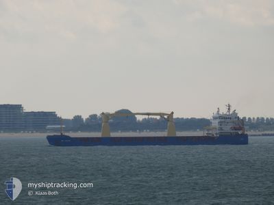
DEFNE
General Cargo
Current Trip
| Time Travelled | 8 days |
|---|---|
| Remaining Time | 20 h, 37 mins |
| Distance Travelled | 765.36 nm |
| Remaining Distance | 736.42 nm |
| AVG Speed | 9.5 Knots |
| MAX Speed | 10.9 Knots |
| AVG Wind | 15.3 knots |
| MAX Wind | 26 knots |
| MIN Temp | 14.8°C / 58.64°F |
| MAX Temp | 22.3°C / 72.14°F |
| Draught | 6.5 m |
| Position Received | 2 d ago |
Current Position
| Longitude | 20.71985° |
|---|---|
| Latitude | 37.57631° |
| Status | Under way using engine |
| Speed | 10.2 Knots |
| Course | 138.6° |
| Area | Ionian Sea |
| Station | T-AIS |
| Position Received | 2 d ago |
Info
Information
The current position of DEFNE is in Ionian Sea with coordinates 37.57631° / 20.71985° as reported on 2024-05-21 17:25 by AIS to our vessel tracker app. The vessel's current speed is 10.2 Knots and is heading at the port of SUEZ CANAL. The estimated time of arrival as calculated by MyShipTracking vessel tracking app is 2024-05-24 17:17 LT
The vessel DEFNE (IMO: 9378230, MMSI: 314756000) is a General Cargo that was built in 2008 ( 16 years old ). It's sailing under the flag of [BB] Barbados.
In this page you can find informations about the vessels current position, last detected port calls, and current voyage information. If the vessels is not in coverage by AIS you will find the latest position.
The current position of DEFNE is detected by our AIS receivers and we are not responsible for the reliability of the data. The last position was recorded while the vessel was in Coverage by the Ais receivers of our vessel tracking app.
The current draught of DEFNE as reported by AIS is 6.5 meters
Weather
| Temperature | 21°C / 69.8°F |
|---|---|
| Wind Speed | 13 knots |
| Direction | 298° WNW |
| Pressure | 1013.4 hPa |
| Humidity | 77.2 % |
| Cloud Coverage | --- |
Featured Company
Last Port Calls
| Port | Arrival | Departure | Time In Port |
|---|---|---|---|
| 2024-05-15 05:09 | 2024-05-15 17:13 | 12 h | |
| 2024-05-08 14:23 | 2024-05-10 17:26 | 2 d | |
| 2024-04-25 18:15 | 2024-04-30 13:18 | 4 d | |
| 2024-04-16 04:56 | 2024-04-19 16:45 | 3 d | |
| 2024-04-11 04:18 | 2024-04-12 12:56 | 1 d | |
| 2024-04-04 15:36 | 2024-04-04 20:52 | 5 h | |
| 2024-03-23 17:06 | 2024-03-26 08:04 | 2 d | |
| 2024-03-04 15:15 | 2024-03-05 05:24 | 14 h |
Last Trips
| Origin | Departure | Destination | Arrival | Distance | |
|---|---|---|---|---|---|
| 2024-05-10 19:26 | 2024-05-15 07:09 | 27.01 nm | |||
| 2024-04-30 15:18 | 2024-05-08 16:23 | 1316.00 nm | |||
| 2024-04-19 18:45 | 2024-04-25 20:15 | 1365.22 nm | |||
| 2024-04-12 15:56 | 2024-04-16 06:56 | 714.89 nm | |||
| 2024-04-04 22:52 | 2024-04-11 07:18 | 1413.19 nm | |||
| 2024-03-26 09:04 | 2024-04-04 17:36 | 1420.70 nm | |||
| 2024-03-05 08:24 | 2024-03-23 18:06 | 3296.75 nm | |||
| 2024-02-25 02:09 | 2024-03-04 18:15 | 1552.03 nm |
Events
| Time | Event | Details | Position / Dest | Info |
|---|---|---|---|---|
| 2024-05-21 17:27 | Status Changed | Default Under way using engine |
37.57129 / 20.72546
SUEZ CANAL
|
Speed: 10.2 kn Course: 138.6° |
| 2024-05-21 17:25 | OUT of Coverage |
37.57631 / 20.71985
Ionian Sea
SUEZ CANAL
|
Speed: 10.2 kn Course: 138.6° |
|
| 2024-05-21 12:50 | IN Coverage |
38.25085 / 20.22389
Ionian Sea
SUEZ CANAL
|
Speed: 9.7 kn Course: 159.3° |
|
| 2024-05-21 11:47 | OUT of Coverage |
38.41037 / 20.14276
Ionian Sea
SUEZ CANAL
|
Speed: 9.7 kn Course: 158.3° |
|
| 2024-05-21 10:13 | Change Sea Area | Greek part of the Ionian Sea Albanian part of the Adriatic Sea |
38.64374 / 20.01955
Ionian Sea
SUEZ CANAL
|
Speed: 9.6 kn Course: 155.1° |
| 2024-05-21 10:12 | IN Coverage |
38.64374 / 20.01955
Ionian Sea
SUEZ CANAL
|
Speed: 9.6 kn Course: 155.1° |
|
| 2024-05-20 20:49 | Status Changed | Default Under way using engine |
40.70141 / 19.16242
SUEZ CANAL
|
Speed: 10 kn Course: 174.4° |
| 2024-05-20 20:40 | OUT of Coverage |
40.72702 / 19.15890
Adriatic Sea
SUEZ CANAL
|
Speed: 10 kn Course: 174.4° |
|
| 2024-05-20 20:17 | Detected in Sea | Albanian part of the Adriatic Sea |
40.79009 / 19.15068
Adriatic Sea
SUEZ CANAL
|
Speed: 10 kn Course: 175° |
| 2024-05-20 20:17 | Status Changed | Under way using engine Default |
40.79009 / 19.15068
SUEZ CANAL
|
Speed: 10.3 kn Course: 175° |