
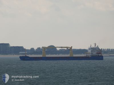
DEFNE
General Cargo
Current Trip
MUSLIM CREW TURKISH
| Time Travelled | 7 days |
|---|---|
| Remaining Time | --- |
| Distance Travelled | 1854.00 nm |
| Remaining Distance | --- |
| AVG Speed | 10 Knopen |
| MAX Speed | 12 Knopen |
| AVG Wind | 10.8 knots |
| MAX Wind | 31 knots |
| MIN Temp | 21.5°C / 70.7°F |
| MAX Temp | 25.3°C / 77.54°F |
| Diepgang | 6.3 M |
| Positie ontvangen | 4 d geleden |
Current Position
| Lengtegraad | --- |
|---|---|
| Breedtegraat | --- |
| Status | Under way using engine |
| Snelheid | 6.1 Knopen |
| Koers | 154.2° |
| Gebied | Red Sea |
| Station | T-AIS |
| Positie ontvangen | 4 d geleden |
Info
Information
The current position of DEFNE is in Red Sea with coordinates 12.84131° / 43.20775° as reported on 2025-02-11 19:51 by AIS to our vessel tracker app. The vessel's current speed is 6.1 Knopen
The vessel DEFNE (IMO: 9378230, MMSI: 314756000) is a General Cargo that was built in 2008 ( 17 Jaar oud ). It's sailing under the flag of [BB] Barbados.
In this page you can find informations about the vessels current position, last detected port calls, and current voyage information. If the vessels is not in coverage by AIS you will find the latest position.
The current position of DEFNE is detected by our AIS receivers and we are not responsible for the reliability of the data. The last position was recorded while the vessel was in Coverage by the Ais receivers of our vessel tracking app.
The current draught of DEFNE as reported by AIS is 6.3 meters
Weather
| Temperature | 24.7°C / 76.46°F |
|---|---|
| Wind Speed | 8 knots |
| Direction | 187° S |
| Pressure | 1013.9 hPa |
| Humidity | 68.5 % |
| Cloud Coverage | 4 % |
Featured Company
Last Port Calls
| Port | Arrival | Departure | Time In Port |
|---|---|---|---|
| 2025-02-08 11:13 | 2025-02-09 01:28 | 14 h | |
| 2025-02-05 18:46 | 2025-02-05 22:45 | 3 h | |
| 2025-02-02 06:05 | 2025-02-02 16:02 | 9 h | |
| 2025-01-27 04:11 | 2025-01-30 02:04 | 2 d | |
| 2025-01-17 07:11 | 2025-01-22 23:18 | 5 d | |
| 2024-12-27 05:34 | 2024-12-27 19:12 | 13 h | |
| 2024-12-16 12:36 | 2024-12-21 15:14 | 5 d | |
| 2024-12-13 08:20 | 2024-12-13 18:15 | 9 h | |
| 2024-12-10 23:54 | 2024-12-12 15:23 | 1 d |
Most Visited Ports (Last year)
| Port | Arrivals | |
|---|---|---|
| 6 | ||
| 4 | ||
| 3 | ||
| 3 | ||
| 2 | ||
| 2 |
Last Trips
| Origin | Departure | Destination | Arrival | Distance | |
|---|---|---|---|---|---|
| 2025-02-05 22:45 | 2025-02-08 11:13 | 172.70 nm | |||
| 2025-01-30 02:04 | 2025-02-05 18:46 | 1324.42 nm | |||
| 2025-01-30 02:04 | 2025-02-02 06:05 | 606.79 nm | |||
| 2025-01-22 23:18 | 2025-01-27 04:11 | 1043.17 nm | |||
| 2024-12-27 19:12 | 2025-01-17 07:11 | 2168.03 nm | |||
| 2024-12-21 15:14 | 2024-12-27 05:34 | 1068.37 nm | |||
| 2024-12-12 15:23 | 2024-12-16 12:36 | 704.06 nm | |||
| 2024-12-12 15:23 | 2024-12-13 08:20 | 13.74 nm | |||
| 2024-11-29 11:51 | 2024-12-10 23:54 | 2689.50 nm |
Events
| Tijd | Evenement | Details | Positie / Bestemming | Info |
|---|---|---|---|---|
| 2025-02-11 20:36 | Status Changed | Default Under way using engine |
12.77225 / 43.24343
MUSLIM CREW TURKISH
|
Snelheid: 6.1 kn Koers: 154.2° |
| 2025-02-11 19:51 | Buitenbereik |
12.84131 / 43.20775
Red Sea
MUSLIM CREW TURKISH
|
Snelheid: 6.1 kn Koers: 154.2° |
|
| 2025-02-11 19:26 | Destination Changed | MUSLIM CREW TURKISH QAHMD |
12.88185 / 43.18867
MUSLIM CREW TURKISH
|
Snelheid: 6.8 kn Koers: 153° |
| 2025-02-11 17:01 | Binnenbereik |
13.14412 / 43.05838
Red Sea
QAHMD
|
Snelheid: 7 kn Koers: 154.9° |
|
| 2025-02-11 14:53 | Status Changed | Default Under way using engine |
13.31610 / 42.85275
QAHMD
|
Snelheid: 8.8 kn Koers: 123.8° |
| 2025-02-11 14:29 | Buitenbereik |
13.34676 / 42.80407
Red Sea
QAHMD
|
Snelheid: 8.8 kn Koers: 123.8° |
|
| 2025-02-11 14:09 | Gevonden in zee | Eritrean part of the Red Sea |
13.37343 / 42.76241
Red Sea
QAHMD
|
Snelheid: 8.8 kn Koers: 123.5° |
| 2025-02-11 14:09 | Status Changed | Under way using engine Default |
13.37343 / 42.76241
QAHMD
|
Snelheid: 8.8 kn Koers: 124° |
| 2025-02-11 14:09 | Binnenbereik |
13.37343 / 42.76241
Red Sea
QAHMD
|
Snelheid: 8.8 kn Koers: 123.5° |
|
| 2025-02-09 01:05 | Buitenbereik |
22.17228 / 38.81117
Red Sea
QAHMD
|
Snelheid: 9.9 kn Koers: 224.9° |