

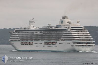
CRYSTAL SERENITY
Passengers Ship

Current Trip
| Trip Time | 2 days |
|---|---|
| Trip Distance | 320.38 nm |
| AVG Speed | 9.1 Knots |
| MAX Speed | 14.7 Knots |
| Draught | 7.6 m |
| AVG Wind | 8.2 knots |
| MAX Wind | 20 knots |
| MIN Temp | 21.2°C / 70.16°F |
| MAX Temp | 31.8°C / 89.24°F |
| Position Received | 17 h, 11 m ago |
Current Position
| Longitude | --- |
|---|---|
| Latitude | --- |
| Status | Moored |
| Speed | |
| Course | 110° |
| Area | South Atlantic Ocean |
| Station | T-AIS |
| Position Received | 17 h, 11 m ago |
Information
The current position of CRYSTAL SERENITY is in South Atlantic Ocean with coordinates -22.89488° / -43.18208° as reported on 2025-03-04 13:22 by AIS to our vessel tracker app. The vessel's current speed is 0 Knots and is currently inside the port of RIO DE JANEIRO.
The vessel CRYSTAL SERENITY (IMO: 9243667, MMSI: 311536000) is a Passengers Ship that was built in 2003 ( 22 years old ). It's sailing under the flag of [BS] Bahamas.
In this page you can find informations about the vessels current position, last detected port calls, and current voyage information. If the vessels is not in coverage by AIS you will find the latest position.
The current position of CRYSTAL SERENITY is detected by our AIS receivers and we are not responsible for the reliability of the data. The last position was recorded while the vessel was in Coverage by the Ais receivers of our vessel tracking app.
The current draught of CRYSTAL SERENITY as reported by AIS is 7.6 meters
Weather
| Temperature | 23.7°C / 74.66°F |
|---|---|
| Wind Speed | 5 knots |
| Direction | 61° ENE |
| Pressure | 1016.3 hPa |
| Humidity | 82 % |
| Cloud Coverage | --- |


Featured Company
Last Port Calls
| Port | Arrival | Departure | Time In Port |
|---|---|---|---|
| 2025-03-03 07:50 | |||
| 2025-02-27 05:06 | 2025-02-28 22:56 | 1 d | |
| 2025-02-20 07:34 | 2025-02-22 19:34 | 2 d | |
| 2025-02-18 13:18 | 2025-02-19 19:10 | 1 d | |
| 2025-02-16 09:25 | 2025-02-16 19:12 | 9 h | |
| 2025-02-11 17:52 | 2025-02-12 21:45 | 1 d | |
| 2025-02-05 07:09 | 2025-02-05 18:49 | 11 h | |
| 2025-02-02 07:14 | 2025-02-03 17:33 | 1 d | |
| 2025-01-30 08:31 | 2025-01-30 18:49 | 10 h | |
| 2025-01-29 08:22 | 2025-01-29 18:28 | 10 h |
Last Trips
| Origin | Departure | Destination | Arrival | Distance | |
|---|---|---|---|---|---|
| 2025-02-28 22:56 | 2025-03-03 07:50 | 320.38 nm | |||
| 2025-02-22 19:34 | 2025-02-27 05:06 | 1145.82 nm | |||
| 2025-02-19 19:10 | 2025-02-20 07:34 | 138.25 nm | |||
| 2025-02-16 19:12 | 2025-02-18 13:18 | 718.31 nm | |||
| 2025-02-12 21:45 | 2025-02-16 09:25 | 1116.38 nm | |||
| 2025-02-05 18:49 | 2025-02-11 17:52 | 1514.31 nm | |||
| 2025-02-03 17:33 | 2025-02-05 07:09 | 638.36 nm | |||
| 2025-01-30 18:49 | 2025-02-02 07:14 | 612.81 nm | |||
| 2025-01-29 18:28 | 2025-01-30 08:31 | 230.64 nm | |||
| 2025-01-26 21:58 | 2025-01-29 08:22 | 696.79 nm |
Events
| Time | Event | Details | Position / Dest | Info |
|---|---|---|---|---|
| 2025-03-04 13:28 | Status Changed | Default Moored |
-22.89488 / -43.18208
[BR] RIO DE JANEIRO
|
Speed: Course: 110° |
| 2025-03-04 13:22 | Status Changed | Moored Default |
-22.89488 / -43.18208
[BR] RIO DE JANEIRO
|
Speed: Course: 110° |
| 2025-03-04 13:22 | IN Coverage |
-22.89488 / -43.18208
South Atlantic Ocean
[BR] RIO DE JANEIRO
|
Speed: Course: 275.5° |
|
| 2025-03-04 13:22 | OUT of Coverage |
-22.89488 / -43.18208
South Atlantic Ocean
[BR] RIO DE JANEIRO
|
Speed: Course: 275.5° |
|
| 2025-03-03 10:51 | STOP Moving |
-22.89431 / -43.18195
[BR] RIO DE JANEIRO
|
Speed: 0.3 kn Course: 132° |
|
| 2025-03-03 10:50 | PORT ARRIVAL |
|
-22.89431 / -43.18195
[BR] RIO DE JANEIRO
|
Speed: 1.3 kn Course: 164° |
| 2025-03-02 21:32 | START Moving | 5.14 nm, North East of PARATY |
-23.15992 / -44.64201
ILHABELA
|
Speed: 9.1 kn Course: 61° |
| 2025-03-02 10:59 | STOP Moving | 4.28 nm, North East of PARATY |
-23.17122 / -44.65186
ILHABELA
|
Speed: 0.2 kn Course: 166° |
| 2025-03-01 21:12 | START Moving | 3.97 nm, North East of SAO SEBASTIAO |
-23.74895 / -45.36251
ILHABELA
|
Speed: 8.2 kn Course: 15° |
| 2025-03-01 10:21 | STOP Moving | 2.57 nm, North East of SAO SEBASTIAO |
-23.77428 / -45.36576
ILHABELA
|
Speed: 0.1 kn Course: 30° |