
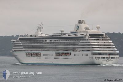
CRYSTAL SERENITY
Passengers Ship
Current Trip
FUNCHAL
| Time Travelled | 4 days |
|---|---|
| Remaining Time | --- |
| Distance Travelled | 1968.44 nm |
| Remaining Distance | --- |
| AVG Speed | 18.3 Noeuds |
| MAX Speed | 19.2 Noeuds |
| AVG Wind | 7.6 knots |
| MAX Wind | 17.9 knots |
| MIN Temp | 19.5°C / 67.1°F |
| MAX Temp | 26.9°C / 80.42°F |
| Tirant d eau | 7.6 m |
| Position reçue | 4 d depuis |
Current Position
| Longitude | -18.10026° |
|---|---|
| Latitude | 32.44477° |
| Etat | Under way using engine |
| Vitesse | 19.2 Noeuds |
| Parcours | 265.4° |
| Zone | North Atlantic Ocean |
| Station | T-AIS |
| Position reçue | 4 d depuis |
Info
Information
The current position of CRYSTAL SERENITY is in North Atlantic Ocean with coordinates 32.44477° / -18.10026° as reported on 2024-05-29 22:31 by AIS to our vessel tracker app. The vessel's current speed is 19.2 Noeuds
The vessel CRYSTAL SERENITY (IMO: 9243667, MMSI: 311536000) is a Passengers Ship that was built in 2003 ( 21 Age ). It's sailing under the flag of [BS] Bahamas.
In this page you can find informations about the vessels current position, last detected port calls, and current voyage information. If the vessels is not in coverage by AIS you will find the latest position.
The current position of CRYSTAL SERENITY is detected by our AIS receivers and we are not responsible for the reliability of the data. The last position was recorded while the vessel was in Coverage by the Ais receivers of our vessel tracking app.
The current draught of CRYSTAL SERENITY as reported by AIS is 7.6 meters
Weather
| Temperature | 26.1°C / 78.98°F |
|---|---|
| Wind Speed | 6 knots |
| Direction | 213° SSW |
| Pressure | 1018.6 hPa |
| Humidity | 78.8 % |
| Cloud Coverage | 93 % |
Featured Company
Last Port Calls
| Port | Arrival | Departure | Time In Port |
|---|---|---|---|
| 2024-05-29 08:24 | 2024-05-29 19:08 | 10 h | |
| 2024-05-28 05:35 | 2024-05-28 15:43 | 10 h | |
| 2024-05-27 06:16 | 2024-05-27 19:23 | 13 h | |
| 2024-05-21 05:26 | 2024-05-21 18:23 | 12 h | |
| 2024-05-17 08:06 | 2024-05-17 18:14 | 10 h | |
| 2024-05-16 07:16 | 2024-05-16 18:44 | 11 h | |
| 2024-05-12 06:06 | 2024-05-12 17:14 | 11 h | |
| 2024-05-10 06:23 | 2024-05-10 19:58 | 13 h | |
| 2024-05-07 09:39 | 2024-05-08 16:51 | 1 d | |
| 2024-05-04 07:18 | 2024-05-05 16:21 | 1 d |
Last Trips
| Origin | Departure | Destination | Arrival | Distance | |
|---|---|---|---|---|---|
| 2024-05-28 16:43 | 2024-05-29 09:24 | 307.99 nm | |||
| 2024-05-27 20:23 | 2024-05-28 06:35 | 118.40 nm | |||
| 2024-05-21 18:23 | 2024-05-27 07:16 | 1525.01 nm | |||
| 2024-05-17 18:14 | 2024-05-21 05:26 | 1322.29 nm | |||
| 2024-05-16 18:44 | 2024-05-17 08:06 | 171.67 nm | |||
| 2024-05-12 18:14 | 2024-05-16 07:16 | 1207.46 nm | |||
| 2024-05-10 20:58 | 2024-05-12 07:06 | 462.75 nm | |||
| 2024-05-08 18:51 | 2024-05-10 07:23 | 541.46 nm | |||
| 2024-05-05 18:21 | 2024-05-07 11:39 | 725.04 nm | |||
| 2024-05-02 19:03 | 2024-05-04 09:18 | 452.76 nm |
Events
| Heure | Evenement | Détails | Position/ Destination | Info |
|---|---|---|---|---|
| 2024-05-29 22:34 | Etat Changé | Default Under way using engine |
32.44333 / -18.11667
FUNCHAL
|
Vitesse: 19.2 kn Parcours: 265.4° |
| 2024-05-29 22:31 | Detecté en mer | Portuguese (Madeira) part of the North Atlantic Ocean |
32.44477 / -18.10026
North Atlantic Ocean
|
Vitesse: 19.2 kn Parcours: 265.4° |
| 2024-05-29 22:31 | Hors de la zone couverte |
32.44477 / -18.10026
North Atlantic Ocean
|
Vitesse: 19.2 kn Parcours: 265.4° |
|
| 2024-05-29 22:30 | Etat Changé | Under way using engine Default |
32.44512 / -18.09650
FUNCHAL
|
Vitesse: 19 kn Parcours: 263° |
| 2024-05-29 22:24 | Dans la zone couverte |
32.44477 / -18.10026
North Atlantic Ocean
|
Vitesse: 19.2 kn Parcours: 265.4° |
|
| 2024-05-29 19:08 | PORT DE DEPART |
|
32.63301 / -16.90091
FUNCHAL
|
Vitesse: 6.5 kn Parcours: 140° |
| 2024-05-29 19:00 | Démarrage |
32.64310 / -16.90788
[PT] FUNCHAL
|
Vitesse: 4.4 kn Parcours: 95° |
|
| 2024-05-29 08:40 | Arret |
32.64347 / -16.91352
[PT] FUNCHAL
|
Vitesse: 0.1 kn Parcours: 54° |
|
| 2024-05-29 08:24 | Port d'arrivée |
|
32.64225 / -16.90452
[PT] FUNCHAL
|
Vitesse: 2 kn Parcours: 109° |
| 2024-05-28 21:29 | Hors de la zone couverte |
30.34471 / -14.17111
North Atlantic Ocean
FUNCHAL
|
Vitesse: 19.5 kn Parcours: 310.3° |