

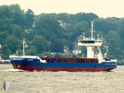
COE MINA
General Cargo

Current Trip
| Time Travelled | 1 day |
|---|---|
| Remaining Time | --- |
| Distance Travelled | 353.97 nm |
| Remaining Distance | 1.20 nm |
| AVG Speed | 9.6 Knots |
| MAX Speed | 12.3 Knots |
| AVG Wind | 5.6 knots |
| MAX Wind | 8 knots |
| MIN Temp | 3.3°C / 37.94°F |
| MAX Temp | 13°C / 55.4°F |
| Draught | 3.1 m |
| Position Received | 4 m ago |
Current Position
| Longitude | --- |
|---|---|
| Latitude | --- |
| Status | Moored |
| Speed | |
| Course | 26° |
| Area | North Sea |
| Station | T-AIS |
| Position Received | 4 m ago |
Information
The current position of COE MINA is in North Sea with coordinates 56.68155° / 8.23095° as reported on 2025-03-21 08:04 by AIS to our vessel tracker app. The vessel's current speed is 0 Knots and is heading at the port of THYBORON. The estimated time of arrival as calculated by MyShipTracking vessel tracking app is 2025-03-21 06:00 LT
The vessel COE MINA (IMO: 8509820, MMSI: 268246900) is a General Cargo that was built in 1985 ( 40 years old ). It's sailing under the flag of [SM] San Marino.
In this page you can find informations about the vessels current position, last detected port calls, and current voyage information. If the vessels is not in coverage by AIS you will find the latest position.
The current position of COE MINA is detected by our AIS receivers and we are not responsible for the reliability of the data. The last position was recorded while the vessel was in Coverage by the Ais receivers of our vessel tracking app.
The current draught of COE MINA as reported by AIS is 3.1 meters
Weather
| Temperature | 4.2°C / 39.56°F |
|---|---|
| Wind Speed | 10 knots |
| Direction | 100° E |
| Pressure | 1023.4 hPa |
| Humidity | 66 % |
| Cloud Coverage | 12 % |


Featured Company
Last Port Calls
| Port | Arrival | Departure | Time In Port |
|---|---|---|---|
| 2025-03-19 01:47 | 2025-03-19 18:47 | 16 h | |
| 2025-03-16 13:01 | 2025-03-18 13:57 | 2 d | |
| 2025-03-09 17:15 | 2025-03-12 15:42 | 2 d | |
| 2025-03-06 16:13 | 2025-03-07 16:13 | 1 d | |
| 2025-03-04 03:12 | 2025-03-05 14:41 | 1 d | |
| 2025-02-28 16:17 | 2025-03-03 19:53 | 3 d | |
| 2025-02-25 22:02 | 2025-02-27 14:29 | 1 d | |
| 2025-02-17 04:55 | 2025-02-24 16:47 | 7 d | |
| 2025-02-14 15:21 | 2025-02-14 20:02 | 4 h | |
| 2025-02-10 15:34 | 2025-02-12 18:13 | 2 d |
Last Trips
| Origin | Departure | Destination | Arrival | Distance | |
|---|---|---|---|---|---|
| 2025-03-18 13:57 | 2025-03-19 01:47 | 108.66 nm | |||
| 2025-03-12 15:42 | 2025-03-16 13:01 | 804.95 nm | |||
| 2025-03-07 16:13 | 2025-03-09 17:15 | 248.02 nm | |||
| 2025-03-05 14:41 | 2025-03-06 16:13 | 228.24 nm | |||
| 2025-03-03 19:53 | 2025-03-04 03:12 | 71.82 nm | |||
| 2025-02-27 14:29 | 2025-02-28 16:17 | 226.24 nm | |||
| 2025-02-24 16:47 | 2025-02-25 22:02 | 260.15 nm | |||
| 2025-02-14 20:02 | 2025-02-17 04:55 | 114.65 nm | |||
| 2025-02-12 18:13 | 2025-02-14 15:21 | 207.49 nm | |||
| 2025-02-07 18:10 | 2025-02-10 15:34 | 401.21 nm |
Events
| Time | Event | Details | Position / Dest | Info |
|---|---|---|---|---|
| 2025-03-21 03:43 | Status Changed | Moored Under way using engine |
56.68157 / 8.23096
DKTYB
|
Speed: Course: 25° |
| 2025-03-21 03:19 | STOP Moving | 1.06 nm, South of THYBORON |
56.68109 / 8.23222
DKTYB
|
Speed: 0.3 kn Course: 233° |
| 2025-03-20 17:02 | Detected in Sea | Danish part of the North Sea |
55.44618 / 6.14838
North Sea
DKTYB
|
Speed: 10.7 kn Course: 24.5° |
| 2025-03-20 10:59 | Change Sea Area | German part of the North Sea Dutch part of the North Sea |
54.45477 / 5.40169
North Sea
DKTYB
|
Speed: 10.9 kn Course: 24.9° |
| 2025-03-20 10:20 | IN Coverage |
54.34890 / 5.31455
North Sea
DKTYB
|
Speed: 11.2 kn Course: 23.1° |
|
| 2025-03-20 06:09 | OUT of Coverage |
53.62835 / 4.87190
North Sea
DKTYB
|
Speed: 10.8 kn Course: 32.3° |
|
| 2025-03-20 03:54 | IN Coverage |
53.27126 / 4.59729
North Sea
DKTYB
|
Speed: 10 kn Course: 29.1° |
|
| 2025-03-20 00:54 | OUT of Coverage |
52.83604 / 4.21875
North Sea
DKTYB
|
Speed: 9.6 kn Course: 33.9° |
|
| 2025-03-19 19:13 | Status Changed | Under way using engine Moored |
51.98433 / 4.08743
DKTYB
|
Speed: 11.5 kn Course: 287.6° |
| 2025-03-19 17:47 | PORT DEPARTURE |
|
51.90183 / 4.43401
DKTYB
|
Speed: 6.9 kn Course: 296° |