

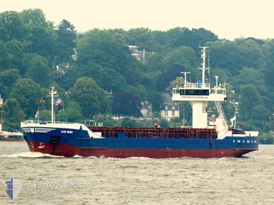
COE MINA
General Cargo

Current Trip
| Time Travelled | 7 days |
|---|---|
| Remaining Time | 1 h, 13 mins |
| Distance Travelled | 600.19 nm |
| Remaining Distance | 13.68 nm |
| AVG Speed | 9.7 Knopen |
| MAX Speed | 12.6 Knopen |
| AVG Wind | 8.4 knots |
| MAX Wind | 20.3 knots |
| MIN Temp | 3.3°C / 37.94°F |
| MAX Temp | 13°C / 55.4°F |
| Diepgang | 3.3 M |
| Positie ontvangen | 1 m geleden |
Current Position
| Lengtegraad | --- |
|---|---|
| Breedtegraat | --- |
| Status | Under way using engine |
| Snelheid | 10.8 Knopen |
| Koers | 162.6° |
| Gebied | Kattegat |
| Station | T-AIS |
| Positie ontvangen | 1 m geleden |
Information
The current position of COE MINA is in Kattegat with coordinates 56.02811° / 12.65403° as reported on 2025-03-27 16:37 by AIS to our vessel tracker app. The vessel's current speed is 10.8 Knopen and is heading at the port of LANDSKRONA. The estimated time of arrival as calculated by MyShipTracking vessel tracking app is 2025-03-27 18:52 LT
The vessel COE MINA (IMO: 8509820, MMSI: 268246900) is a General Cargo that was built in 1985 ( 40 Jaar oud ). It's sailing under the flag of [SM] San Marino.
In this page you can find informations about the vessels current position, last detected port calls, and current voyage information. If the vessels is not in coverage by AIS you will find the latest position.
The current position of COE MINA is detected by our AIS receivers and we are not responsible for the reliability of the data. The last position was recorded while the vessel was in Coverage by the Ais receivers of our vessel tracking app.
The current draught of COE MINA as reported by AIS is 3.3 meters
Weather
| Temperature | 9.1°C / 48.38°F |
|---|---|
| Wind Speed | 10 knots |
| Direction | 255° WSW |
| Pressure | 1014.5 hPa |
| Humidity | 71.6 % |
| Cloud Coverage | 84 % |


Featured Company
Last Port Calls
| Port | Arrival | Departure | Time In Port |
|---|---|---|---|
| 2025-03-19 01:47 | 2025-03-19 18:47 | 16 h | |
| 2025-03-16 13:01 | 2025-03-18 13:57 | 2 d | |
| 2025-03-09 17:15 | 2025-03-12 15:42 | 2 d | |
| 2025-03-06 16:13 | 2025-03-07 16:13 | 1 d | |
| 2025-03-04 03:12 | 2025-03-05 14:41 | 1 d | |
| 2025-02-28 16:17 | 2025-03-03 19:53 | 3 d | |
| 2025-02-25 22:02 | 2025-02-27 14:29 | 1 d | |
| 2025-02-17 04:55 | 2025-02-24 16:47 | 7 d | |
| 2025-02-14 15:21 | 2025-02-14 20:02 | 4 h | |
| 2025-02-10 15:34 | 2025-02-12 18:13 | 2 d |
Last Trips
| Origin | Departure | Destination | Arrival | Distance | |
|---|---|---|---|---|---|
| 2025-03-18 13:57 | 2025-03-19 01:47 | 108.66 nm | |||
| 2025-03-12 15:42 | 2025-03-16 13:01 | 804.95 nm | |||
| 2025-03-07 16:13 | 2025-03-09 17:15 | 248.02 nm | |||
| 2025-03-05 14:41 | 2025-03-06 16:13 | 228.24 nm | |||
| 2025-03-03 19:53 | 2025-03-04 03:12 | 71.82 nm | |||
| 2025-02-27 14:29 | 2025-02-28 16:17 | 226.24 nm | |||
| 2025-02-24 16:47 | 2025-02-25 22:02 | 260.15 nm | |||
| 2025-02-14 20:02 | 2025-02-17 04:55 | 114.65 nm | |||
| 2025-02-12 18:13 | 2025-02-14 15:21 | 207.49 nm | |||
| 2025-02-07 18:10 | 2025-02-10 15:34 | 401.21 nm |
Events
| Tijd | Evenement | Details | Positie / Bestemming | Info |
|---|---|---|---|---|
| 2025-03-27 15:19 | Wijzig zee gebeid | Danish part of the Kattegat Swedish part of the Kattegat |
56.19188 / 12.40148
Kattegat
SELAA
|
Snelheid: 9.6 kn Koers: 168.1° |
| 2025-03-27 09:01 | ETA Changed | 2025/03/28 18:00 2025/03/28 19:00 |
57.15359 / 11.90481
SELAA
|
Snelheid: 10 kn Koers: 159.1° |
| 2025-03-27 06:07 | Gevonden in zee | Swedish part of the Kattegat |
57.52697 / 11.33758
Kattegat
SELAA
|
Snelheid: 10.4 kn Koers: 133.3° |
| 2025-03-27 04:01 | Wijzig zee gebeid | Danish part of the Kattegat Danish part of the Skaggerak |
57.77761 / 10.85787
Kattegat
SELAA
|
Snelheid: 10.2 kn Koers: 134.7° |
| 2025-03-26 20:07 | Wijzig zee gebeid | Danish part of the Skaggerak Danish part of the North Sea |
57.19607 / 8.50130
Skaggerak
SELAA
|
Snelheid: 10.4 kn Koers: 46.1° |
| 2025-03-26 19:11 | ETA Changed | 2025/03/28 19:00 2025/03/28 21:00 |
57.05097 / 8.36663
SELAA
|
Snelheid: 10 kn Koers: 26.6° |
| 2025-03-26 16:46 | Status Changed | Under way using engine Moored |
56.70588 / 8.23353
SELAA
|
Snelheid: 10.6 kn Koers: 349.7° |
| 2025-03-26 16:40 | Start beweging | 0.75 nm, South East of THYBORON |
56.68850 / 8.23841
SELAA
|
Snelheid: 9.4 kn Koers: 348.5° |
| 2025-03-26 16:21 | Draught Changed | 3.3 3.1 |
56.67692 / 8.22714
SELAA
|
Snelheid: Koers: 205° |
| 2025-03-26 15:58 | Destination Changed | SELAA DKTYB |
56.67693 / 8.22712
SELAA
|
Snelheid: Koers: 206° |