

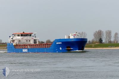
CATANIA
General Cargo

Current Trip
| Time Travelled | 4 days |
|---|---|
| Remaining Time | --- |
| Distance Travelled | 561.54 nm |
| Remaining Distance | --- |
| AVG Speed | 6.7 Knots |
| MAX Speed | 11.8 Knots |
| AVG Wind | 28.5 knots |
| MAX Wind | 44 knots |
| MIN Temp | 12.1°C / 53.78°F |
| MAX Temp | 16.4°C / 61.52°F |
| Draught | 4 m |
| Position Received | 1 d ago |
Current Position
| Longitude | --- |
|---|---|
| Latitude | --- |
| Status | Under way using engine |
| Speed | 7.5 Knots |
| Course | 2° |
| Area | North Atlantic Ocean |
| Station | T-AIS |
| Position Received | 1 d ago |
Information
The current position of CATANIA is in North Atlantic Ocean with coordinates 39.21542° / -9.83368° as reported on 2025-03-20 11:13 by AIS to our vessel tracker app. The vessel's current speed is 7.5 Knots and is heading at the port of SZCZECIN. The estimated time of arrival as calculated by MyShipTracking vessel tracking app is 2025-03-28 19:00 LT
The vessel CATANIA (IMO: 9556832, MMSI: 305930000) is a General Cargo that was built in 2012 ( 13 years old ). It's sailing under the flag of [AG] Antigua Barbuda.
In this page you can find informations about the vessels current position, last detected port calls, and current voyage information. If the vessels is not in coverage by AIS you will find the latest position.
The current position of CATANIA is detected by our AIS receivers and we are not responsible for the reliability of the data. The last position was recorded while the vessel was in Coverage by the Ais receivers of our vessel tracking app.
The current draught of CATANIA as reported by AIS is 4 meters
Weather
| Temperature | 13.5°C / 56.3°F |
|---|---|
| Wind Speed | 10 knots |
| Direction | 278° W |
| Pressure | 998.9 hPa |
| Humidity | 79.2 % |
| Cloud Coverage | 100 % |


Featured Company
Last Port Calls
| Port | Arrival | Departure | Time In Port |
|---|---|---|---|
| 2025-03-17 19:41 | 2025-03-17 20:26 | 44 m | |
| 2025-03-15 09:42 | 2025-03-16 17:41 | 1 d | |
| 2025-03-06 15:56 | 2025-03-08 00:28 | 1 d | |
| 2025-03-01 18:02 | 2025-03-03 20:25 | 2 d | |
| 2025-02-24 06:28 | 2025-02-24 23:24 | 16 h | |
| 2025-02-17 11:29 | 2025-02-19 18:05 | 2 d | |
| 2025-01-31 20:43 | 2025-02-03 22:01 | 3 d | |
| 2025-01-24 07:14 | 2025-01-27 21:14 | 3 d | |
| 2025-01-22 03:55 | 2025-01-23 13:21 | 1 d | |
| 2025-01-16 20:11 | 2025-01-17 20:15 | 1 d |
Last Trips
| Origin | Departure | Destination | Arrival | Distance | |
|---|---|---|---|---|---|
| 2025-03-16 17:41 | 2025-03-17 19:41 | 219.81 nm | |||
| 2025-03-08 00:28 | 2025-03-15 09:42 | 1437.46 nm | |||
| 2025-03-03 20:25 | 2025-03-06 15:56 | 599.49 nm | |||
| 2025-02-24 23:24 | 2025-03-01 18:02 | 913.55 nm | |||
| 2025-02-19 18:05 | 2025-02-24 06:28 | 198.14 nm | |||
| 2025-02-03 22:01 | 2025-02-17 11:29 | 1886.03 nm | |||
| 2025-01-27 21:14 | 2025-01-31 20:43 | 596.33 nm | |||
| 2025-01-23 13:21 | 2025-01-24 07:14 | 126.51 nm | |||
| 2025-01-17 20:15 | 2025-01-22 03:55 | 766.10 nm | |||
| 2025-01-15 19:46 | 2025-01-16 20:11 | 125.87 nm |
Events
| Time | Event | Details | Position / Dest | Info |
|---|---|---|---|---|
| 2025-03-20 11:20 | Status Changed | Default Under way using engine |
39.22880 / -9.83235
PLSZZ
|
Speed: 7.5 kn Course: 2° |
| 2025-03-20 11:13 | OUT of Coverage |
39.21542 / -9.83368
North Atlantic Ocean
PLSZZ
|
Speed: 7.5 kn Course: 2° |
|
| 2025-03-20 11:12 | Status Changed | Under way using engine Default |
39.21202 / -9.83375
PLSZZ
|
Speed: 7 kn Course: 348° |
| 2025-03-20 11:04 | Status Changed | Default Under way using engine |
39.19686 / -9.82972
PLSZZ
|
Speed: 6.6 kn Course: 359.4° |
| 2025-03-20 10:58 | Status Changed | Under way using engine Default |
39.18600 / -9.82658
PLSZZ
|
Speed: 7.1 kn Course: 358° |
| 2025-03-20 10:56 | Status Changed | Default Under way using engine |
39.18204 / -9.82626
PLSZZ
|
Speed: 7.2 kn Course: 356.7° |
| 2025-03-20 10:46 | Status Changed | Under way using engine Default |
39.16273 / -9.82560
PLSZZ
|
Speed: 7.3 kn Course: 358° |
| 2025-03-20 10:44 | Status Changed | Default Under way using engine |
39.15779 / -9.82535
PLSZZ
|
Speed: 7.3 kn Course: 3.9° |
| 2025-03-20 10:10 | Status Changed | Under way using engine Default |
39.09056 / -9.82532
PLSZZ
|
Speed: 7.1 kn Course: 354° |
| 2025-03-20 10:08 | Status Changed | Default Under way using engine |
39.08561 / -9.82528
PLSZZ
|
Speed: 6.9 kn Course: 359.6° |