
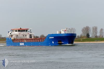
CATANIA
General Cargo
Current Trip
| Time Travelled | 9 days |
|---|---|
| Remaining Time | 1 day |
| Distance Travelled | 1572.24 nm |
| Remaining Distance | 270.89 nm |
| AVG Speed | 7 Knop |
| MAX Speed | 11.8 Knop |
| AVG Wind | 24.7 knots |
| MAX Wind | 44 knots |
| MIN Temp | 5.4°C / 41.72°F |
| MAX Temp | 16.4°C / 61.52°F |
| Djupgående | 4.1 m |
| Position mottagen | 2 m sen |
Current Position
| Longitud | --- |
|---|---|
| Latitude | --- |
| Status | Under way using engine |
| Fart | 6.6 Knop |
| Kurs | 38.9° |
| Område | North Sea |
| Station | T-AIS |
| Position mottagen | 2 m sen |
Information
The current position of CATANIA is in North Sea with coordinates 53.93075° / 9.20850° as reported on 2025-03-27 14:08 by AIS to our vessel tracker app. The vessel's current speed is 6.6 Knop and is heading at the port of SZCZECIN. The estimated time of arrival as calculated by MyShipTracking vessel tracking app is 2025-03-29 11:32 LT
The vessel CATANIA (IMO: 9556832, MMSI: 305930000) is a General Cargo that was built in 2012 ( 13 År gammal ). It's sailing under the flag of [AG] Antigua Barbuda.
In this page you can find informations about the vessels current position, last detected port calls, and current voyage information. If the vessels is not in coverage by AIS you will find the latest position.
The current position of CATANIA is detected by our AIS receivers and we are not responsible for the reliability of the data. The last position was recorded while the vessel was in Coverage by the Ais receivers of our vessel tracking app.
The current draught of CATANIA as reported by AIS is 4.1 meters
Weather
| Temperature | 12.3°C / 54.14°F |
|---|---|
| Wind Speed | 10 knots |
| Direction | 260° W |
| Pressure | 1018.8 hPa |
| Humidity | 61.2 % |
| Cloud Coverage | 20 % |
Featured Company
Last Port Calls
| Port | Arrival | Departure | Time In Port |
|---|---|---|---|
| 2025-03-17 18:41 | 2025-03-17 19:26 | 44 m | |
| 2025-03-15 09:42 | 2025-03-16 17:41 | 1 d | |
| 2025-03-06 14:56 | 2025-03-07 23:28 | 1 d | |
| 2025-03-01 18:02 | 2025-03-03 20:25 | 2 d | |
| 2025-02-24 06:28 | 2025-02-24 23:24 | 16 h | |
| 2025-02-17 11:29 | 2025-02-19 18:05 | 2 d | |
| 2025-01-31 20:43 | 2025-02-03 22:01 | 3 d | |
| 2025-01-24 06:14 | 2025-01-27 20:14 | 3 d | |
| 2025-01-22 02:55 | 2025-01-23 12:21 | 1 d | |
| 2025-01-16 19:11 | 2025-01-17 19:15 | 1 d |
Last Trips
| Origin | Departure | Destination | Arrival | Distance | |
|---|---|---|---|---|---|
| 2025-03-16 17:41 | 2025-03-17 19:41 | 219.81 nm | |||
| 2025-03-08 00:28 | 2025-03-15 09:42 | 1437.46 nm | |||
| 2025-03-03 20:25 | 2025-03-06 15:56 | 599.49 nm | |||
| 2025-02-24 23:24 | 2025-03-01 18:02 | 913.55 nm | |||
| 2025-02-19 18:05 | 2025-02-24 06:28 | 198.14 nm | |||
| 2025-02-03 22:01 | 2025-02-17 11:29 | 1886.03 nm | |||
| 2025-01-27 21:14 | 2025-01-31 20:43 | 596.33 nm | |||
| 2025-01-23 13:21 | 2025-01-24 07:14 | 126.51 nm | |||
| 2025-01-17 20:15 | 2025-01-22 03:55 | 766.10 nm | |||
| 2025-01-15 19:46 | 2025-01-16 20:11 | 125.87 nm |
Events
| Tid | Event | Detaljer | Position / Dest | Information |
|---|---|---|---|---|
| 2025-03-27 13:59 | Status ändrad | Under way using engine Default |
53.91804 / 9.19053
PLSZZ
|
Fart: 6.8 kn Kurs: 50° |
| 2025-03-27 13:58 | Status ändrad | Default Under way using engine |
53.91594 / 9.18663
PLSZZ
|
Fart: 6.9 kn Kurs: 48.4° |
| 2025-03-27 13:41 | STARTAR förflyttning | 0.67 nm, South West of BRUNSBUETTEL |
53.89370 / 9.14927
PLSZZ
|
Fart: 4 kn Kurs: 37° |
| 2025-03-27 13:36 | Status ändrad | Under way using engine Default |
53.89203 / 9.14716
PLSZZ
|
Fart: Kurs: 38° |
| 2025-03-27 13:33 | Status ändrad | Default Under way using engine |
53.89201 / 9.14715
PLSZZ
|
Fart: Kurs: 38° |
| 2025-03-27 13:24 | STOPPAR förflyttning | 0.8 nm, South West of BRUNSBUETTEL |
53.89203 / 9.14719
PLSZZ
|
Fart: Kurs: 38° |
| 2025-03-27 10:23 | Status ändrad | Under way using engine Default |
53.96029 / 8.58520
PLSZZ
|
Fart: 8.8 kn Kurs: 105° |
| 2025-03-27 10:18 | Status ändrad | Default Under way using engine |
53.96361 / 8.56361
PLSZZ
|
Fart: 8.7 kn Kurs: 98.6° |
| 2025-03-27 10:12 | Status ändrad | Under way using engine Default |
53.96612 / 8.53983
PLSZZ
|
Fart: 8.7 kn Kurs: 98° |
| 2025-03-27 10:10 | Status ändrad | Default Under way using engine |
53.96690 / 8.53096
PLSZZ
|
Fart: 8.8 kn Kurs: 100.3° |