
CAPTAIN PARIS
Tanker
Current Trip
| Time Travelled | --- |
|---|---|
| Remaining Time | --- |
| Distance Travelled | 12627.18 nm |
| Remaining Distance | --- |
| AVG Speed | 10.9 Knots |
| MAX Speed | 15.7 Knots |
| AVG Wind | 10.6 knots |
| MAX Wind | 30 knots |
| MIN Temp | 14.4°C / 57.92°F |
| MAX Temp | 29.7°C / 85.46°F |
| Draught | 8.3 m |
| Position Received | 6 m ago |
Current Position
| Longitude | --- |
|---|---|
| Latitude | --- |
| Status | Moored |
| Speed | |
| Course | 324° |
| Area | Persian Gulf |
| Station | T-AIS |
| Position Received | 6 m ago |
Info
Information
The current position of CAPTAIN PARIS is in Persian Gulf with coordinates 29.02719° / 48.20702° as reported on 2024-11-30 11:10 by AIS to our vessel tracker app. The vessel's current speed is 0 Knots
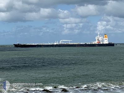
The vessel CAPTAIN PARIS (IMO: 9692844, MMSI: 229716000) is a Tanker It's sailing under the flag of [MT] Malta.
In this page you can find informations about the vessels current position, last detected port calls, and current voyage information. If the vessels is not in coverage by AIS you will find the latest position.
The current position of CAPTAIN PARIS is detected by our AIS receivers and we are not responsible for the reliability of the data. The last position was recorded while the vessel was in Coverage by the Ais receivers of our vessel tracking app.
The current draught of CAPTAIN PARIS as reported by AIS is 8.3 meters
Weather
| Temperature | 19°C / 66.2°F |
|---|---|
| Wind Speed | 14 knots |
| Direction | 334° NNW |
| Pressure | 1020.1 hPa |
| Humidity | 40.1 % |
| Cloud Coverage | --- |
Featured Company
Most Visited Ports (Last year)
| Port | Arrivals | |
|---|---|---|
| 3 | ||
| 2 | ||
| 2 | ||
| 2 | ||
| 1 | ||
| 1 |
Events
| Time | Event | Details | Position / Dest | Info |
|---|---|---|---|---|
| 2024-11-29 04:34 | Status Changed | Moored Default |
29.02709 / 48.20695
KWMEA
|
Speed: Course: 325° |
| 2024-11-29 04:31 | Status Changed | Default Moored |
29.02709 / 48.20699
KWMEA
|
Speed: 0.1 kn Course: 325° |
| 2024-11-28 23:58 | Status Changed | Moored Default |
29.02709 / 48.20692
KWMEA
|
Speed: Course: 324° |
| 2024-11-28 23:55 | Status Changed | Default Moored |
29.02710 / 48.20694
KWMEA
|
Speed: Course: 324° |
| 2024-11-28 20:37 | Status Changed | Moored Under way using engine |
29.02708 / 48.20698
KWMEA
|
Speed: Course: 324° |
| 2024-11-28 19:50 | STOP Moving | 2.11 nm, South East of SHUAIBA |
29.02708 / 48.20767
KWMEA
|
Speed: 0.3 kn Course: 325° |
| 2024-11-28 19:05 | START Moving | 3.65 nm, East of SHUAIBA |
29.02442 / 48.23775
KWMEA
|
Speed: 3.1 kn Course: 255° |
| 2024-11-28 18:44 | Status Changed | Under way using engine At anchor |
29.02664 / 48.24746
KWMEA
|
Speed: 0.1 kn Course: 327° |
| 2024-11-28 17:22 | Status Changed | At anchor Default |
29.02492 / 48.24877
KWMEA
|
Speed: Course: 345° |
| 2024-11-28 17:19 | Status Changed | Default At anchor |
29.02497 / 48.24875
KWMEA
|
Speed: 0.3 kn Course: 342° |