
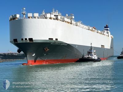
ALLIANCE NORFOLK
Vehicles Carrier
Current Trip
QAHMD
| Time Travelled | 14 h, 57 mins |
|---|---|
| Remaining Time | --- |
| Distance Travelled | 194.14 nm |
| Remaining Distance | --- |
| AVG Speed | 12.5 Knots |
| MAX Speed | 16.7 Knots |
| AVG Wind | 10.5 knots |
| MAX Wind | 27.7 knots |
| MIN Temp | 23.7°C / 74.66°F |
| MAX Temp | 29.4°C / 84.92°F |
| Draught | 9.5 m |
| Position Received | 7 h, 54 m ago |
Current Position
| Longitude | 53.30822° |
|---|---|
| Latitude | 25.67657° |
| Status | Under way using engine |
| Speed | 15.8 Knots |
| Course | 293° |
| Area | Persian Gulf |
| Station | T-AIS |
| Position Received | 7 h, 54 m ago |
Info
Information
The current position of ALLIANCE NORFOLK is in Persian Gulf with coordinates 25.67657° / 53.30822° as reported on 2024-04-30 23:52 by AIS to our vessel tracker app. The vessel's current speed is 15.8 Knots
The vessel ALLIANCE NORFOLK (IMO: 9332547, MMSI: 338619000) is a Vehicles Carrier that was built in 2007 ( 17 years old ). It's sailing under the flag of [US] USA.
In this page you can find informations about the vessels current position, last detected port calls, and current voyage information. If the vessels is not in coverage by AIS you will find the latest position.
The current position of ALLIANCE NORFOLK is detected by our AIS receivers and we are not responsible for the reliability of the data. The last position was recorded while the vessel was in Coverage by the Ais receivers of our vessel tracking app.
The current draught of ALLIANCE NORFOLK as reported by AIS is 9.5 meters
Weather
| Temperature | 23.7°C / 74.66°F |
|---|---|
| Wind Speed | 26 knots |
| Direction | 6° N |
| Pressure | 1011.1 hPa |
| Humidity | 82 % |
| Cloud Coverage | 100 % |
Featured Company
Last Port Calls
| Port | Arrival | Departure | Time In Port |
|---|---|---|---|
| 2024-04-28 23:37 | 2024-04-30 16:49 | 1 d | |
| 2024-04-17 23:32 | 2024-04-18 10:00 | 10 h | |
| 2024-03-12 13:42 | |||
| 2024-03-09 13:50 | 2024-03-10 18:49 | 1 d | |
| 2024-03-07 21:04 | |||
| 2024-03-03 01:24 |
Last Trips
| Origin | Departure | Destination | Arrival | Distance | |
|---|---|---|---|---|---|
| 2024-04-18 12:00 | 2024-04-29 03:37 | 4352.44 nm | |||
| 2024-03-10 13:49 | 2024-03-12 08:42 | 532.77 nm | |||
| 2024-03-07 15:04 | 2024-03-09 07:50 | 617.46 nm |
Events
| Time | Event | Details | Position / Dest | Info |
|---|---|---|---|---|
| 2024-04-30 23:59 | Status Changed | Default Under way using engine |
25.68547 / 53.27875
QAHMD
|
Speed: 15.8 kn Course: 293° |
| 2024-04-30 23:52 | OUT of Coverage |
25.67657 / 53.30822
Persian Gulf
QAHMD
|
Speed: 15.8 kn Course: 293° |
|
| 2024-04-30 22:34 | Change Sea Area | Iranian part of the Persian Gulf United Arab Emirates part of the Persian Gulf |
25.53360 / 53.66077
Persian Gulf
QAHMD
|
Speed: 16.6 kn Course: 294° |
| 2024-04-30 20:22 | Status Changed | Under way using engine Default |
25.29635 / 54.22370
QAHMD
|
Speed: 13.3 kn Course: 294° |
| 2024-04-30 20:16 | Status Changed | Default Under way using engine |
25.28725 / 54.24655
QAHMD
|
Speed: 13.3 kn Course: 294° |
| 2024-04-30 16:49 | PORT DEPARTURE |
|
24.83428 / 54.67070
QAHMD
|
Speed: 10.7 kn Course: 325° |
| 2024-04-30 16:42 | START Moving |
24.81948 / 54.67192
[AE] KHALIFA
|
Speed: 3.2 kn Course: 40° |
|
| 2024-04-30 16:26 | Status Changed | Under way using engine Moored |
24.82008 / 54.66757
[AE] KHALIFA
|
Speed: Course: 229° |
| 2024-04-30 15:40 | Status Changed | Moored Under way using engine |
24.82020 / 54.66755
[AE] KHALIFA
|
Speed: Course: 230° |
| 2024-04-30 15:39 | Draught Changed | 9.5 9.4 |
24.82020 / 54.66755
[AE] KHALIFA
|
Speed: Course: 230° |