
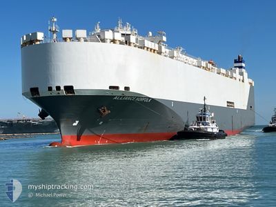
ALLIANCE NORFOLK
Vehicles Carrier
Current Trip
| Time Travelled | 9 days |
|---|---|
| Remaining Time | 2 h, 50 mins |
| Distance Travelled | 1003.06 nm |
| Remaining Distance | 47.70 nm |
| AVG Speed | 10.9 Knopen |
| MAX Speed | 16.7 Knopen |
| AVG Wind | 13.6 knots |
| MAX Wind | 36.2 knots |
| MIN Temp | 22.1°C / 71.78°F |
| MAX Temp | 30.5°C / 86.9°F |
| Diepgang | 9 M |
| Positie ontvangen | 4 h, 17 m geleden |
Current Position
| Lengtegraad | 51.28992° |
|---|---|
| Breedtegraat | 27.05887° |
| Status | Under way using engine |
| Snelheid | 9.1 Knopen |
| Koers | 359° |
| Gebied | Persian Gulf |
| Station | T-AIS |
| Positie ontvangen | 4 h, 17 m geleden |
Info
Information
The current position of ALLIANCE NORFOLK is in Persian Gulf with coordinates 27.05887° / 51.28992° as reported on 2024-05-10 00:10 by AIS to our vessel tracker app. The vessel's current speed is 9.1 Knopen and is heading at the port of DAMMAM. The estimated time of arrival as calculated by MyShipTracking vessel tracking app is 2024-05-10 07:18 LT
The vessel ALLIANCE NORFOLK (IMO: 9332547, MMSI: 338619000) is a Vehicles Carrier that was built in 2007 ( 17 Jaar oud ). It's sailing under the flag of [US] USA.
In this page you can find informations about the vessels current position, last detected port calls, and current voyage information. If the vessels is not in coverage by AIS you will find the latest position.
The current position of ALLIANCE NORFOLK is detected by our AIS receivers and we are not responsible for the reliability of the data. The last position was recorded while the vessel was in Coverage by the Ais receivers of our vessel tracking app.
The current draught of ALLIANCE NORFOLK as reported by AIS is 9 meters
Weather
| Temperature | 26.4°C / 79.52°F |
|---|---|
| Wind Speed | 21 knots |
| Direction | 338° NNW |
| Pressure | 1010.4 hPa |
| Humidity | 60.4 % |
| Cloud Coverage | --- |
Featured Company
Last Port Calls
| Port | Arrival | Departure | Time In Port |
|---|---|---|---|
| 2024-04-28 23:37 | 2024-04-30 16:49 | 1 d | |
| 2024-04-17 23:32 | 2024-04-18 10:00 | 10 h | |
| 2024-03-12 13:42 | |||
| 2024-03-09 13:50 | 2024-03-10 18:49 | 1 d | |
| 2024-03-07 21:04 | |||
| 2024-03-03 01:24 |
Last Trips
| Origin | Departure | Destination | Arrival | Distance | |
|---|---|---|---|---|---|
| 2024-04-18 12:00 | 2024-04-29 03:37 | 4352.44 nm | |||
| 2024-03-10 13:49 | 2024-03-12 08:42 | 532.77 nm | |||
| 2024-03-07 15:04 | 2024-03-09 07:50 | 617.46 nm |
Events
| Tijd | Evenement | Details | Positie / Bestemming | Info |
|---|---|---|---|---|
| 2024-05-10 00:12 | Status Changed | Default Under way using engine |
27.06180 / 51.28973
SADMN
|
Snelheid: 9.1 kn Koers: 359° |
| 2024-05-10 00:10 | Buitenbereik |
27.05887 / 51.28992
Persian Gulf
|
Snelheid: 9.1 kn Koers: 359° |
|
| 2024-05-10 00:02 | Gevonden in zee | Iranian part of the Persian Gulf |
27.03722 / 51.28983
Persian Gulf
|
Snelheid: 9.1 kn Koers: 0° |
| 2024-05-10 00:02 | Status Changed | Under way using engine Default |
27.03722 / 51.28983
SADMN
|
Snelheid: 9.2 kn Koers: 0° |
| 2024-05-09 23:58 | Status Changed | Default Under way using engine |
27.02782 / 51.28972
SADMN
|
Snelheid: 9.1 kn Koers: 0° |
| 2024-05-09 23:02 | Status Changed | Under way using engine Default |
26.94610 / 51.21892
SADMN
|
Snelheid: 9 kn Koers: 90° |
| 2024-05-09 22:56 | Status Changed | Default Under way using engine |
26.94618 / 51.19983
SADMN
|
Snelheid: 9 kn Koers: 90° |
| 2024-05-09 22:31 | Gevonden in zee | Qatari part of the Persian Gulf |
26.94648 / 51.12995
Persian Gulf
|
Snelheid: 9.3 kn Koers: 89° |
| 2024-05-09 22:31 | Status Changed | Under way using engine Default |
26.94648 / 51.12995
SADMN
|
Snelheid: 9.2 kn Koers: 90° |
| 2024-05-09 22:15 | Status Changed | Default Under way using engine |
26.94670 / 51.08493
SADMN
|
Snelheid: 9.3 kn Koers: 90° |