
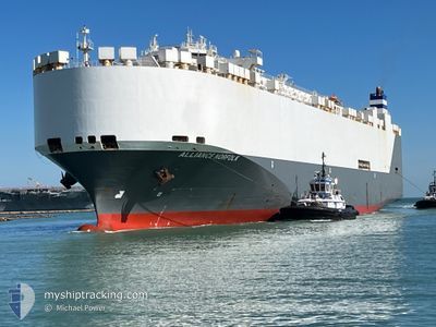
ALLIANCE NORFOLK
Vehicles Carrier
Current Trip
| Time Travelled | 11 days |
|---|---|
| Remaining Time | 16 mins |
| Distance Travelled | 1228.03 морская миля |
| Remaining Distance | 62.35 морская миля |
| AVG Speed | 10.5 Узлы |
| MAX Speed | 16.7 Узлы |
| AVG Wind | 14.2 knots |
| MAX Wind | 36.2 knots |
| MIN Temp | 22.1°C / 71.78°F |
| MAX Temp | 30.5°C / 86.9°F |
| Осадка | 9 м |
| Позиция Получена | 1 h, 30 m тому назад |
Current Position
| Долгота | 51.02450° |
|---|---|
| Широта | 27.06805° |
| Статус | Under way using engine |
| Скорость | 0.6 Узлы |
| Курс | 28° |
| Район | Persian Gulf |
| Станция | T-AIS |
| Позиция Получена | 1 h, 30 m тому назад |
Info
Information
The current position of ALLIANCE NORFOLK is in Persian Gulf with coordinates 27.06805° / 51.02450° as reported on 2024-05-11 19:14 by AIS to our vessel tracker app. The vessel's current speed is 0.6 Узлы and is heading at the port of DAMMAM. The estimated time of arrival as calculated by MyShipTracking vessel tracking app is 2024-05-11 21:01 LT
The vessel ALLIANCE NORFOLK (IMO: 9332547, MMSI: 338619000) is a Vehicles Carrier that was built in 2007 ( 17 лет ). It's sailing under the flag of [US] USA.
In this page you can find informations about the vessels current position, last detected port calls, and current voyage information. If the vessels is not in coverage by AIS you will find the latest position.
The current position of ALLIANCE NORFOLK is detected by our AIS receivers and we are not responsible for the reliability of the data. The last position was recorded while the vessel was in Coverage by the Ais receivers of our vessel tracking app.
The current draught of ALLIANCE NORFOLK as reported by AIS is 9 meters
Weather
| Temperature | 26.5°C / 79.7°F |
|---|---|
| Wind Speed | 7 knots |
| Direction | 328° NNW |
| Pressure | 1009.3 hPa |
| Humidity | 71 % |
| Cloud Coverage | 10 % |
Featured Company
Last Port Calls
| Port | Arrival | Departure | Time In Port |
|---|---|---|---|
| 2024-04-28 23:37 | 2024-04-30 16:49 | 1 d | |
| 2024-04-17 23:32 | 2024-04-18 10:00 | 10 h | |
| 2024-03-12 13:42 | |||
| 2024-03-09 13:50 | 2024-03-10 18:49 | 1 d | |
| 2024-03-07 21:04 | |||
| 2024-03-03 01:24 |
Last Trips
| Origin | Departure | Destination | Arrival | Distance | |
|---|---|---|---|---|---|
| 2024-04-18 12:00 | 2024-04-29 03:37 | 4352.44 морская миля | |||
| 2024-03-10 13:49 | 2024-03-12 08:42 | 532.77 морская миля | |||
| 2024-03-07 15:04 | 2024-03-09 07:50 | 617.46 морская миля |
Events
| Время | Событие | Детали | Позиция / Направление | Информация |
|---|---|---|---|---|
| 2024-05-11 19:16 | Статус изменился | Default Under way using engine |
27.06775 / 51.02480
SADMN
|
Скорость: 0.6 kn Курс: 28° |
| 2024-05-11 19:14 | Статус изменился | Under way using engine Default |
27.06805 / 51.02450
SADMN
|
Скорость: 0.7 kn Курс: 28° |
| 2024-05-11 19:14 | Вне покрытия |
27.06805 / 51.02450
Persian Gulf
|
Скорость: 0.6 kn Курс: 136° |
|
| 2024-05-11 19:14 | Изменение морского района | Bahraini part of the Persian Gulf Iranian part of the Persian Gulf |
27.06805 / 51.02450
Persian Gulf
|
Скорость: 0.6 kn Курс: 136° |
| 2024-05-11 19:12 | В покрытии |
27.06805 / 51.02450
Persian Gulf
|
Скорость: 0.6 kn Курс: 136° |
|
| 2024-05-11 15:11 | Начало движения |
27.13062 / 51.42893
SADMN
|
Скорость: 4.6 kn Курс: 261° |
|
| 2024-05-11 14:23 | Статус изменился | Default Under way using engine |
27.13847 / 51.42002
SADMN
|
Скорость: 1.2 kn Курс: 228° |
| 2024-05-11 14:18 | Вне покрытия |
27.13885 / 51.41830
Persian Gulf
|
Скорость: 1.2 kn Курс: 105° |
|
| 2024-05-11 14:15 | Статус изменился | Under way using engine Default |
27.13910 / 51.41708
SADMN
|
Скорость: 1.4 kn Курс: 221° |
| 2024-05-11 14:09 | Статус изменился | Default Under way using engine |
27.13967 / 51.41428
SADMN
|
Скорость: 1.4 kn Курс: 221° |