

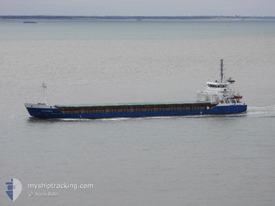
ALEXANDER
General Cargo

Current Trip
| Time Travelled | 2 days |
|---|---|
| Remaining Time | 1 day |
| Distance Travelled | 618.21 nm |
| Remaining Distance | 191.45 nm |
| AVG Speed | 9.1 Knots |
| MAX Speed | 13.8 Knots |
| AVG Wind | 20.5 knots |
| MAX Wind | 34 knots |
| MIN Temp | 5.3°C / 41.54°F |
| MAX Temp | 9.7°C / 49.46°F |
| Draught | 4.1 m |
| Position Received | 1 m ago |
Current Position
| Longitude | --- |
|---|---|
| Latitude | --- |
| Status | Under way using engine |
| Speed | 3.9 Knots |
| Course | 129° |
| Area | North Sea |
| Station | T-AIS |
| Position Received | 1 m ago |
Information
The current position of ALEXANDER is in North Sea with coordinates 57.57258° / 6.19624° as reported on 2025-03-22 08:34 by AIS to our vessel tracker app. The vessel's current speed is 3.9 Knots and is heading at the port of GOTEBORG. The estimated time of arrival as calculated by MyShipTracking vessel tracking app is 2025-03-23 23:57 LT
The vessel ALEXANDER (IMO: 9433353, MMSI: 305393000) is a General Cargo that was built in 2009 ( 16 years old ). It's sailing under the flag of [AG] Antigua Barbuda.
In this page you can find informations about the vessels current position, last detected port calls, and current voyage information. If the vessels is not in coverage by AIS you will find the latest position.
The current position of ALEXANDER is detected by our AIS receivers and we are not responsible for the reliability of the data. The last position was recorded while the vessel was in Coverage by the Ais receivers of our vessel tracking app.
The current draught of ALEXANDER as reported by AIS is 4.1 meters
Weather
| Temperature | 5.3°C / 41.54°F |
|---|---|
| Wind Speed | 32 knots |
| Direction | 101° E |
| Pressure | 1018 hPa |
| Humidity | 82.7 % |
| Cloud Coverage | 9 % |


Featured Company
Last Port Calls
| Port | Arrival | Departure | Time In Port |
|---|---|---|---|
| 2025-03-15 23:03 | 2025-03-19 18:16 | 3 d | |
| 2025-03-08 23:06 | 2025-03-11 18:13 | 2 d | |
| 2025-03-07 16:41 | 2025-03-08 11:30 | 18 h | |
| 2025-03-01 22:54 | 2025-03-03 16:48 | 1 d | |
| 2025-02-22 09:35 | 2025-02-26 14:42 | 4 d | |
| 2025-02-19 02:31 | 2025-02-19 11:26 | 8 h | |
| 2025-02-12 09:16 | 2025-02-12 14:11 | 4 h | |
| 2025-01-27 11:25 | 2025-02-03 22:21 | 7 d | |
| 2025-01-20 11:55 | 2025-01-21 15:56 | 1 d | |
| 2025-01-17 08:58 | 2025-01-18 22:55 | 1 d |
Last Trips
| Origin | Departure | Destination | Arrival | Distance | |
|---|---|---|---|---|---|
| 2025-03-11 18:13 | 2025-03-15 23:03 | 760.35 nm | |||
| 2025-03-08 11:30 | 2025-03-08 23:06 | 118.54 nm | |||
| 2025-03-03 16:48 | 2025-03-07 16:41 | 696.17 nm | |||
| 2025-02-26 14:42 | 2025-03-01 22:54 | 436.85 nm | |||
| 2025-02-19 11:26 | 2025-02-22 09:35 | 187.61 nm | |||
| 2025-02-12 14:11 | 2025-02-19 02:31 | 1639.86 nm | |||
| 2025-02-03 22:21 | 2025-02-12 09:16 | 2006.41 nm | |||
| 2025-01-21 15:56 | 2025-01-27 11:25 | 377.23 nm | |||
| 2025-01-18 22:55 | 2025-01-20 11:55 | 66.55 nm | |||
| 2025-01-09 16:47 | 2025-01-17 08:58 | 1824.99 nm |
Events
| Time | Event | Details | Position / Dest | Info |
|---|---|---|---|---|
| 2025-03-21 12:26 | Status Changed | Under way using engine Default |
58.12038 / 2.48668
SEGOT
|
Speed: 10.5 kn Course: 102° |
| 2025-03-21 11:35 | Status Changed | Default Under way using engine |
58.16710 / 2.21922
SEGOT
|
Speed: 10.5 kn Course: 111.3° |
| 2025-03-21 11:35 | Status Changed | Under way using engine Default |
58.16794 / 2.21489
SEGOT
|
Speed: 10.7 kn Course: 111° |
| 2025-03-21 11:13 | Status Changed | Default Under way using engine |
58.19018 / 2.09987
SEGOT
|
Speed: 10.5 kn Course: 109.8° |
| 2025-03-21 09:46 | Change Sea Area | Norwegian part of the North Sea United Kingdom part of the North Sea |
58.26940 / 1.63338
North Sea
SEGOT
|
Speed: 10.8 kn Course: 107.4° |
| 2025-03-21 08:17 | Status Changed | Under way using engine Default |
58.36092 / 1.15878
SEGOT
|
Speed: 11 kn Course: 111° |
| 2025-03-21 07:59 | IN Coverage |
58.36092 / 1.15878
North Sea
SEGOT
|
Speed: 10.9 kn Course: 110.4° |
|
| 2025-03-20 21:48 | Status Changed | Default Under way using engine |
58.68998 / -2.55393
SEGOT
|
Speed: 11.6 kn Course: 97° |
| 2025-03-20 21:42 | OUT of Coverage |
58.69240 / -2.59058
North Sea
SEGOT
|
Speed: 11.6 kn Course: 97° |
|
| 2025-03-20 21:37 | Status Changed | Under way using engine Default |
58.69411 / -2.62082
SEGOT
|
Speed: 11.4 kn Course: 97° |