
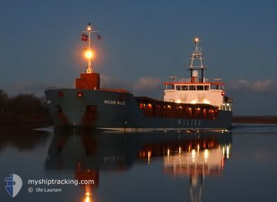
WILSON AVILES
General Cargo
Current Trip
| Time Travelled | 4 days |
|---|---|
| Remaining Time | --- |
| Distance Travelled | 800.03 nm |
| Remaining Distance | --- |
| AVG Speed | 8.7 Knop |
| MAX Speed | 11.4 Knop |
| AVG Wind | 14.4 knots |
| MAX Wind | 42 knots |
| MIN Temp | -7.3°C / 18.86°F |
| MAX Temp | 6.7°C / 44.06°F |
| Djupgående | 5.2 m |
| Position mottagen | 2 m sen |
Current Position
| Longitud | --- |
|---|---|
| Latitude | --- |
| Status | Under way using engine |
| Fart | 5.4 Knop |
| Kurs | 220.7° |
| Område | Norwegian Sea |
| Station | T-AIS |
| Position mottagen | 2 m sen |
Info
Information
The current position of WILSON AVILES is in Norwegian Sea with coordinates 67.71558° / 14.05218° as reported on 2025-01-15 13:43 by AIS to our vessel tracker app. The vessel's current speed is 5.4 Knop and is heading at the port of FECAMP. The estimated time of arrival as calculated by MyShipTracking vessel tracking app is 2025-01-22 18:00 LT
The vessel WILSON AVILES (IMO: 9313709, MMSI: 314603000) is a General Cargo that was built in 2008 ( 17 År gammal ). It's sailing under the flag of [BB] Barbados.
In this page you can find informations about the vessels current position, last detected port calls, and current voyage information. If the vessels is not in coverage by AIS you will find the latest position.
The current position of WILSON AVILES is detected by our AIS receivers and we are not responsible for the reliability of the data. The last position was recorded while the vessel was in Coverage by the Ais receivers of our vessel tracking app.
The current draught of WILSON AVILES as reported by AIS is 5.2 meters
Weather
| Temperature | 6.6°C / 43.88°F |
|---|---|
| Wind Speed | 28 knots |
| Direction | 249° WSW |
| Pressure | 994.8 hPa |
| Humidity | 95.6 % |
| Cloud Coverage | 100 % |
Featured Company
Last Port Calls
| Port | Arrival | Departure | Time In Port |
|---|---|---|---|
| 2025-01-10 19:19 | |||
| 2024-12-31 12:19 | 2025-01-02 19:48 | 2 d | |
| 2024-12-30 14:52 | 2024-12-30 15:48 | 55 m | |
| 2024-12-27 14:42 | 2024-12-27 15:19 | 36 m | |
| 2024-12-21 02:16 | 2024-12-26 13:09 | 5 d | |
| 2024-12-20 06:59 | 2024-12-20 23:52 | 16 h | |
| 2024-12-10 13:01 | 2024-12-12 14:45 | 2 d | |
| 2024-12-04 00:34 | 2024-12-05 04:15 | 1 d | |
| 2024-12-02 03:02 | 2024-12-03 21:30 | 1 d | |
| 2024-11-26 23:53 | 2024-11-28 18:05 | 1 d |
Most Visited Ports (Last year)
| Port | Arrivals | |
|---|---|---|
| 5 | ||
| 2 | ||
| 2 | ||
| 2 | ||
| 2 | ||
| 2 |
Last Trips
| Origin | Departure | Destination | Arrival | Distance | |
|---|---|---|---|---|---|
| 2024-12-30 15:48 | 2024-12-31 13:19 | 195.05 nm | |||
| 2024-12-27 15:19 | 2024-12-30 14:52 | 0.59 nm | |||
| 2024-12-26 14:09 | 2024-12-27 14:42 | 184.25 nm | |||
| 2024-12-21 00:52 | 2024-12-21 03:16 | 23.93 nm | |||
| 2024-12-12 15:45 | 2024-12-20 07:59 | 1154.26 nm | |||
| 2024-12-05 05:15 | 2024-12-10 14:01 | 1126.88 nm | |||
| 2024-12-03 22:30 | 2024-12-04 01:34 | 30.07 nm | |||
| 2024-11-28 19:05 | 2024-12-02 04:02 | 658.14 nm | |||
| 2024-11-26 12:24 | 2024-11-27 00:53 | 110.04 nm | |||
| 2024-11-12 17:48 | 2024-11-21 17:18 | 1898.32 nm |
Events
| Tid | Event | Detaljer | Position / Dest | Information |
|---|---|---|---|---|
| 2025-01-13 20:21 | STARTAR förflyttning | 5.43 nm, East of OKSFJORD |
70.25869 / 22.60879
FRFEC
|
Fart: 5.1 kn Kurs: 252.3° |
| 2025-01-13 20:16 | Djupgående ändrat | 5.2 3.2 |
70.26184 / 22.61498
FRFEC
|
Fart: Kurs: 226° |
| 2025-01-13 20:16 | Destination ändrad | FRFEC NOSTY |
70.26184 / 22.61498
FRFEC
|
Fart: Kurs: 226° |
| 2025-01-13 20:16 | ETA ändrat | 2025/01/22 18:00 2025/01/12 19:00 |
70.26184 / 22.61498
FRFEC
|
Fart: Kurs: 226° |
| 2025-01-13 20:09 | Status ändrad | Under way using engine Moored |
70.26187 / 22.61474
NOSTY
|
Fart: Kurs: 219° |
| 2025-01-12 22:04 | Status ändrad | Moored Under way using engine |
70.26186 / 22.61468
NOSTY
|
Fart: Kurs: 218° |
| 2025-01-12 21:35 | STOPPAR förflyttning | 5.59 nm, East of OKSFJORD |
70.26190 / 22.61479
NOSTY
|
Fart: 0.1 kn Kurs: 219° |
| 2025-01-10 19:47 | Djupgående ändrat | 3.2 5.2 |
65.91270 / 13.09120
NOSTY
|
Fart: 10.7 kn Kurs: 308.6° |
| 2025-01-10 19:47 | Destination ändrad | NOSTY NOMJF |
65.91270 / 13.09120
NOSTY
|
Fart: 10.7 kn Kurs: 308.6° |
| 2025-01-10 19:47 | ETA ändrat | 2025/01/12 19:00 2025/01/08 16:00 |
65.91270 / 13.09120
NOSTY
|
Fart: 10.7 kn Kurs: 308.6° |