
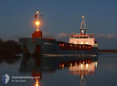
WILSON AVILES
General Cargo
Current Trip
| Time Travelled | 5 h, 11 mins |
|---|---|
| Remaining Time | 1 day |
| Distance Travelled | 39.17 nm |
| Remaining Distance | 198.79 nm |
| AVG Speed | 8.5 Knots |
| MAX Speed | 9.9 Knots |
| AVG Wind | 28.2 knots |
| MAX Wind | 30.3 knots |
| MIN Temp | 8.4°C / 47.12°F |
| MAX Temp | 9.9°C / 49.82°F |
| Dybgang | 3.2 m |
| Position Modtaget | Nu |
Current Position
| Longitude | --- |
|---|---|
| Latitude | --- |
| Status | Under way using engine |
| Fart | 8.9 Knots |
| Kurs | 46.1° |
| Område | English Channel |
| Station | T-AIS |
| Position Modtaget | Nu |
Info
Information
The current position of WILSON AVILES is in English Channel with coordinates 50.25627° / -0.02054° as reported on 2025-01-28 14:39 by AIS to our vessel tracker app. The vessel's current speed is 8.9 Knots and is heading at the port of ANTWERP. The estimated time of arrival as calculated by MyShipTracking vessel tracking app is 2025-01-29 15:03 LT
The vessel WILSON AVILES (IMO: 9313709, MMSI: 314603000) is a General Cargo that was built in 2008 ( 17 år gamle ). It's sailing under the flag of [BB] Barbados.
In this page you can find informations about the vessels current position, last detected port calls, and current voyage information. If the vessels is not in coverage by AIS you will find the latest position.
The current position of WILSON AVILES is detected by our AIS receivers and we are not responsible for the reliability of the data. The last position was recorded while the vessel was in Coverage by the Ais receivers of our vessel tracking app.
The current draught of WILSON AVILES as reported by AIS is 3.2 meters
Weather
| Temperature | 9.8°C / 49.64°F |
|---|---|
| Wind Speed | 28 knots |
| Direction | 254° WSW |
| Pressure | 986.7 hPa |
| Humidity | 81.1 % |
| Cloud Coverage | 79 % |
Featured Company
Last Port Calls
| Port | Arrival | Departure | Time In Port |
|---|---|---|---|
| 2025-01-25 19:08 | 2025-01-28 09:29 | 2 d | |
| 2025-01-21 05:38 | 2025-01-21 08:13 | 2 h | |
| 2025-01-10 19:19 | |||
| 2024-12-31 12:19 | 2025-01-02 19:48 | 2 d | |
| 2024-12-30 14:52 | 2024-12-30 15:48 | 55 m | |
| 2024-12-27 14:42 | 2024-12-27 15:19 | 36 m | |
| 2024-12-21 02:16 | 2024-12-26 13:09 | 5 d | |
| 2024-12-20 06:59 | 2024-12-20 23:52 | 16 h | |
| 2024-12-10 13:01 | 2024-12-12 14:45 | 2 d | |
| 2024-12-04 00:34 | 2024-12-05 04:15 | 1 d |
Most Visited Ports (Last year)
| Port | Arrivals | |
|---|---|---|
| 5 | ||
| 2 | ||
| 2 | ||
| 2 | ||
| 2 | ||
| 2 |
Last Trips
| Origin | Departure | Destination | Arrival | Distance | |
|---|---|---|---|---|---|
| 2025-01-21 09:13 | 2025-01-25 20:08 | 745.54 nm | |||
| 2025-01-10 20:19 | 2025-01-21 06:38 | 1399.15 nm | |||
| 2024-12-30 15:48 | 2024-12-31 13:19 | 195.05 nm | |||
| 2024-12-27 15:19 | 2024-12-30 14:52 | 0.59 nm | |||
| 2024-12-26 14:09 | 2024-12-27 14:42 | 184.25 nm | |||
| 2024-12-21 00:52 | 2024-12-21 03:16 | 23.93 nm | |||
| 2024-12-12 15:45 | 2024-12-20 07:59 | 1154.26 nm | |||
| 2024-12-05 05:15 | 2024-12-10 14:01 | 1126.88 nm | |||
| 2024-12-03 22:30 | 2024-12-04 01:34 | 30.07 nm | |||
| 2024-11-28 19:05 | 2024-12-02 04:02 | 658.14 nm |
Events
| Tid | Hændelsen | Detaljer | Position / Dest | Info |
|---|---|---|---|---|
| 2025-01-28 14:24 | Ændre havområde | United Kingdom part of the English Channel French part of the English Channel |
50.23181 / -.05805
English Channel
BEANR
|
Fart: 8.4 kn Kurs: 46.9° |
| 2025-01-28 10:10 | Dybgangen er ændret | 3.2 5.2 |
49.79051 / .24966
BEANR
|
Fart: 7.8 kn Kurs: 284.1° |
| 2025-01-28 10:10 | Destination er ændret | BEANR FRFEC |
49.79051 / .24966
BEANR
|
Fart: 7.8 kn Kurs: 284.1° |
| 2025-01-28 10:10 | ETA er ændret | 2025/01/29 13:00 2025/01/25 18:00 |
49.79051 / .24966
BEANR
|
Fart: 7.8 kn Kurs: 284.1° |
| 2025-01-28 09:39 | Status er ændret | Under way using engine Default |
49.76756 / .34330
FRFEC
|
Fart: 3.2 kn Kurs: 289° |
| 2025-01-28 09:39 | Indenfor Dækning |
49.77083 / .33835
English Channel
|
Fart: 8.6 kn Kurs: 315.9° |
|
| 2025-01-28 09:29 | Afsejlet fra sidste havn |
|
49.76756 / .34330
FRFEC
|
Fart: 3.2 kn Kurs: 289° |
| 2025-01-28 09:21 | START Sejllads |
49.76165 / .37368
[FR] FECAMP
|
Fart: 3.2 kn Kurs: 289° |
|
| 2025-01-25 19:08 | Skibe i havn |
|
49.76086 / .37908
[FR] FECAMP
|
Fart: 5.6 kn Kurs: 83° |
| 2025-01-25 18:43 | Udenfor Dækning |
49.76469 / .33914
English Channel
[FR] FECAMP
|
Fart: 5.6 kn Kurs: 43.4° |