
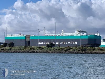
TONGALA
Vehicles Carrier
Current Trip
| Time Travelled | 2 days |
|---|---|
| Remaining Time | 3 days |
| Distance Travelled | 848.09 nm |
| Remaining Distance | 1474.10 nm |
| AVG Speed | 16 Knop |
| MAX Speed | 18 Knop |
| AVG Wind | 12.8 knots |
| MAX Wind | 24.8 knots |
| MIN Temp | 17.9°C / 64.22°F |
| MAX Temp | 27.4°C / 81.32°F |
| Djupgående | 10.4 m |
| Position mottagen | 8 h, 22 m sen |
Current Position
| Longitud | 118.53469° |
|---|---|
| Latitude | 21.72400° |
| Status | Under way using engine |
| Fart | 17.9 Knop |
| Kurs | 219.2° |
| Område | South China Sea |
| Station | T-AIS |
| Position mottagen | 8 h, 22 m sen |
Info
Information
The current position of TONGALA is in South China Sea with coordinates 21.72400° / 118.53469° as reported on 2024-05-18 09:21 by AIS to our vessel tracker app. The vessel's current speed is 17.9 Knop and is heading at the port of LAEM CHABANG. The estimated time of arrival as calculated by MyShipTracking vessel tracking app is 2024-05-22 14:53 LT
The vessel TONGALA (IMO: 9605786, MMSI: 215654000) is a Vehicles Carrier that was built in 2012 ( 12 År gammal ). It's sailing under the flag of [MT] Malta.
In this page you can find informations about the vessels current position, last detected port calls, and current voyage information. If the vessels is not in coverage by AIS you will find the latest position.
The current position of TONGALA is detected by our AIS receivers and we are not responsible for the reliability of the data. The last position was recorded while the vessel was in Coverage by the Ais receivers of our vessel tracking app.
The current draught of TONGALA as reported by AIS is 10.4 meters
Weather
| Temperature | 27.5°C / 81.5°F |
|---|---|
| Wind Speed | 15 knots |
| Direction | 83° E |
| Pressure | 1006.9 hPa |
| Humidity | 82.2 % |
| Cloud Coverage | 83 % |
Featured Company
Last Port Calls
| Port | Arrival | Departure | Time In Port |
|---|---|---|---|
| 2024-05-16 06:55 | 2024-05-16 20:04 | 13 h | |
| 2024-05-14 06:48 | 2024-05-14 18:04 | 11 h | |
| 2024-05-12 02:56 | 2024-05-13 21:01 | 1 d | |
| 2024-04-30 03:29 | 2024-05-01 02:24 | 22 h | |
| 2024-04-21 21:35 | 2024-04-22 23:39 | 1 d | |
| 2024-04-18 09:01 | 2024-04-19 21:52 | 1 d | |
| 2024-04-11 21:00 | 2024-04-13 15:58 | 1 d | |
| 2024-03-24 15:31 | 2024-03-25 19:34 | 1 d | |
| 2024-03-05 05:15 | 2024-03-05 16:20 | 11 h | |
| 2024-03-01 21:43 |
Most Visited Ports (Last year)
| Port | Arrivals | |
|---|---|---|
| 4 | ||
| 3 | ||
| 3 | ||
| 3 | ||
| 3 | ||
| 3 |
Last Trips
| Origin | Departure | Destination | Arrival | Distance | |
|---|---|---|---|---|---|
| 2024-05-14 18:04 | 2024-05-16 06:55 | 415.24 nm | |||
| 2024-05-13 21:01 | 2024-05-14 06:48 | 128.07 nm | |||
| 2024-05-01 02:24 | 2024-05-12 02:56 | 4370.98 nm | |||
| 2024-04-22 23:39 | 2024-04-30 03:29 | 837.07 nm | |||
| 2024-04-19 21:52 | 2024-04-21 21:35 | 586.73 nm | |||
| 2024-04-13 15:58 | 2024-04-18 09:01 | 1710.95 nm | |||
| 2024-03-25 19:34 | 2024-04-11 21:00 | 4534.50 nm | |||
| 2024-03-05 16:20 | 2024-03-24 15:31 | 6581.73 nm | |||
| 2024-03-01 21:43 | 2024-03-05 05:15 | 570.17 nm |
Events
| Tid | Event | Detaljer | Position / Dest | Information |
|---|---|---|---|---|
| 2024-05-18 09:29 | Status ändrad | Default Under way using engine |
21.69319 / 118.50727
TH LCH
|
Fart: 17.9 kn Kurs: 219.2° |
| 2024-05-18 09:21 | UTANFÖR täckningsområde |
21.72400 / 118.53469
South China Sea
TH LCH
|
Fart: 17.9 kn Kurs: 219.2° |
|
| 2024-05-18 09:13 | Status ändrad | Under way using engine Default |
21.75350 / 118.56077
TH LCH
|
Fart: 17.7 kn Kurs: 219° |
| 2024-05-18 09:09 | I täckningsområde |
21.75154 / 118.55904
South China Sea
TH LCH
|
Fart: 17.8 kn Kurs: 219.4° |
|
| 2024-05-18 08:08 | Status ändrad | Default Under way using engine |
22.00095 / 118.77595
TH LCH
|
Fart: 17.3 kn Kurs: 216.7° |
| 2024-05-18 08:01 | UTANFÖR täckningsområde |
22.02792 / 118.79868
South China Sea
TH LCH
|
Fart: 17.3 kn Kurs: 216.7° |
|
| 2024-05-18 07:31 | Status ändrad | Under way using engine Default |
22.14356 / 118.88992
TH LCH
|
Fart: 16.9 kn Kurs: 216° |
| 2024-05-18 07:29 | Status ändrad | Default Under way using engine |
22.15125 / 118.89575
TH LCH
|
Fart: 16.9 kn Kurs: 215.9° |
| 2024-05-18 07:22 | Status ändrad | Under way using engine Default |
22.17538 / 118.91432
TH LCH
|
Fart: 16.8 kn Kurs: 216° |
| 2024-05-18 07:21 | Status ändrad | Default Under way using engine |
22.18145 / 118.91891
TH LCH
|
Fart: 16.9 kn Kurs: 215.8° |