
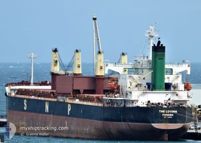
THE LOVING
Bulk Carrier
Current Trip
| Time Travelled | 26 days |
|---|---|
| Remaining Time | --- |
| Distance Travelled | 6214.16 nm |
| Remaining Distance | --- |
| AVG Speed | 12.3 Knop |
| MAX Speed | 16 Knop |
| AVG Wind | 13.1 knots |
| MAX Wind | 33 knots |
| MIN Temp | 17.3°C / 63.14°F |
| MAX Temp | 30.2°C / 86.36°F |
| Djupgående | 6.3 m |
| Position mottagen | 2 d sen |
Current Position
| Longitud | -51.89237° |
|---|---|
| Latitude | -32.13582° |
| Status | At anchor |
| Fart | 0.8 Knop |
| Kurs | 220° |
| Område | South Atlantic Ocean |
| Station | T-AIS |
| Position mottagen | 2 d sen |
Info
Information
The current position of THE LOVING is in South Atlantic Ocean with coordinates -32.13582° / -51.89237° as reported on 2024-04-24 09:55 by AIS to our vessel tracker app. The vessel's current speed is 0.8 Knop
The vessel THE LOVING (IMO: 9368883, MMSI: 373468000) is a Bulk Carrier that was built in 2007 ( 17 År gammal ). It's sailing under the flag of [PA] Panama.
In this page you can find informations about the vessels current position, last detected port calls, and current voyage information. If the vessels is not in coverage by AIS you will find the latest position.
The current position of THE LOVING is detected by our AIS receivers and we are not responsible for the reliability of the data. The last position was recorded while the vessel was in Coverage by the Ais receivers of our vessel tracking app.
The current draught of THE LOVING as reported by AIS is 6.3 meters
Weather
| Temperature | 21.5°C / 70.7°F |
|---|---|
| Wind Speed | 3 knots |
| Direction | 68° ENE |
| Pressure | 1007.9 hPa |
| Humidity | 98.1 % |
| Cloud Coverage | 100 % |
Featured Company
Last Port Calls
| Port | Arrival | Departure | Time In Port |
|---|---|---|---|
| 2024-03-25 23:54 | 2024-03-31 12:55 | 5 d | |
| 2024-03-12 13:46 | 2024-03-19 11:23 | 6 d | |
| 2024-02-19 04:28 | 2024-02-19 13:45 | 9 h |
Most Visited Ports (Last year)
| Port | Arrivals | |
|---|---|---|
| 3 | ||
| 1 | ||
| 1 | ||
| 1 | ||
| 1 | ||
| 1 |
Last Trips
| Origin | Departure | Destination | Arrival | Distance | |
|---|---|---|---|---|---|
| 2024-03-19 14:23 | 2024-03-26 02:54 | 53.22 nm | |||
| 2024-01-09 15:49 | 2024-03-12 16:46 | 6195.52 nm | |||
| 2024-01-09 15:49 | 2024-02-19 06:28 | 6784.35 nm |
Events
| Tid | Event | Detaljer | Position / Dest | Information |
|---|---|---|---|---|
| 2024-04-24 10:01 | Status ändrad | Default At anchor |
-32.13573 / -51.89248
BR RIG
|
Fart: 0.8 kn Kurs: 220° |
| 2024-04-24 09:55 | UTANFÖR täckningsområde |
-32.13582 / -51.89237
South Atlantic Ocean
|
Fart: 0.8 kn Kurs: 315° |
|
| 2024-04-24 09:52 | Status ändrad | At anchor Default |
-32.13623 / -51.89168
BR RIG
|
Fart: 0.8 kn Kurs: 200° |
| 2024-04-24 09:46 | Status ändrad | Default At anchor |
-32.13617 / -51.89183
BR RIG
|
Fart: 0.5 kn Kurs: 184° |
| 2024-04-24 08:46 | Status ändrad | At anchor Default |
-32.13627 / -51.89177
BR RIG
|
Fart: 0.7 kn Kurs: 208° |
| 2024-04-24 08:40 | Status ändrad | Default At anchor |
-32.13623 / -51.89170
BR RIG
|
Fart: 0.1 kn Kurs: 196° |
| 2024-04-24 08:10 | Status ändrad | At anchor Default |
-32.13610 / -51.89210
BR RIG
|
Fart: 0.3 kn Kurs: 221° |
| 2024-04-24 07:34 | Status ändrad | Default At anchor |
-32.13600 / -51.89232
BR RIG
|
Fart: 0.6 kn Kurs: 207° |
| 2024-04-24 06:16 | Djupgående ändrat | 6.3 6.2 |
-32.13597 / -51.89265
BR RIG
|
Fart: 0.4 kn Kurs: 193° |
| 2024-04-24 06:04 | Status ändrad | At anchor Default |
-32.13615 / -51.89237
BR RIG
|
Fart: 0.3 kn Kurs: 215° |