
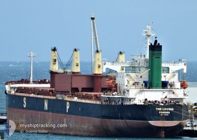
THE LOVING
Bulk Carrier
Current Trip
| Time Travelled | 31 days |
|---|---|
| Remaining Time | 3 days |
| Distance Travelled | 7215.40 nm |
| Remaining Distance | 807.87 nm |
| AVG Speed | 9.3 Knots |
| MAX Speed | 13.9 Knots |
| AVG Wind | 13.2 knots |
| MAX Wind | 30 knots |
| MIN Temp | 19.1°C / 66.38°F |
| MAX Temp | 29°C / 84.2°F |
| Dybgang | 12.8 m |
| Position Modtaget | 8 d siden |
Current Position
| Longitude | --- |
|---|---|
| Latitude | --- |
| Status | Under way using engine |
| Fart | 11.6 Knots |
| Kurs | 54° |
| Område | Singapore Strait |
| Station | T-AIS |
| Position Modtaget | 8 d siden |
Info
Information
The current position of THE LOVING is in Singapore Strait with coordinates 1.29825° / 104.35125° as reported on 2024-11-23 13:49 by AIS to our vessel tracker app. The vessel's current speed is 11.6 Knots and is heading at the port of TIANJIN. The estimated time of arrival as calculated by MyShipTracking vessel tracking app is 2024-12-05 19:55 LT
The vessel THE LOVING (IMO: 9368883, MMSI: 373468000) is a Bulk Carrier that was built in 2007 ( 17 år gamle ). It's sailing under the flag of [PA] Panama.
In this page you can find informations about the vessels current position, last detected port calls, and current voyage information. If the vessels is not in coverage by AIS you will find the latest position.
The current position of THE LOVING is detected by our AIS receivers and we are not responsible for the reliability of the data. The last position was recorded while the vessel was in Coverage by the Ais receivers of our vessel tracking app.
The current draught of THE LOVING as reported by AIS is 12.8 meters
Weather
| Temperature | 19.7°C / 67.46°F |
|---|---|
| Wind Speed | 10 knots |
| Direction | 84° E |
| Pressure | 1019.6 hPa |
| Humidity | 72.1 % |
| Cloud Coverage | 40 % |
Featured Company
Last Port Calls
| Port | Arrival | Departure | Time In Port |
|---|---|---|---|
| 2024-10-30 08:51 | 2024-10-31 23:39 | 1 d | |
| 2024-10-23 13:05 | 2024-10-30 05:19 | 6 d | |
| 2024-10-09 04:04 |
Most Visited Ports (Last year)
| Port | Arrivals | |
|---|---|---|
| 5 | ||
| 2 | ||
| 2 | ||
| 1 | ||
| 1 | ||
| 1 |
Last Trips
| Origin | Departure | Destination | Arrival | Distance | |
|---|---|---|---|---|---|
| 2024-10-30 05:19 | 2024-10-30 08:51 | 13.17 nm | |||
| 2024-10-09 04:04 | 2024-10-23 13:05 | 2794.38 nm |
Events
| Tid | Hændelsen | Detaljer | Position / Dest | Info |
|---|---|---|---|---|
| 2024-11-23 13:57 | Status er ændret | Default Under way using engine |
1.31333 / 104.36906
TIANJIN CHINA
|
Fart: 11.6 kn Kurs: 54° |
| 2024-11-23 13:49 | Udenfor Dækning |
1.29825 / 104.35125
Singapore Strait
TIANJIN CHINA
|
Fart: 11.6 kn Kurs: 54° |
|
| 2024-11-23 12:41 | Ændre havområde | Malaysian part of the Singapore Strait Indonesian part of the Singapore Strait |
1.25797 / 104.15528
Singapore Strait
TIANJIN CHINA
|
Fart: 10 kn Kurs: 81° |
| 2024-11-23 11:35 | Ændre havområde | Indonesian part of the Singapore Strait Singaporean part of the Singapore Strait |
1.25305 / 104.00150
Singapore Strait
TIANJIN CHINA
|
Fart: 7.7 kn Kurs: 110° |
| 2024-11-23 11:13 | START Sejllads | 2 nm, South West of TANAH MERAH |
1.28490 / 103.99868
TIANJIN CHINA
|
Fart: 3.1 kn Kurs: 185° |
| 2024-11-23 11:05 | Status er ændret | Under way using engine At anchor |
1.28718 / 104.00043
TIANJIN CHINA
|
Fart: 0.3 kn Kurs: 287° |
| 2024-11-23 11:02 | Destination er ændret | TIANJIN CHINA SING PEBGB |
1.28712 / 104.00005
TIANJIN CHINA
|
Fart: 0.6 kn Kurs: 299° |
| 2024-11-23 11:02 | ETA er ændret | 2024/12/03 10:00 2024/11/23 01:30 |
1.28712 / 104.00005
TIANJIN CHINA
|
Fart: 0.6 kn Kurs: 299° |
| 2024-11-23 10:57 | Status er ændret | At anchor Default |
1.28732 / 103.99965
SING PEBGB
|
Fart: 0.1 kn Kurs: 299° |
| 2024-11-23 10:54 | Status er ændret | Default At anchor |
1.28742 / 103.99942
SING PEBGB
|
Fart: Kurs: 298° |