
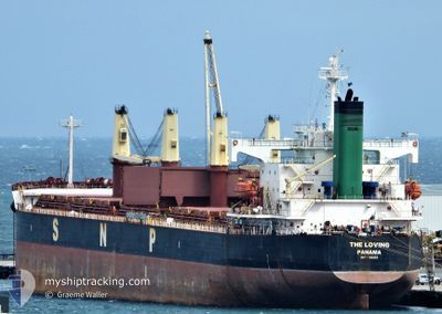
THE LOVING
Bulk Carrier
Current Trip
| Time Travelled | 36 days |
|---|---|
| Remaining Time | 4 days |
| Distance Travelled | 7434.16 морская миля |
| Remaining Distance | 1254.62 морская миля |
| AVG Speed | 12 Узлы |
| MAX Speed | 16 Узлы |
| AVG Wind | 13.5 knots |
| MAX Wind | 33 knots |
| MIN Temp | 16.7°C / 62.06°F |
| MAX Temp | 29.7°C / 85.46°F |
| Осадка | 6.3 м |
| Позиция Получена | 5 d тому назад |
Current Position
| Долгота | -52.10307° |
|---|---|
| Широта | -32.10398° |
| Статус | Moored |
| Скорость | |
| Курс | 2° |
| Район | South Atlantic Ocean |
| Станция | T-AIS |
| Позиция Получена | 5 d тому назад |
Info
Information
The current position of THE LOVING is in South Atlantic Ocean with coordinates -32.10398° / -52.10307° as reported on 2024-05-02 01:38 by AIS to our vessel tracker app. The vessel's current speed is 0 Узлы and is heading at the port of RIO GRANDE. The estimated time of arrival as calculated by MyShipTracking vessel tracking app is 2024-05-12 06:53 LT
The vessel THE LOVING (IMO: 9368883, MMSI: 373468000) is a Bulk Carrier that was built in 2007 ( 17 лет ). It's sailing under the flag of [PA] Panama.
In this page you can find informations about the vessels current position, last detected port calls, and current voyage information. If the vessels is not in coverage by AIS you will find the latest position.
The current position of THE LOVING is detected by our AIS receivers and we are not responsible for the reliability of the data. The last position was recorded while the vessel was in Coverage by the Ais receivers of our vessel tracking app.
The current draught of THE LOVING as reported by AIS is 6.3 meters
Weather
| Temperature | 27.5°C / 81.5°F |
|---|---|
| Wind Speed | 17 knots |
| Direction | 78° ENE |
| Pressure | 1017 hPa |
| Humidity | 74.2 % |
| Cloud Coverage | 2 % |
Featured Company
Last Port Calls
| Port | Arrival | Departure | Time In Port |
|---|---|---|---|
| 2024-03-25 23:54 | 2024-03-31 12:55 | 5 d | |
| 2024-03-12 13:46 | 2024-03-19 11:23 | 6 d |
Most Visited Ports (Last year)
| Port | Arrivals | |
|---|---|---|
| 3 | ||
| 1 | ||
| 1 | ||
| 1 | ||
| 1 | ||
| 1 |
Last Trips
| Origin | Departure | Destination | Arrival | Distance | |
|---|---|---|---|---|---|
| 2024-03-19 14:23 | 2024-03-26 02:54 | 53.22 морская миля | |||
| 2024-01-09 15:49 | 2024-03-12 16:46 | 6195.52 морская миля |
Events
| Время | Событие | Детали | Позиция / Направление | Информация |
|---|---|---|---|---|
| 2024-05-02 21:16 | Начало движения | 5.29 nm, South of RIO GRANDE |
-32.11577 / -52.09953
BR RIG
|
Скорость: 7.4 kn Курс: 178° |
| 2024-05-02 01:47 | Статус изменился | Default Moored |
-32.10399 / -52.10307
BR RIG
|
Скорость: Курс: 2° |
| 2024-05-02 01:38 | Вне покрытия |
-32.10398 / -52.10307
South Atlantic Ocean
|
Скорость: Курс: 13° |
|
| 2024-05-02 00:17 | Статус изменился | Moored Default |
-32.10395 / -52.10307
BR RIG
|
Скорость: Курс: 2° |
| 2024-05-02 00:02 | В покрытии |
-32.10393 / -52.10303
South Atlantic Ocean
|
Скорость: Курс: 13° |
|
| 2024-05-01 22:26 | Статус изменился | Default Moored |
-32.10395 / -52.10310
BR RIG
|
Скорость: Курс: 2° |
| 2024-05-01 22:02 | Вне покрытия |
-32.10395 / -52.10308
South Atlantic Ocean
|
Скорость: Курс: 11° |
|
| 2024-05-01 21:11 | Статус изменился | Moored Default |
-32.10393 / -52.10310
BR RIG
|
Скорость: Курс: 2° |
| 2024-05-01 20:50 | Статус изменился | Default Moored |
-32.10393 / -52.10310
BR RIG
|
Скорость: Курс: 2° |
| 2024-05-01 19:58 | ETA изменился | 2025/04/21 21:00 2024/04/21 21:00 |
-32.10393 / -52.10312
BR RIG
|
Скорость: Курс: 2° |