
SINE A
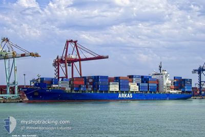
Container Ship
Current Trip
| Time Travelled | 19 days |
|---|---|
| Remaining Time | 10 h, 43 mins |
| Distance Travelled | 5707.02 nm |
| Remaining Distance | 176.07 nm |
| AVG Speed | 12.5 Knop |
| MAX Speed | 19.9 Knop |
| AVG Wind | 12.9 knots |
| MAX Wind | 35.5 knots |
| MIN Temp | 9.7°C / 49.46°F |
| MAX Temp | 20°C / 68°F |
| Djupgående | 11.1 m |
| Position mottagen | 30 m sen |
Current Position
| Longitud | 32.17524° |
|---|---|
| Latitude | 35.90506° |
| Status | Under way using engine |
| Fart | 12.5 Knop |
| Kurs | 87.4° |
| Område | Mediterranean Sea - Eastern Basin |
| Station | T-AIS |
| Position mottagen | 30 m sen |
Info
Information
The current position of SINE A is in Mediterranean Sea - Eastern Basin with coordinates 35.90506° / 32.17524° as reported on 2024-04-27 06:46 by AIS to our vessel tracker app. The vessel's current speed is 12.5 Knop and is heading at the port of MERSIN. The estimated time of arrival as calculated by MyShipTracking vessel tracking app is 2024-04-27 18:00 LT
The vessel SINE A (IMO: 9343089, MMSI: 256318000) is a Container Ship that was built in 2008 ( 16 År gammal ). It's sailing under the flag of [MT] Malta.
In this page you can find informations about the vessels current position, last detected port calls, and current voyage information. If the vessels is not in coverage by AIS you will find the latest position.
The current position of SINE A is detected by our AIS receivers and we are not responsible for the reliability of the data. The last position was recorded while the vessel was in Coverage by the Ais receivers of our vessel tracking app.
The current draught of SINE A as reported by AIS is 11.1 meters
Weather
| Temperature | 19.2°C / 66.56°F |
|---|---|
| Wind Speed | 4 knots |
| Direction | 147° SSE |
| Pressure | 1010.5 hPa |
| Humidity | 81.9 % |
| Cloud Coverage | 100 % |
Featured Company
Last Port Calls
| Port | Arrival | Departure | Time In Port |
|---|---|---|---|
| 2024-04-07 09:24 | 2024-04-08 04:50 | 19 h | |
| 2024-04-05 13:11 | 2024-04-06 00:21 | 11 h | |
| 2024-04-03 09:37 | 2024-04-04 11:32 | 1 d | |
| 2024-03-24 09:10 | 2024-03-24 14:32 | 5 h | |
| 2024-03-17 16:17 | 2024-03-18 07:29 | 15 h | |
| 2024-03-16 06:43 | 2024-03-16 14:19 | 7 h | |
| 2024-03-15 12:26 | 2024-03-16 00:24 | 11 h | |
| 2024-03-14 14:02 | 2024-03-15 06:41 | 16 h | |
| 2024-03-11 10:11 | 2024-03-12 04:36 | 18 h | |
| 2024-02-29 08:03 | 2024-03-01 01:32 | 17 h |
Last Trips
| Origin | Departure | Destination | Arrival | Distance | |
|---|---|---|---|---|---|
| 2024-04-05 20:21 | 2024-04-07 05:24 | 508.76 nm | |||
| 2024-04-04 07:32 | 2024-04-05 09:11 | 284.81 nm | |||
| 2024-03-24 15:32 | 2024-04-03 05:37 | 3550.79 nm | |||
| 2024-03-18 10:29 | 2024-03-24 10:10 | 1691.28 nm | |||
| 2024-03-16 17:19 | 2024-03-17 19:17 | 289.33 nm | |||
| 2024-03-16 03:24 | 2024-03-16 09:43 | 71.46 nm | |||
| 2024-03-15 09:41 | 2024-03-15 15:26 | 58.65 nm | |||
| 2024-03-12 07:36 | 2024-03-14 17:02 | 789.30 nm | |||
| 2024-03-01 04:32 | 2024-03-11 13:11 | 828.98 nm | |||
| 2024-02-28 23:19 | 2024-02-29 11:03 | 6.52 nm |
Events
| Tid | Event | Detaljer | Position / Dest | Information |
|---|---|---|---|---|
| 2024-04-27 06:52 | Status ändrad | Default Under way using engine |
35.90557 / 32.20094
TRMER
|
Fart: 12.5 kn Kurs: 87.4° |
| 2024-04-27 06:43 | Status ändrad | Under way using engine Default |
35.90470 / 32.16027
TRMER
|
Fart: 12.5 kn Kurs: 86° |
| 2024-04-27 06:28 | I täckningsområde |
35.90470 / 32.16027
Mediterranean Sea - Eastern Basin
TRMER
|
Fart: 12.5 kn Kurs: 88.1° |
|
| 2024-04-27 05:28 | Status ändrad | Default Under way using engine |
35.88981 / 31.84560
TRMER
|
Fart: 12.1 kn Kurs: 85.1° |
| 2024-04-27 05:22 | UTANFÖR täckningsområde |
35.88800 / 31.81868
Mediterranean Sea - Eastern Basin
TRMER
|
Fart: 12.1 kn Kurs: 85.1° |
|
| 2024-04-27 05:20 | Status ändrad | Under way using engine Default |
35.88741 / 31.80912
TRMER
|
Fart: 12 kn Kurs: 86° |
| 2024-04-27 05:14 | Status ändrad | Default Under way using engine |
35.88500 / 31.78500
TRMER
|
Fart: 12.2 kn Kurs: 85.6° |
| 2024-04-27 05:12 | Status ändrad | Under way using engine Default |
35.88564 / 31.77491
TRMER
|
Fart: 12.3 kn Kurs: 87° |
| 2024-04-27 05:01 | I täckningsområde |
35.88564 / 31.77491
Mediterranean Sea - Eastern Basin
TRMER
|
Fart: 12.2 kn Kurs: 85.6° |
|
| 2024-04-27 04:05 | UTANFÖR täckningsområde |
35.87547 / 31.49673
Mediterranean Sea - Eastern Basin
TRMER
|
Fart: 12.3 kn Kurs: 85.1° |