
SINE A
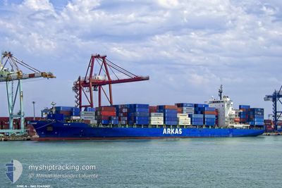
Container Ship
Current Trip
| Time Travelled | 4 days |
|---|---|
| Remaining Time | --- |
| Distance Travelled | 1651.48 nm |
| Remaining Distance | --- |
| AVG Speed | 15.3 Knots |
| MAX Speed | 18.2 Knots |
| AVG Wind | 15.1 knots |
| MAX Wind | 33.8 knots |
| MIN Temp | 15.1°C / 59.18°F |
| MAX Temp | 22.6°C / 72.68°F |
| Draught | 10.6 m |
| Position Received | 4 d ago |
Current Position
| Longitude | --- |
|---|---|
| Latitude | --- |
| Status | Under way using engine |
| Speed | 15.6 Knots |
| Course | 255.5° |
| Area | North Atlantic Ocean |
| Station | T-AIS |
| Position Received | 4 d ago |
Info
Information
The current position of SINE A is in North Atlantic Ocean with coordinates 35.61657° / -7.83593° as reported on 2024-11-24 14:45 by AIS to our vessel tracker app. The vessel's current speed is 15.6 Knots and is heading at the port of NEW YORK. The estimated time of arrival as calculated by MyShipTracking vessel tracking app is 2024-12-04 02:00 LT
The vessel SINE A (IMO: 9343089, MMSI: 256318000) is a Container Ship that was built in 2008 ( 16 years old ). It's sailing under the flag of [MT] Malta.
In this page you can find informations about the vessels current position, last detected port calls, and current voyage information. If the vessels is not in coverage by AIS you will find the latest position.
The current position of SINE A is detected by our AIS receivers and we are not responsible for the reliability of the data. The last position was recorded while the vessel was in Coverage by the Ais receivers of our vessel tracking app.
The current draught of SINE A as reported by AIS is 10.6 meters
Weather
| Temperature | 20.7°C / 69.26°F |
|---|---|
| Wind Speed | 7 knots |
| Direction | 311° NW |
| Pressure | 1017 hPa |
| Humidity | 70.2 % |
| Cloud Coverage | 9 % |
Featured Company
Last Port Calls
| Port | Arrival | Departure | Time In Port |
|---|---|---|---|
| 2024-11-23 14:36 | 2024-11-24 07:28 | 16 h | |
| 2024-11-18 06:25 | 2024-11-18 21:23 | 14 h | |
| 2024-11-16 22:17 | 2024-11-17 11:19 | 13 h | |
| 2024-11-15 15:17 | 2024-11-16 17:04 | 1 d | |
| 2024-11-14 19:48 | 2024-11-15 10:56 | 15 h | |
| 2024-11-11 09:24 | 2024-11-12 05:28 | 20 h | |
| 2024-10-22 18:18 | 2024-10-23 09:55 | 15 h | |
| 2024-10-19 18:03 | 2024-10-20 09:58 | 15 h | |
| 2024-10-17 03:53 | 2024-10-18 20:57 | 1 d | |
| 2024-10-05 01:45 | 2024-10-05 09:41 | 7 h |
Last Trips
| Origin | Departure | Destination | Arrival | Distance | |
|---|---|---|---|---|---|
| 2024-11-18 21:23 | 2024-11-23 14:36 | 1685.70 nm | |||
| 2024-11-17 11:19 | 2024-11-18 06:25 | 284.17 nm | |||
| 2024-11-16 17:04 | 2024-11-16 22:17 | 71.24 nm | |||
| 2024-11-15 10:56 | 2024-11-15 15:17 | 54.01 nm | |||
| 2024-11-12 05:28 | 2024-11-14 19:48 | 799.77 nm | |||
| 2024-10-23 09:55 | 2024-11-11 09:24 | 5942.08 nm | |||
| 2024-10-20 09:58 | 2024-10-22 18:18 | 514.50 nm | |||
| 2024-10-18 20:57 | 2024-10-19 18:03 | 289.43 nm | |||
| 2024-10-05 09:41 | 2024-10-17 03:53 | 3617.78 nm | |||
| 2024-09-30 17:30 | 2024-10-05 01:45 | 1655.60 nm |
Events
| Time | Event | Details | Position / Dest | Info |
|---|---|---|---|---|
| 2024-11-24 14:48 | Status Changed | Default Under way using engine |
35.61307 / -7.85096
USNYC
|
Speed: 15.6 kn Course: 255.5° |
| 2024-11-24 14:45 | OUT of Coverage |
35.61657 / -7.83593
North Atlantic Ocean
USNYC
|
Speed: 15.6 kn Course: 255.5° |
|
| 2024-11-24 14:28 | Change Sea Area | Portuguese part of the North Atlantic Ocean Moroccan part of the North Atlantic Ocean |
35.63544 / -7.75187
North Atlantic Ocean
USNYC
|
Speed: 15.6 kn Course: 257.7° |
| 2024-11-24 12:47 | Status Changed | Under way using engine Default |
35.75271 / -7.22290
USNYC
|
Speed: 15.7 kn Course: 256° |
| 2024-11-24 12:39 | Status Changed | Default Under way using engine |
35.76194 / -7.17987
USNYC
|
Speed: 15.4 kn Course: 254.6° |
| 2024-11-24 11:53 | Status Changed | Under way using engine Default |
35.81099 / -6.94423
USNYC
|
Speed: 15.5 kn Course: 255° |
| 2024-11-24 11:46 | Status Changed | Default Under way using engine |
35.81724 / -6.91035
USNYC
|
Speed: 15.5 kn Course: 256.7° |
| 2024-11-24 11:33 | Detected in Sea | Moroccan part of the North Atlantic Ocean |
35.82966 / -6.84095
North Atlantic Ocean
USNYC
|
Speed: 15.5 kn Course: 257.7° |
| 2024-11-24 11:33 | Status Changed | Under way using engine Default |
35.82966 / -6.84095
USNYC
|
Speed: 15.5 kn Course: 259° |
| 2024-11-24 11:16 | IN Coverage |
35.82966 / -6.84095
North Atlantic Ocean
USNYC
|
Speed: 15.5 kn Course: 257.7° |