
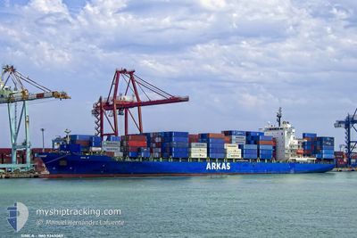
SINE A
Container Ship
Current Trip
| Time Travelled | 1 day |
|---|---|
| Remaining Time | 2 days |
| Distance Travelled | 603.67 nm |
| Remaining Distance | 1228.86 nm |
| AVG Speed | 18.5 Noeuds |
| MAX Speed | 19.7 Noeuds |
| AVG Wind | 8.2 knots |
| MAX Wind | 18 knots |
| MIN Temp | 5.3°C / 41.54°F |
| MAX Temp | 15.7°C / 60.26°F |
| Tirant d eau | 9.3 m |
| Position reçue | 1 d depuis |
Current Position
| Longitude | --- |
|---|---|
| Latitude | --- |
| Etat | Under way using engine |
| Vitesse | 18.7 Noeuds |
| Parcours | 212.5° |
| Zone | Aegean Sea |
| Station | T-AIS |
| Position reçue | 1 d depuis |
Info
Information
The current position of SINE A is in Aegean Sea with coordinates 36.83545° / 23.54296° as reported on 2025-02-25 18:56 by AIS to our vessel tracker app. The vessel's current speed is 18.7 Noeuds and is heading at the port of ALGECIRAS. The estimated time of arrival as calculated by MyShipTracking vessel tracking app is 2025-03-01 01:31 LT
The vessel SINE A (IMO: 9343089, MMSI: 256318000) is a Container Ship that was built in 2008 ( 17 Age ). It's sailing under the flag of [MT] Malta.
In this page you can find informations about the vessels current position, last detected port calls, and current voyage information. If the vessels is not in coverage by AIS you will find the latest position.
The current position of SINE A is detected by our AIS receivers and we are not responsible for the reliability of the data. The last position was recorded while the vessel was in Coverage by the Ais receivers of our vessel tracking app.
The current draught of SINE A as reported by AIS is 9.3 meters
Weather
| Temperature | 14.9°C / 58.82°F |
|---|---|
| Wind Speed | 11 knots |
| Direction | 260° W |
| Pressure | 1017.7 hPa |
| Humidity | 81.2 % |
| Cloud Coverage | 100 % |
Featured Company
Last Port Calls
| Port | Arrival | Departure | Time In Port |
|---|---|---|---|
| 2025-02-25 01:24 | 2025-02-25 10:25 | 9 h | |
| 2025-02-23 12:49 | 2025-02-23 19:58 | 7 h | |
| 2025-02-22 20:21 | 2025-02-23 06:38 | 10 h | |
| 2025-02-21 07:00 | 2025-02-22 04:14 | 21 h | |
| 2025-02-17 10:03 | 2025-02-19 06:57 | 1 d | |
| 2025-01-31 16:43 | 2025-02-01 20:11 | 1 d | |
| 2025-01-25 04:20 | 2025-01-25 14:00 | 9 h | |
| 2025-01-22 10:18 | 2025-01-23 09:24 | 23 h | |
| 2025-01-13 06:32 | 2025-01-13 12:42 | 6 h | |
| 2025-01-06 16:46 | 2025-01-07 04:33 | 11 h |
Last Trips
| Origin | Departure | Destination | Arrival | Distance | |
|---|---|---|---|---|---|
| 2025-02-23 19:58 | 2025-02-25 01:24 | 282.68 nm | |||
| 2025-02-23 06:38 | 2025-02-23 12:49 | 72.29 nm | |||
| 2025-02-22 04:14 | 2025-02-22 20:21 | 91.43 nm | |||
| 2025-02-19 06:57 | 2025-02-21 07:00 | 790.35 nm | |||
| 2025-02-01 20:11 | 2025-02-17 10:03 | 5969.32 nm | |||
| 2025-01-25 14:00 | 2025-01-31 16:43 | 515.95 nm | |||
| 2025-01-23 09:24 | 2025-01-25 04:20 | 292.78 nm | |||
| 2025-01-13 12:42 | 2025-01-22 10:18 | 3649.11 nm | |||
| 2025-01-07 04:33 | 2025-01-13 06:32 | 1705.46 nm | |||
| 2025-01-05 06:53 | 2025-01-06 16:46 | 294.70 nm |
Events
| Heure | Evenement | Détails | Position/ Destination | Info |
|---|---|---|---|---|
| 2025-02-25 18:59 | Etat Changé | Default Under way using engine |
36.82222 / 23.53234
ESALG
|
Vitesse: 18.7 kn Parcours: 212.5° |
| 2025-02-25 18:56 | Hors de la zone couverte |
36.83545 / 23.54296
Aegean Sea
ESALG
|
Vitesse: 18.7 kn Parcours: 212.5° |
|
| 2025-02-25 18:48 | Etat Changé | Under way using engine Default |
36.87098 / 23.57022
ESALG
|
Vitesse: 19.2 kn Parcours: 211° |
| 2025-02-25 18:22 | Etat Changé | Default Under way using engine |
36.98757 / 23.65729
ESALG
|
Vitesse: 19.1 kn Parcours: 210.5° |
| 2025-02-25 17:40 | Etat Changé | Under way using engine Default |
37.17906 / 23.80242
ESALG
|
Vitesse: 18.7 kn Parcours: 213° |
| 2025-02-25 17:34 | Etat Changé | Default Under way using engine |
37.20780 / 23.82486
ESALG
|
Vitesse: 18.9 kn Parcours: 211.5° |
| 2025-02-25 14:30 | Etat Changé | Under way using engine Default |
37.94639 / 24.56894
ESALG
|
Vitesse: 19 kn Parcours: 213° |
| 2025-02-25 14:30 | Dans la zone couverte |
37.93962 / 24.56345
Aegean Sea
ESALG
|
Vitesse: 19.2 kn Parcours: 212.9° |
|
| 2025-02-25 09:48 | Etat Changé | Default Under way using engine |
38.76350 / 26.02680
ESALG
|
Vitesse: 19.5 kn Parcours: 270.7° |
| 2025-02-25 09:42 | Hors de la zone couverte |
38.76317 / 26.06757
Aegean Sea
ESALG
|
Vitesse: 19.5 kn Parcours: 270.7° |