
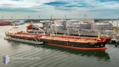
SIMOON
Oil Products Tanker
Current Trip
| Time Travelled | 3 days |
|---|---|
| Remaining Time | --- |
| Distance Travelled | 370.24 nm |
| Remaining Distance | --- |
| AVG Speed | 10.4 Knop |
| MAX Speed | 12.5 Knop |
| AVG Wind | 12.9 knots |
| MAX Wind | 20.7 knots |
| MIN Temp | 17.2°C / 62.96°F |
| MAX Temp | 19.7°C / 67.46°F |
| Djupgående | 13 m |
| Position mottagen | 3 d sen |
Current Position
| Longitud | 120.61244° |
|---|---|
| Latitude | 35.02355° |
| Status | Under way using engine |
| Fart | 10.9 Knop |
| Kurs | 90.8° |
| Område | Yellow Sea |
| Station | T-AIS |
| Position mottagen | 3 d sen |
Info
Information
The current position of SIMOON is in Yellow Sea with coordinates 35.02355° / 120.61244° as reported on 2024-05-25 10:07 by AIS to our vessel tracker app. The vessel's current speed is 10.9 Knop
The vessel SIMOON (IMO: 9274525, MMSI: 352002251) is a Oil Products Tanker that was built in 2004 ( 20 År gammal ). It's sailing under the flag of [PA] Panama.
In this page you can find informations about the vessels current position, last detected port calls, and current voyage information. If the vessels is not in coverage by AIS you will find the latest position.
The current position of SIMOON is detected by our AIS receivers and we are not responsible for the reliability of the data. The last position was recorded while the vessel was in Coverage by the Ais receivers of our vessel tracking app.
The current draught of SIMOON as reported by AIS is 13 meters
Weather
| Temperature | 18.8°C / 65.84°F |
|---|---|
| Wind Speed | 7 knots |
| Direction | 97° E |
| Pressure | 1013.7 hPa |
| Humidity | 74.2 % |
| Cloud Coverage | 100 % |
Featured Company
Last Port Calls
| Port | Arrival | Departure | Time In Port |
|---|---|---|---|
| 2024-05-22 02:52 | 2024-05-25 04:12 | 3 d | |
| 2024-03-27 05:51 | 2024-03-27 15:21 | 9 h | |
| 2024-03-07 23:08 | 2024-03-09 08:36 | 1 d |
Most Visited Ports (Last year)
| Port | Arrivals | |
|---|---|---|
| 4 | ||
| 2 | ||
| 2 | ||
| 2 | ||
| 1 | ||
| 1 |
Last Trips
| Origin | Departure | Destination | Arrival | Distance | |
|---|---|---|---|---|---|
| 2024-03-09 11:36 | 2024-05-22 10:52 | 8663.15 nm | |||
| 2024-03-09 11:36 | 2024-03-27 07:51 | 4783.76 nm | |||
| 2024-01-31 22:57 | 2024-03-08 02:08 | 1663.03 nm |
Events
| Tid | Event | Detaljer | Position / Dest | Information |
|---|---|---|---|---|
| 2024-05-28 20:04 | STOPPAR förflyttning |
33.31297 / 123.84214
CN RZH
|
Fart: Kurs: 287° |
|
| 2024-05-28 13:20 | STARTAR förflyttning |
33.07501 / 123.88896
CN RZH
|
Fart: 5.6 kn Kurs: 9° |
|
| 2024-05-28 03:51 | STOPPAR förflyttning |
33.27670 / 123.86485
CN RZH
|
Fart: Kurs: 250° |
|
| 2024-05-27 22:04 | STARTAR förflyttning |
33.34772 / 123.51479
CN RZH
|
Fart: 5.4 kn Kurs: 69° |
|
| 2024-05-26 05:11 | STOPPAR förflyttning |
33.46052 / 123.73796
CN RZH
|
Fart: Kurs: 332° |
|
| 2024-05-25 10:11 | Status ändrad | Default Under way using engine |
35.02327 / 120.62796
CN RZH
|
Fart: 10.9 kn Kurs: 90.8° |
| 2024-05-25 10:07 | UTANFÖR täckningsområde |
35.02355 / 120.61244
Yellow Sea
|
Fart: 10.9 kn Kurs: 90.8° |
|
| 2024-05-25 09:53 | Status ändrad | Under way using engine Default |
35.02377 / 120.56088
CN RZH
|
Fart: 10.8 kn Kurs: 84° |
| 2024-05-25 09:53 | I täckningsområde |
35.02422 / 120.56946
Yellow Sea
|
Fart: 10.8 kn Kurs: 88.8° |
|
| 2024-05-25 04:12 | AVGÅTT HAMN |
|
35.09798 / 119.42640
CN RZH
|
Fart: 4.7 kn Kurs: 114° |