
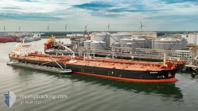
SIMOON
Oil Products Tanker
Current Trip
| Time Travelled | --- |
|---|---|
| Remaining Time | --- |
| Distance Travelled | 6379.28 nm |
| Remaining Distance | --- |
| AVG Speed | 10.3 Knots |
| MAX Speed | 15.3 Knots |
| AVG Wind | 8.5 knots |
| MAX Wind | 20.9 knots |
| MIN Temp | 24.6°C / 76.28°F |
| MAX Temp | 33.7°C / 92.66°F |
| Dybgang | 13 m |
| Position Modtaget | 23 h, 28 m siden |
Current Position
| Longitude | 104.38655° |
|---|---|
| Latitude | 1.32702° |
| Status | Under way using engine |
| Fart | 15.3 Knots |
| Kurs | 44.7° |
| Område | South China Sea |
| Station | T-AIS |
| Position Modtaget | 23 h, 28 m siden |
Info
Information
The current position of SIMOON is in South China Sea with coordinates 1.32702° / 104.38655° as reported on 2024-05-12 22:01 by AIS to our vessel tracker app. The vessel's current speed is 15.3 Knots and is heading at the port of RIZHAO. The estimated time of arrival as calculated by MyShipTracking vessel tracking app is 2024-05-22 18:00 LT
The vessel SIMOON (IMO: 9274525, MMSI: 352002251) is a Oil Products Tanker that was built in 2004 ( 20 år gamle ). It's sailing under the flag of [PA] Panama.
In this page you can find informations about the vessels current position, last detected port calls, and current voyage information. If the vessels is not in coverage by AIS you will find the latest position.
The current position of SIMOON is detected by our AIS receivers and we are not responsible for the reliability of the data. The last position was recorded while the vessel was in Coverage by the Ais receivers of our vessel tracking app.
The current draught of SIMOON as reported by AIS is 13 meters
Weather
| Temperature | 29.4°C / 84.92°F |
|---|---|
| Wind Speed | 7 knots |
| Direction | 60° ENE |
| Pressure | 1007.5 hPa |
| Humidity | 73.9 % |
| Cloud Coverage | 100 % |
Featured Company
Last Port Calls
| Port | Arrival | Departure | Time In Port |
|---|---|---|---|
| 2024-03-27 05:51 | 2024-03-27 15:21 | 9 h | |
| 2024-03-07 23:08 | 2024-03-09 08:36 | 1 d |
Most Visited Ports (Last year)
| Port | Arrivals | |
|---|---|---|
| 4 | ||
| 2 | ||
| 2 | ||
| 2 | ||
| 1 | ||
| 1 |
Last Trips
| Origin | Departure | Destination | Arrival | Distance | |
|---|---|---|---|---|---|
| 2024-03-09 11:36 | 2024-03-27 07:51 | 4783.76 nm | |||
| 2024-01-31 22:57 | 2024-03-08 02:08 | 1663.03 nm |
Events
| Tid | Hændelsen | Detaljer | Position / Dest | Info |
|---|---|---|---|---|
| 2024-05-12 22:09 | Status er ændret | Default Under way using engine |
1.34982 / 104.40938
CN RZH
|
Fart: 15.3 kn Kurs: 44.7° |
| 2024-05-12 22:01 | Udenfor Dækning |
1.32702 / 104.38655
South China Sea
CN RZH
|
Fart: 15.3 kn Kurs: 44.7° |
|
| 2024-05-12 21:56 | Ændre havområde | Malaysian part of the South China Sea Malaysian part of the Singapore Strait |
1.31112 / 104.37167
South China Sea
CN RZH
|
Fart: 15 kn Kurs: 42.2° |
| 2024-05-12 21:50 | Ændre havområde | Malaysian part of the Singapore Strait Indonesian part of the Singapore Strait |
1.29317 / 104.35578
Singapore Strait
CN RZH
|
Fart: 14.2 kn Kurs: 42.5° |
| 2024-05-12 21:44 | Ændre havområde | Indonesian part of the Singapore Strait Malaysian part of the Singapore Strait |
1.27968 / 104.33551
Singapore Strait
CN RZH
|
Fart: 14.1 kn Kurs: 77.6° |
| 2024-05-12 20:47 | Ændre havområde | Malaysian part of the Singapore Strait Indonesian part of the Singapore Strait |
1.25826 / 104.21343
Singapore Strait
CN RZH
|
Fart: 5.2 kn Kurs: 80.2° |
| 2024-05-12 16:11 | Destination er ændret | CN RZH INMUN |
1.06740 / 103.69430
CN RZH
|
Fart: 11.5 kn Kurs: 60.6° |
| 2024-05-12 16:11 | ETA er ændret | 2024/05/22 18:00 2024/04/09 21:30 |
1.06740 / 103.69430
CN RZH
|
Fart: 11.5 kn Kurs: 60.6° |
| 2024-05-12 16:11 | Dybgangen er ændret | 13 13.2 |
1.06740 / 103.69430
CN RZH
|
Fart: 11.5 kn Kurs: 60.6° |
| 2024-05-12 14:28 | Ændre havområde | Indonesian part of the Singapore Strait Indonesian part of the Malacca Strait |
1.17579 / 103.41992
Singapore Strait
|
Fart: 10.9 kn Kurs: 118.8° |