
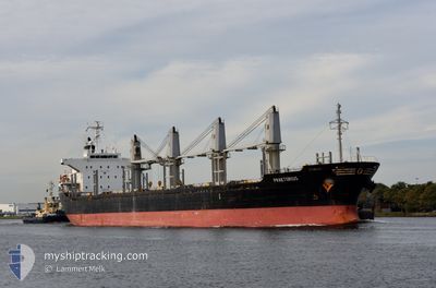
PRAETORIUS
Bulk Carrier
Current Trip
| Time Travelled | 17 days |
|---|---|
| Remaining Time | 22 h, 49 mins |
| Distance Travelled | 4760.32 nm |
| Remaining Distance | 473.83 nm |
| AVG Speed | 12.4 Knop |
| MAX Speed | 15.4 Knop |
| AVG Wind | 11.4 knots |
| MAX Wind | 22 knots |
| MIN Temp | 10.5°C / 50.9°F |
| MAX Temp | 29°C / 84.2°F |
| Djupgående | 9.2 m |
| Position mottagen | 20 h, 52 m sen |
Current Position
| Longitud | -61.15371° |
|---|---|
| Latitude | 13.57166° |
| Status | Under way using engine |
| Fart | 14.7 Knop |
| Kurs | 302.9° |
| Område | Caribbean Sea |
| Station | T-AIS |
| Position mottagen | 20 h, 52 m sen |
Info
Information
The current position of PRAETORIUS is in Caribbean Sea with coordinates 13.57166° / -61.15371° as reported on 2024-05-18 09:56 by AIS to our vessel tracker app. The vessel's current speed is 14.7 Knop and is heading at the port of RIO HAINA. The estimated time of arrival as calculated by MyShipTracking vessel tracking app is 2024-05-20 01:37 LT
The vessel PRAETORIUS (IMO: 9470856, MMSI: 538008454) is a Bulk Carrier that was built in 2008 ( 16 År gammal ). It's sailing under the flag of [MH] Marshall Is.
In this page you can find informations about the vessels current position, last detected port calls, and current voyage information. If the vessels is not in coverage by AIS you will find the latest position.
The current position of PRAETORIUS is detected by our AIS receivers and we are not responsible for the reliability of the data. The last position was recorded while the vessel was in Coverage by the Ais receivers of our vessel tracking app.
The current draught of PRAETORIUS as reported by AIS is 9.2 meters
Weather
| Temperature | 28.5°C / 83.3°F |
|---|---|
| Wind Speed | 12 knots |
| Direction | 94° E |
| Pressure | 1013.9 hPa |
| Humidity | 79.4 % |
| Cloud Coverage | 36 % |
Featured Company
Last Port Calls
| Port | Arrival | Departure | Time In Port |
|---|---|---|---|
| 2024-04-24 03:33 | 2024-05-01 06:33 | 7 d | |
| 2024-04-16 09:30 | 2024-04-16 09:45 | 15 m | |
| 2024-04-10 09:14 | 2024-04-15 02:46 | 4 d | |
| 2024-03-13 10:38 | 2024-03-15 15:24 | 2 d | |
| 2024-03-12 15:48 | 2024-03-13 10:36 | 18 h | |
| 2024-03-01 21:33 | 2024-03-09 12:18 | 7 d |
Most Visited Ports (Last year)
| Port | Arrivals | |
|---|---|---|
| 5 | ||
| 2 | ||
| 1 | ||
| 1 | ||
| 1 | ||
| 1 |
Last Trips
| Origin | Departure | Destination | Arrival | Distance | |
|---|---|---|---|---|---|
| 2024-04-16 09:45 | 2024-04-24 03:33 | 818.00 nm | |||
| 2024-04-15 02:46 | 2024-04-16 09:30 | 156.91 nm | |||
| 2024-03-15 15:24 | 2024-04-10 09:14 | 6944.37 nm | |||
| 2024-03-13 10:36 | 2024-03-13 10:38 | --- | |||
| 2024-03-09 12:18 | 2024-03-12 15:48 | 916.65 nm | |||
| 2024-02-16 14:29 | 2024-03-01 21:33 | 3281.39 nm |
Events
| Tid | Event | Detaljer | Position / Dest | Information |
|---|---|---|---|---|
| 2024-05-18 10:03 | Status ändrad | Default Under way using engine |
13.58815 / -61.17897
DOHAI
|
Fart: 14.7 kn Kurs: 302.9° |
| 2024-05-18 09:56 | Status ändrad | Under way using engine Default |
13.57166 / -61.15371
DOHAI
|
Fart: 14.8 kn Kurs: 304° |
| 2024-05-18 09:56 | UTANFÖR täckningsområde |
13.57166 / -61.15371
Caribbean Sea
DOHAI
|
Fart: 14.7 kn Kurs: 302.9° |
|
| 2024-05-18 09:38 | Status ändrad | Default Under way using engine |
13.53227 / -61.09402
DOHAI
|
Fart: 14.7 kn Kurs: 303.9° |
| 2024-05-18 09:34 | Byter havsområde | Saint Vincent and the Grenadines part of the Caribbean Sea Brazilian part of the South Atlantic Ocean |
13.52145 / -61.07761
Caribbean Sea
DOHAI
|
Fart: 14.7 kn Kurs: 303.9° |
| 2024-05-18 09:34 | Status ändrad | Under way using engine Default |
13.52145 / -61.07761
DOHAI
|
Fart: 14.6 kn Kurs: 304° |
| 2024-05-18 09:18 | I täckningsområde |
13.52145 / -61.07761
Caribbean Sea
DOHAI
|
Fart: 14.7 kn Kurs: 303.9° |