

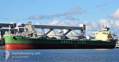
PEAK HAKU
Cargo

Current Trip
| Time Travelled | 41 days |
|---|---|
| Remaining Time | --- |
| Distance Travelled | 8449.42 nm |
| Remaining Distance | --- |
| AVG Speed | 11.5 Knop |
| MAX Speed | 15.8 Knop |
| AVG Wind | 11 knots |
| MAX Wind | 27.8 knots |
| MIN Temp | 17.1°C / 62.78°F |
| MAX Temp | 29.1°C / 84.38°F |
| Djupgående | 7.7 m |
| Position mottagen | 2 d sen |
Current Position
| Longitud | --- |
|---|---|
| Latitude | --- |
| Status | At anchor |
| Fart | |
| Kurs | 129° |
| Område | South Atlantic Ocean |
| Station | T-AIS |
| Position mottagen | 2 d sen |
Information
The current position of PEAK HAKU is in South Atlantic Ocean with coordinates -25.67667° / -48.33633° as reported on 2025-03-25 19:58 by AIS to our vessel tracker app. The vessel's current speed is 0 Knop
The vessel PEAK HAKU (IMO: 9888467, MMSI: 636019190) is a Cargo It's sailing under the flag of [LR] Liberia.
In this page you can find informations about the vessels current position, last detected port calls, and current voyage information. If the vessels is not in coverage by AIS you will find the latest position.
The current position of PEAK HAKU is detected by our AIS receivers and we are not responsible for the reliability of the data. The last position was recorded while the vessel was in Coverage by the Ais receivers of our vessel tracking app.
The current draught of PEAK HAKU as reported by AIS is 7.7 meters
Weather
| Temperature | 25.7°C / 78.26°F |
|---|---|
| Wind Speed | 7 knots |
| Direction | 58° ENE |
| Pressure | 1014.5 hPa |
| Humidity | 78.5 % |
| Cloud Coverage | 53 % |


Featured Company
Last Port Calls
| Port | Arrival | Departure | Time In Port |
|---|---|---|---|
| 2025-02-12 21:11 | 2025-02-15 05:19 | 2 d |
Most Visited Ports (Last year)
| Port | Arrivals | |
|---|---|---|
| 2 | ||
| 2 | ||
| 1 | ||
| 1 | ||
| 1 | ||
| 1 |
Last Trips
| Origin | Departure | Destination | Arrival | Distance | |
|---|---|---|---|---|---|
| 2024-12-20 07:00 | 2025-02-12 21:11 | 6707.06 nm |
Events
| Tid | Event | Detaljer | Position / Dest | Information |
|---|---|---|---|---|
| 2025-03-25 20:07 | Status ändrad | Default At anchor |
-25.67672 / -48.33637
INKRI>>BRPNG
|
Fart: Kurs: 129° |
| 2025-03-25 19:58 | UTANFÖR täckningsområde |
-25.67667 / -48.33633
South Atlantic Ocean
|
Fart: Kurs: 202.9° |
|
| 2025-03-25 19:43 | Status ändrad | At anchor Default |
-25.67659 / -48.33626
INKRI>>BRPNG
|
Fart: Kurs: 127° |
| 2025-03-25 19:31 | I täckningsområde |
-25.67659 / -48.33626
South Atlantic Ocean
|
Fart: Kurs: 202.9° |
|
| 2025-03-25 02:37 | Status ändrad | Default At anchor |
-25.67835 / -48.33702
INKRI>>BRPNG
|
Fart: Kurs: 85° |
| 2025-03-25 02:31 | Status ändrad | At anchor Default |
-25.67844 / -48.33710
INKRI>>BRPNG
|
Fart: Kurs: 82° |
| 2025-03-25 02:31 | UTANFÖR täckningsområde |
-25.67844 / -48.33710
South Atlantic Ocean
|
Fart: Kurs: 159° |
|
| 2025-03-25 02:13 | Status ändrad | Default At anchor |
-25.67842 / -48.33714
INKRI>>BRPNG
|
Fart: 0.1 kn Kurs: 91° |
| 2025-03-25 02:10 | Status ändrad | At anchor Default |
-25.67832 / -48.33711
INKRI>>BRPNG
|
Fart: Kurs: 98° |
| 2025-03-25 01:43 | Status ändrad | Default At anchor |
-25.67836 / -48.33704
INKRI>>BRPNG
|
Fart: Kurs: 87° |