
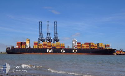
MSC RUBY
Container Ship
Current Trip
| Time Travelled | 12 h, 34 mins |
|---|---|
| Remaining Time | -1 mins |
| Distance Travelled | 154.62 nm |
| Remaining Distance | 6.56 nm |
| AVG Speed | 11.7 Knop |
| MAX Speed | 15.3 Knop |
| AVG Wind | 5.4 knots |
| MAX Wind | 12.8 knots |
| MIN Temp | 4.5°C / 40.1°F |
| MAX Temp | 7.8°C / 46.04°F |
| Djupgående | 14.3 m |
| Position mottagen | 1 m sen |
Current Position
| Longitud | --- |
|---|---|
| Latitude | --- |
| Status | Under way using engine |
| Fart | 0.8 Knop |
| Kurs | 107° |
| Område | The Coastal Waters of Southeast Alaska and British Columbia |
| Station | T-AIS |
| Position mottagen | 1 m sen |
Info
Information
The current position of MSC RUBY is in The Coastal Waters of Southeast Alaska and British Columbia with coordinates 49.30161° / -123.22866° as reported on 2025-12-25 11:42 by AIS to our vessel tracker app. The vessel's current speed is 0.8 Knop and is heading at the port of VANCOUVER. The estimated time of arrival as calculated by MyShipTracking vessel tracking app is 2025-12-25 11:43 LT
The vessel MSC RUBY (IMO: 9502960, MMSI: 636024999) is a Container Ship that was built in 2013 ( 12 År gammal ). It's sailing under the flag of [LR] Liberia.
In this page you can find informations about the vessels current position, last detected port calls, and current voyage information. If the vessels is not in coverage by AIS you will find the latest position.
The current position of MSC RUBY is detected by our AIS receivers and we are not responsible for the reliability of the data. The last position was recorded while the vessel was in Coverage by the Ais receivers of our vessel tracking app.
The current draught of MSC RUBY as reported by AIS is 14.3 meters
Weather
| Temperature | 4.7°C / 40.46°F |
|---|---|
| Wind Speed | 7 knots |
| Direction | 343° NNW |
| Pressure | 1005.4 hPa |
| Humidity | 74.7 % |
| Cloud Coverage | 85 % |
Featured Company
Last Port Calls
| Port | Arrival | Departure | Time In Port |
|---|---|---|---|
| 2025-12-20 21:02 | 2025-12-24 23:10 | 4 d | |
| 2025-10-17 06:17 | 2025-10-20 08:55 | 3 d | |
| 2025-10-17 05:20 | 2025-10-17 05:45 | 24 m | |
| 2025-10-12 06:14 | 2025-10-15 15:44 | 3 d | |
| 2025-10-08 22:34 | 2025-10-11 15:18 | 2 d |
Most Visited Ports (Last year)
| Port | Arrivals | |
|---|---|---|
| 2 | ||
| 2 | ||
| 2 | ||
| 1 | ||
| 1 | ||
| 1 |
Last Trips
| Origin | Departure | Destination | Arrival | Distance | |
|---|---|---|---|---|---|
| 2025-10-20 01:55 | 2025-12-20 13:02 | 5969.70 nm | |||
| 2025-10-16 22:45 | 2025-10-16 23:17 | 0.96 nm | |||
| 2025-10-15 08:44 | 2025-10-16 22:20 | 590.06 nm | |||
| 2025-10-11 08:18 | 2025-10-11 23:14 | 165.21 nm | |||
| 2025-08-06 21:17 | 2025-10-08 15:34 | 6167.64 nm |
Events
| Tid | Event | Detaljer | Position / Dest | Information |
|---|---|---|---|---|
| 2025-12-25 09:46 | Byter havsområde | Canadian part of the The Coastal Waters of Southeast Alaska and British Columbia United States part of the The Coastal Waters of Southeast Alaska and British Columbia |
49.00083 / -123.23946
The Coastal Waters of Southeast Alaska and British Columbia
CAVAN
|
Fart: 13.6 kn Kurs: 314.3° |
| 2025-12-25 08:49 | Byter havsområde | United States part of the The Coastal Waters of Southeast Alaska and British Columbia Canadian part of the The Coastal Waters of Southeast Alaska and British Columbia |
48.83680 / -123.02161
The Coastal Waters of Southeast Alaska and British Columbia
CAVAN
|
Fart: 12.9 kn Kurs: 330.2° |
| 2025-12-25 08:01 | Byter havsområde | Canadian part of the The Coastal Waters of Southeast Alaska and British Columbia United States part of the The Coastal Waters of Southeast Alaska and British Columbia |
48.72523 / -123.15422
The Coastal Waters of Southeast Alaska and British Columbia
CAVAN
|
Fart: 12.5 kn Kurs: 64.7° |
| 2025-12-25 06:31 | Byter havsområde | United States part of the The Coastal Waters of Southeast Alaska and British Columbia Canadian part of the The Coastal Waters of Southeast Alaska and British Columbia |
48.46297 / -123.16499
The Coastal Waters of Southeast Alaska and British Columbia
CAVAN
|
Fart: 11.8 kn Kurs: 346.9° |
| 2025-12-25 04:45 | Byter havsområde | Canadian part of the The Coastal Waters of Southeast Alaska and British Columbia United States part of the The Coastal Waters of Southeast Alaska and British Columbia |
48.25811 / -123.44173
The Coastal Waters of Southeast Alaska and British Columbia
CAVAN
|
Fart: 9.3 kn Kurs: 3.4° |
| 2025-12-25 02:47 | Destination ändrad | CAVAN CAVANANGELES |
48.20490 / -122.99699
CAVAN
|
Fart: 14.5 kn Kurs: 274.4° |
| 2025-12-25 02:27 | Destination ändrad | CAVANANGELES CAVAN |
48.19769 / -122.87934
CAVANANGELES
|
Fart: 14.4 kn Kurs: 275.3° |
| 2025-12-25 01:41 | Destination ändrad | CAVAN CAVANAN |
48.11578 / -122.65638
CAVAN
|
Fart: 12.6 kn Kurs: 321.2° |
| 2025-12-25 00:55 | Destination ändrad | CAVANAN CAVAN |
47.95751 / -122.55698
CAVANAN
|
Fart: 13.9 kn Kurs: 303.5° |
| 2025-12-24 23:10 | AVGÅTT HAMN |
|
47.61226 / -122.39208
CAVAN
|
Fart: 10.8 kn Kurs: 299° |