
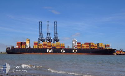
MSC RUBY
Container Ship
Current Trip
| Time Travelled | 4 days |
|---|---|
| Remaining Time | 2 days |
| Distance Travelled | 82.12 nm |
| Remaining Distance | 1396.55 nm |
| AVG Speed | 11.1 Knots |
| MAX Speed | 14.3 Knots |
| AVG Wind | 7.5 knots |
| MAX Wind | 19 knots |
| MIN Temp | 17.2°C / 62.96°F |
| MAX Temp | 22.9°C / 73.22°F |
| Dybgang | 15.5 m |
| Position Modtaget | 2 d siden |
Current Position
| Longitude | --- |
|---|---|
| Latitude | --- |
| Status | Under way using engine |
| Fart | 13.2 Knots |
| Kurs | 168.8° |
| Område | South China Sea |
| Station | T-AIS |
| Position Modtaget | 2 d siden |
Info
Information
The current position of MSC RUBY is in South China Sea with coordinates 22.25153° / 113.81226° as reported on 2026-02-18 16:35 by AIS to our vessel tracker app. The vessel's current speed is 13.2 Knots and is heading at the port of SINGAPORE. The estimated time of arrival as calculated by MyShipTracking vessel tracking app is 2026-02-23 21:03 LT
The vessel MSC RUBY (IMO: 9502960, MMSI: 636024999) is a Container Ship that was built in 2013 ( 13 år gamle ). It's sailing under the flag of [LR] Liberia.
In this page you can find informations about the vessels current position, last detected port calls, and current voyage information. If the vessels is not in coverage by AIS you will find the latest position.
The current position of MSC RUBY is detected by our AIS receivers and we are not responsible for the reliability of the data. The last position was recorded while the vessel was in Coverage by the Ais receivers of our vessel tracking app.
The current draught of MSC RUBY as reported by AIS is 15.5 meters
Weather
| Temperature | 19°C / 66.2°F |
|---|---|
| Wind Speed | 19 knots |
| Direction | 96° E |
| Pressure | 1022.3 hPa |
| Humidity | 79.7 % |
| Cloud Coverage | 2 % |
Featured Company
Last Port Calls
| Port | Arrival | Departure | Time In Port |
|---|---|---|---|
| 2026-02-15 18:25 | 2026-02-16 11:20 | 16 h | |
| 2026-01-05 23:01 | 2026-01-07 17:30 | 1 d | |
| 2026-01-05 22:08 | 2026-01-05 22:31 | 22 m | |
| 2025-12-27 21:20 | 2025-12-31 09:38 | 3 d | |
| 2025-12-20 13:02 | 2025-12-24 15:10 | 4 d |
Most Visited Ports (Last year)
| Port | Arrivals | |
|---|---|---|
| 4 | ||
| 2 | ||
| 2 | ||
| 2 | ||
| 1 | ||
| 1 |
Last Trips
| Origin | Departure | Destination | Arrival | Distance | |
|---|---|---|---|---|---|
| 2026-01-07 17:30 | 2026-02-15 18:25 | 5345.47 nm | |||
| 2026-01-05 22:31 | 2026-01-05 23:01 | 0.88 nm | |||
| 2025-12-31 09:38 | 2026-01-05 22:08 | 697.68 nm | |||
| 2025-12-24 15:10 | 2025-12-27 21:20 | 186.82 nm | |||
| 2025-10-20 01:55 | 2025-12-20 13:02 | 5969.70 nm |
Events
| Tid | Hændelsen | Detaljer | Position / Dest | Info |
|---|---|---|---|---|
| 2026-02-18 16:35 | Udenfor Dækning |
22.25153 / 113.81226
South China Sea
SINGAPORE
|
Fart: 13.2 kn Kurs: 168.8° |
|
| 2026-02-18 15:22 | START Sejllads | --- |
22.45820 / 113.87519
SINGAPORE
|
Fart: 3.1 kn Kurs: 179° |
| 2026-02-18 14:59 | Status er ændret | Under way using engine Moored |
22.46251 / 113.87731
SINGAPORE
|
Fart: Kurs: 153° |
| 2026-02-18 14:14 | Dybgangen er ændret | 15.5 14.7 |
22.46268 / 113.87746
SINGAPORE
|
Fart: Kurs: 154° |
| 2026-02-18 13:17 | ETA er ændret | 2026/02/22 11:30 2026/02/22 00:30 |
22.46262 / 113.87742
SINGAPORE
|
Fart: Kurs: 154° |
| 2026-02-18 07:23 | ETA er ændret | 2026/02/22 00:30 2026/02/17 22:00 |
22.46260 / 113.87739
SINGAPORE
|
Fart: Kurs: 154° |
| 2026-02-18 07:17 | Destination er ændret | SINGAPORE SHEKOU |
22.46253 / 113.87746
SINGAPORE
|
Fart: Kurs: 154° |
| 2026-02-18 01:00 | Status er ændret | Moored Under way using engine |
22.46257 / 113.87739
SHEKOU
|
Fart: 0.1 kn Kurs: 154° |
| 2026-02-18 00:48 | STOP Sejllads | --- |
22.46251 / 113.87629
SHEKOU
|
Fart: 0.3 kn Kurs: 148° |
| 2026-02-17 22:28 | Dybgangen er ændret | 14.7 15 |
22.29374 / 114.10118
SHEKOU
|
Fart: 13.8 kn Kurs: 338.4° |