
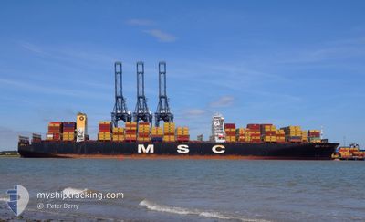
MSC RUBY
Container Ship
Current Trip
| Time Travelled | 12 h, 40 mins |
|---|---|
| Remaining Time | --- |
| Distance Travelled | 29.39 nm |
| Remaining Distance | --- |
| AVG Speed | 12.3 Knoten |
| MAX Speed | 14.3 Knoten |
| AVG Wind | 4.1 knots |
| MAX Wind | 6.9 knots |
| MIN Temp | 20.7°C / 69.26°F |
| MAX Temp | 22.9°C / 73.22°F |
| Tiefgang | 15 m |
| Position erhalten | 10 h, 18 m alt |
Current Position
| Länge | --- |
|---|---|
| Breite | --- |
| Zustand | Under way using engine |
| Geschwindigkeit | 14.3 Knoten |
| Kurs | 155.1° |
| Gebiet | South China Sea |
| Station | T-AIS |
| Position erhalten | 10 h, 18 m alt |
Info
Information
Die aktuelle Position von MSC RUBY befindet sich in South China Sea mit den Koordinaten 22.15988° / 113.83437°, wie von AIS am 2026-02-16 05:41 an unsere Schiffsverfolgungs-App. Die aktuelle Geschwindigkeit des Schiffes betragt 14.3 Knoten
Das Schiff MSC RUBY (IMO: 9502960, MMSI: 636024999) ist Container Ship das wurde im Jahr 2013 ( 13 Jahre alt ) gebaut. Es segelt unter der Flagge [LR] Liberia.
Auf dieser Seite finden Sie Informationen zur aktuellen Position des Schiffes, zu den zuletzt erkannten Hafenanlaufen und zu aktuellen Reiseinformationen. Wenn die Schiffe nicht von AIS abgedeckt werden, finden Sie die neueste Position.
Die aktuelle Position von MSC RUBY wird von unseren AIS-Empfangern erkannt und wir sind nicht fur die Zuverlassigkeit der Daten verantwortlich. Die letzte Position wurde von den Ais-Empfangern unserer Schiffsverfolgungs-App aufgezeichnet, wahrend sich das Schiff in Deckung befand.
Der aktuelle Entwurf von MSC RUBY, wie von AIS gemeldet, betragt 15 meter
Weather
| Temperature | 21.4°C / 70.52°F |
|---|---|
| Wind Speed | 5 knots |
| Direction | 124° SE |
| Pressure | 1015.2 hPa |
| Humidity | 89.4 % |
| Cloud Coverage | 14 % |
Featured Company
Last Port Calls
| Port | Arrival | Departure | Time In Port |
|---|---|---|---|
| 2026-02-15 18:25 | 2026-02-16 11:20 | 16 h | |
| 2026-01-05 23:01 | 2026-01-07 17:30 | 1 d | |
| 2026-01-05 22:08 | 2026-01-05 22:31 | 22 m | |
| 2025-12-27 21:20 | 2025-12-31 09:38 | 3 d | |
| 2025-12-20 13:02 | 2025-12-24 15:10 | 4 d |
Most Visited Ports (Last year)
| Port | Arrivals | |
|---|---|---|
| 4 | ||
| 2 | ||
| 2 | ||
| 2 | ||
| 1 | ||
| 1 |
Last Trips
| Origin | Departure | Destination | Arrival | Distance | |
|---|---|---|---|---|---|
| 2026-01-07 17:30 | 2026-02-15 18:25 | 5345.47 nm | |||
| 2026-01-05 22:31 | 2026-01-05 23:01 | 0.88 nm | |||
| 2025-12-31 09:38 | 2026-01-05 22:08 | 697.68 nm | |||
| 2025-12-24 15:10 | 2025-12-27 21:20 | 186.82 nm | |||
| 2025-10-20 01:55 | 2025-12-20 13:02 | 5969.70 nm |
Events
| Zeit | Ereignis | Details | Position / Ziel | Information |
|---|---|---|---|---|
| 2026-02-16 05:41 | außerhalb Abdeckung |
22.15988 / 113.83437
South China Sea
SHEKOU
|
Geschwindigkeit: 14.3 kn Kurs: 155.1° |
|
| 2026-02-16 03:22 | geänderter Status | Under way using engine Moored |
22.62880 / 113.69272
SHEKOU
|
Geschwindigkeit: 2.2 kn Kurs: 130° |
| 2026-02-16 03:22 | START Bewegung | --- |
22.62880 / 113.69272
SHEKOU
|
Geschwindigkeit: 3.1 kn Kurs: 130° |
| 2026-02-16 03:20 | ABFAHRTSHAFEN |
|
22.62937 / 113.69187
SHEKOU
|
Geschwindigkeit: 1.8 kn Kurs: 63° |
| 2026-02-16 03:11 | geänderte voraussichtliche Ankunftszeit | 2026/02/17 14:00 2026/02/15 08:00 |
22.62583 / 113.68725
[CN] NANSHA
|
Geschwindigkeit: 0.3 kn Kurs: 348° |
| 2026-02-16 03:02 | in Abdeckung |
22.62583 / 113.68725
South China Sea
[CN] NANSHA
|
Geschwindigkeit: 0.3 kn Kurs: 60.5° |
|
| 2026-02-16 01:56 | außerhalb Abdeckung |
22.62574 / 113.68672
South China Sea
[CN] NANSHA
|
Geschwindigkeit: Kurs: 245.3° |
|
| 2026-02-15 19:51 | geändertes Ziel | SHEKOU NANSHA |
22.62568 / 113.68674
[CN] NANSHA
|
Geschwindigkeit: Kurs: 348° |
| 2026-02-15 14:23 | in Abdeckung |
22.62575 / 113.68671
South China Sea
[CN] NANSHA
|
Geschwindigkeit: Kurs: 245.3° |
|
| 2026-02-15 12:29 | außerhalb Abdeckung |
22.62567 / 113.68676
South China Sea
[CN] NANSHA
|
Geschwindigkeit: Kurs: 245.3° |