
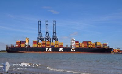
MSC RUBY
Container Ship
Current Trip
| Time Travelled | 2 days |
|---|---|
| Remaining Time | 6 days |
| Distance Travelled | 145.45 nm |
| Remaining Distance | 3355.27 nm |
| AVG Speed | 10.7 Knopen |
| MAX Speed | 16.4 Knopen |
| AVG Wind | 5.5 knots |
| MAX Wind | 8.8 knots |
| MIN Temp | 25.7°C / 78.26°F |
| MAX Temp | 28.5°C / 83.3°F |
| Diepgang | 15.9 M |
| Positie ontvangen | 2 d geleden |
Current Position
| Lengtegraad | --- |
|---|---|
| Breedtegraat | --- |
| Status | Under way using engine |
| Snelheid | 15.6 Knopen |
| Koers | 299.4° |
| Gebied | Malacca Strait |
| Station | T-AIS |
| Positie ontvangen | 2 d geleden |
Info
Information
The current position of MSC RUBY is in Malacca Strait with coordinates 2.43228° / 101.66652° as reported on 2026-02-25 10:35 by AIS to our vessel tracker app. The vessel's current speed is 15.6 Knopen and is heading at the port of JEBEL ALI. The estimated time of arrival as calculated by MyShipTracking vessel tracking app is 2026-03-06 11:29 LT
The vessel MSC RUBY (IMO: 9502960, MMSI: 636024999) is a Container Ship that was built in 2013 ( 13 Jaar oud ). It's sailing under the flag of [LR] Liberia.
In this page you can find informations about the vessels current position, last detected port calls, and current voyage information. If the vessels is not in coverage by AIS you will find the latest position.
The current position of MSC RUBY is detected by our AIS receivers and we are not responsible for the reliability of the data. The last position was recorded while the vessel was in Coverage by the Ais receivers of our vessel tracking app.
The current draught of MSC RUBY as reported by AIS is 15.9 meters
Weather
| Temperature | 28.2°C / 82.76°F |
|---|---|
| Wind Speed | 7 knots |
| Direction | 302° WNW |
| Pressure | 1006.4 hPa |
| Humidity | 72 % |
| Cloud Coverage | 100 % |
Featured Company
Last Port Calls
| Port | Arrival | Departure | Time In Port |
|---|---|---|---|
| 2026-02-24 14:34 | 2026-02-25 08:37 | 18 h | |
| 2026-02-15 18:25 | 2026-02-16 11:20 | 16 h | |
| 2026-01-05 23:01 | 2026-01-07 17:30 | 1 d | |
| 2026-01-05 22:08 | 2026-01-05 22:31 | 22 m | |
| 2025-12-27 21:20 | 2025-12-31 09:38 | 3 d | |
| 2025-12-20 13:02 | 2025-12-24 15:10 | 4 d |
Most Visited Ports (Last year)
| Port | Arrivals | |
|---|---|---|
| 4 | ||
| 3 | ||
| 2 | ||
| 2 | ||
| 1 | ||
| 1 |
Last Trips
| Origin | Departure | Destination | Arrival | Distance | |
|---|---|---|---|---|---|
| 2026-02-16 11:20 | 2026-02-24 14:34 | 1498.53 nm | |||
| 2026-01-07 17:30 | 2026-02-15 18:25 | 5345.47 nm | |||
| 2026-01-05 22:31 | 2026-01-05 23:01 | 0.88 nm | |||
| 2025-12-31 09:38 | 2026-01-05 22:08 | 697.68 nm | |||
| 2025-12-24 15:10 | 2025-12-27 21:20 | 186.82 nm | |||
| 2025-10-20 01:55 | 2025-12-20 13:02 | 5969.70 nm |
Events
| Tijd | Evenement | Details | Positie / Bestemming | Info |
|---|---|---|---|---|
| 2026-02-25 10:35 | Buitenbereik |
2.43228 / 101.66652
Malacca Strait
JEBEL ALI
|
Snelheid: 15.6 kn Koers: 299.4° |
|
| 2026-02-25 04:13 | Gevonden in zee | Malaysian part of the Malacca Strait |
1.49420 / 103.06158
Malacca Strait
JEBEL ALI
|
Snelheid: 15.9 kn Koers: 306.7° |
| 2026-02-25 04:13 | Binnenbereik |
1.49420 / 103.06158
Malacca Strait
JEBEL ALI
|
Snelheid: 15.9 kn Koers: 306.7° |
|
| 2026-02-25 02:36 | Buitenbereik |
1.24105 / 103.39801
Malacca Strait
JEBEL ALI
|
Snelheid: 14.9 kn Koers: 302.1° |
|
| 2026-02-25 02:36 | Wijzig zee gebeid | Indonesian part of the Malacca Strait Malaysian part of the Malacca Strait |
1.24105 / 103.39801
Malacca Strait
JEBEL ALI
|
Snelheid: 14.9 kn Koers: 302.1° |
| 2026-02-25 02:25 | Wijzig zee gebeid | Malaysian part of the Malacca Strait Malaysian part of the Singapore Strait |
1.22190 / 103.44341
Malacca Strait
JEBEL ALI
|
Snelheid: 14.9 kn Koers: 289.5° |
| 2026-02-25 01:47 | Wijzig zee gebeid | Malaysian part of the Singapore Strait Indonesian part of the Singapore Strait |
1.19694 / 103.58578
Singapore Strait
JEBEL ALI
|
Snelheid: 12.8 kn Koers: 261.7° |
| 2026-02-25 01:29 | Wijzig zee gebeid | Indonesian part of the Singapore Strait Singaporean part of the Singapore Strait |
1.20385 / 103.63156
Singapore Strait
JEBEL ALI
|
Snelheid: 5.3 kn Koers: 266.2° |
| 2026-02-25 00:37 | Vertrekhaven |
|
1.24305 / 103.64451
JEBEL ALI
|
Snelheid: 5.3 kn Koers: 80° |
| 2026-02-25 00:32 | Draught Changed | 15.9 15.8 |
1.24210 / 103.63842
[SG] SINGAPORE
|
Snelheid: 4.2 kn Koers: 80° |