
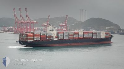
MERKUR ARCHIPELAGO
Container Ship
Current Trip
| Trip Time | 8 days |
|---|---|
| Trip Distance | 2697.00 nm |
| AVG Speed | 14.8 Knop |
| MAX Speed | 20.1 Knop |
| Djupgående | 12.1 m |
| AVG Wind | 12.6 knots |
| MAX Wind | 27.7 knots |
| MIN Temp | 16.5°C / 61.7°F |
| MAX Temp | 29°C / 84.2°F |
| Position mottagen | 9 d sen |
Current Position
| Longitud | -13.97542° |
|---|---|
| Latitude | 27.35641° |
| Status | Under way using engine |
| Fart | 18.6 Knop |
| Kurs | 218.2° |
| Område | North Atlantic Ocean |
| Station | T-AIS |
| Position mottagen | 9 d sen |
Info
Information
The current position of MERKUR ARCHIPELAGO is in North Atlantic Ocean with coordinates 27.35641° / -13.97542° as reported on 2024-05-12 14:28 by AIS to our vessel tracker app. The vessel's current speed is 18.6 Knop and is currently inside the port of ABIDJAN.
The vessel MERKUR ARCHIPELAGO (IMO: 9456977, MMSI: 636091883) is a Container Ship that was built in 2009 ( 15 År gammal ). It's sailing under the flag of [LR] Liberia.
In this page you can find informations about the vessels current position, last detected port calls, and current voyage information. If the vessels is not in coverage by AIS you will find the latest position.
The current position of MERKUR ARCHIPELAGO is detected by our AIS receivers and we are not responsible for the reliability of the data. The last position was recorded while the vessel was in Coverage by the Ais receivers of our vessel tracking app.
The current draught of MERKUR ARCHIPELAGO as reported by AIS is 12.1 meters
Weather
| Temperature | 29°C / 84.2°F |
|---|---|
| Wind Speed | 12 knots |
| Direction | 220° SW |
| Pressure | 1011.1 hPa |
| Humidity | 77.3 % |
| Cloud Coverage | 100 % |
Featured Company
Last Port Calls
| Port | Arrival | Departure | Time In Port |
|---|---|---|---|
| 2024-05-19 09:46 | |||
| 2024-05-10 12:59 | 2024-05-11 00:54 | 11 h | |
| 2024-04-28 23:10 | 2024-04-30 18:58 | 1 d | |
| 2024-04-19 21:32 | 2024-04-20 16:51 | 19 h | |
| 2024-04-19 02:56 | 2024-04-19 12:59 | 10 h | |
| 2024-04-09 06:43 | 2024-04-10 19:16 | 1 d | |
| 2024-03-31 17:30 | 2024-04-01 08:38 | 15 h | |
| 2024-03-18 09:56 | |||
| 2024-03-09 22:38 | 2024-03-10 12:32 | 13 h |
Most Visited Ports (Last year)
| Port | Arrivals | |
|---|---|---|
| 9 | ||
| 7 | ||
| 5 | ||
| 5 | ||
| 5 | ||
| 4 |
Last Trips
| Origin | Departure | Destination | Arrival | Distance | |
|---|---|---|---|---|---|
| 2024-05-11 01:54 | 2024-05-19 09:46 | 2697.00 nm | |||
| 2024-04-30 18:58 | 2024-05-10 13:59 | 2824.49 nm | |||
| 2024-04-20 18:51 | 2024-04-28 23:10 | 2717.70 nm | |||
| 2024-04-19 13:59 | 2024-04-19 23:32 | 50.79 nm | |||
| 2024-04-10 19:16 | 2024-04-19 03:56 | 2847.13 nm | |||
| 2024-04-01 08:38 | 2024-04-09 06:43 | 2783.90 nm | |||
| 2024-03-18 09:56 | 2024-03-31 17:30 | 2971.30 nm | |||
| 2024-02-24 05:51 | 2024-03-09 23:38 | 3875.94 nm |
Events
| Tid | Event | Detaljer | Position / Dest | Information |
|---|---|---|---|---|
| 2024-05-19 10:19 | STOPPAR förflyttning |
5.27840 / -4.01859
[CI] ABIDJAN
|
Fart: 0.1 kn Kurs: 1° |
|
| 2024-05-19 09:46 | ANLÄNDER HAMN |
|
5.25316 / -4.00779
[CI] ABIDJAN
|
Fart: 8.7 kn Kurs: 311° |
| 2024-05-19 07:33 | STARTAR förflyttning | 19.02 nm, South of ABIDJAN |
4.99802 / -4.03171
ABIDJAN
|
Fart: 3.5 kn Kurs: 66° |
| 2024-05-18 11:25 | STOPPAR förflyttning |
4.85500 / -4.23667
ABIDJAN
|
Fart: Kurs: -1° |
|
| 2024-05-12 14:34 | Status ändrad | Default Under way using engine |
27.33333 / -13.99333
ABIDJAN
|
Fart: 18.6 kn Kurs: 218.2° |
| 2024-05-12 14:28 | Byter havsområde | Western Saharan part of the North Atlantic Ocean Moroccan part of the North Atlantic Ocean |
27.35641 / -13.97542
North Atlantic Ocean
ABIDJAN
|
Fart: 18.6 kn Kurs: 218.2° |
| 2024-05-12 14:28 | Status ändrad | Under way using engine Default |
27.35641 / -13.97542
ABIDJAN
|
Fart: 18.6 kn Kurs: 219° |
| 2024-05-12 14:28 | I täckningsområde |
27.35641 / -13.97542
North Atlantic Ocean
ABIDJAN
|
Fart: 18.6 kn Kurs: 218.2° |
|
| 2024-05-12 14:28 | UTANFÖR täckningsområde |
27.35641 / -13.97542
North Atlantic Ocean
ABIDJAN
|
Fart: 18.6 kn Kurs: 218.2° |
|
| 2024-05-12 13:02 | UTANFÖR täckningsområde |
27.70307 / -13.67247
North Atlantic Ocean
ABIDJAN
|
Fart: 17.9 kn Kurs: 217.3° |